Friday's science stories

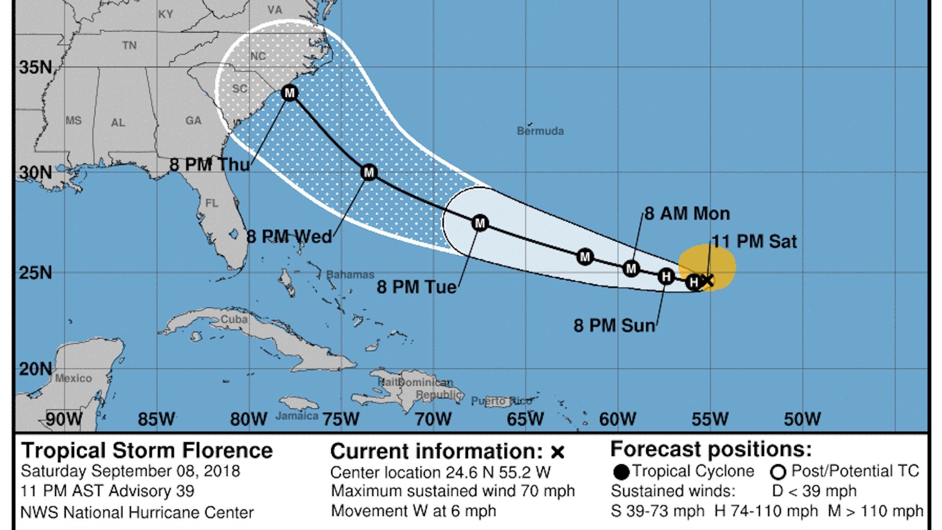
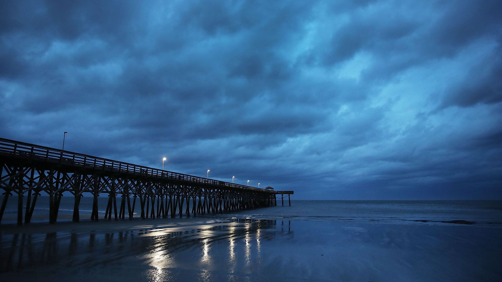
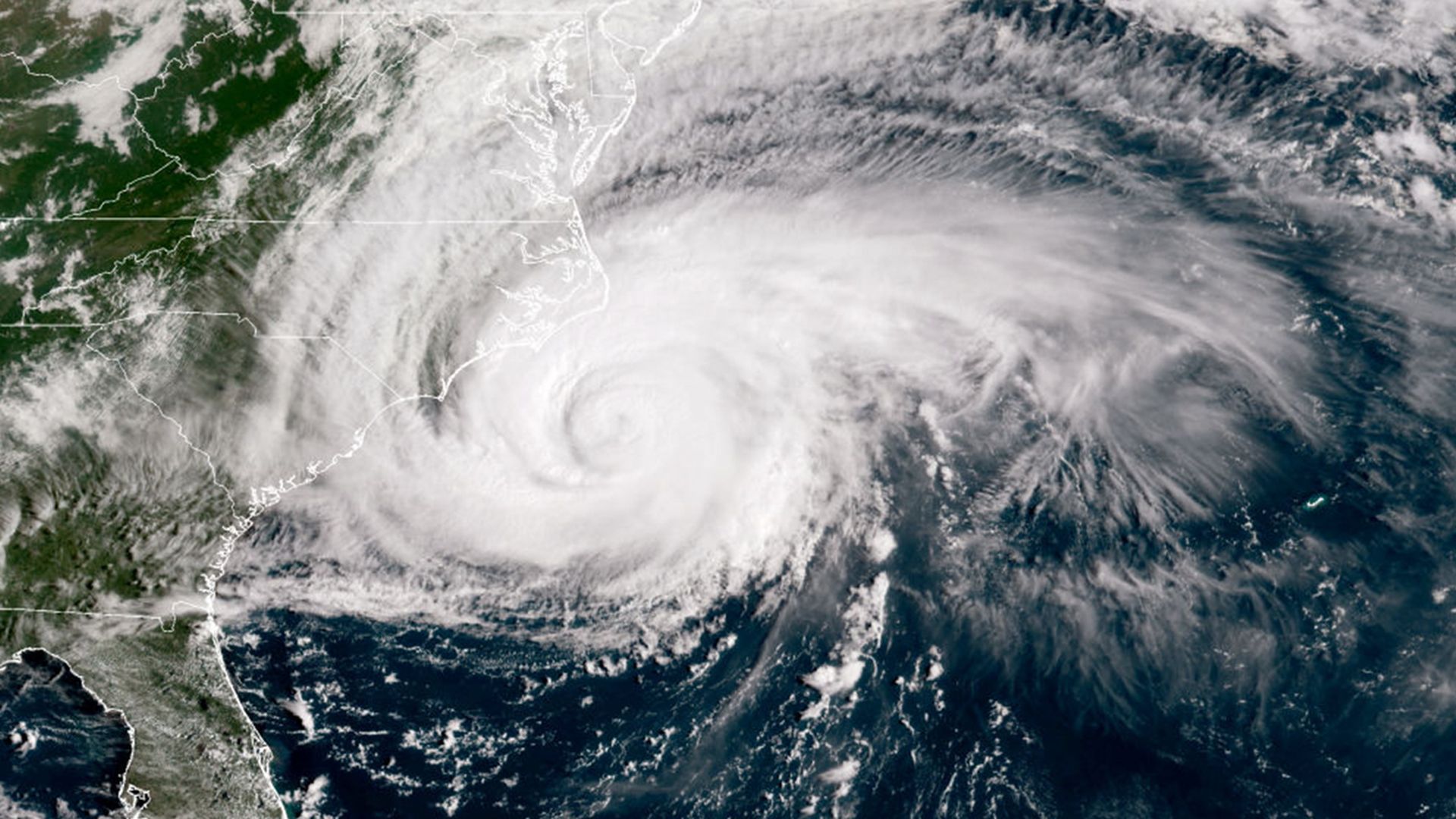
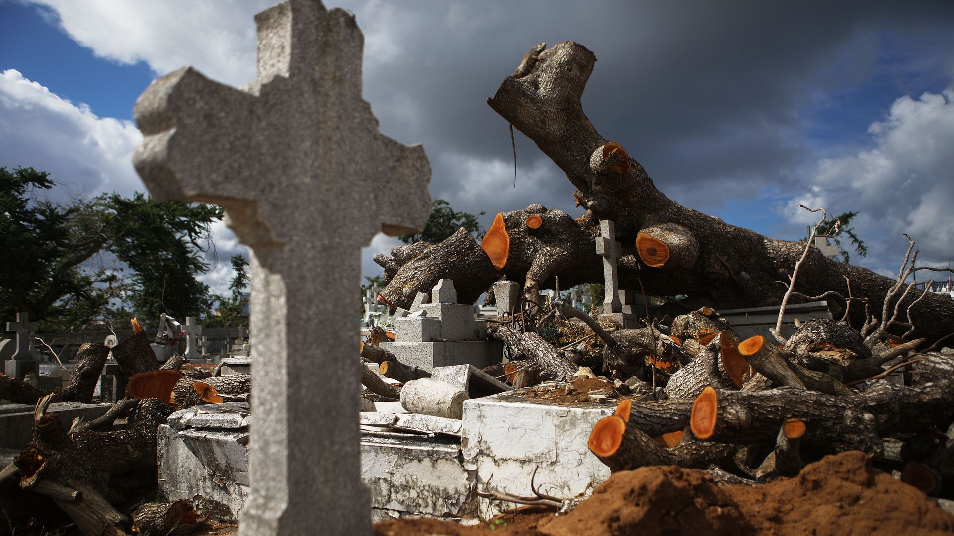
Tropical Storm Florence wallops Carolinas with surge and catastrophic flooding


Super Typhoon Mangkhut to slam into northern Philippines
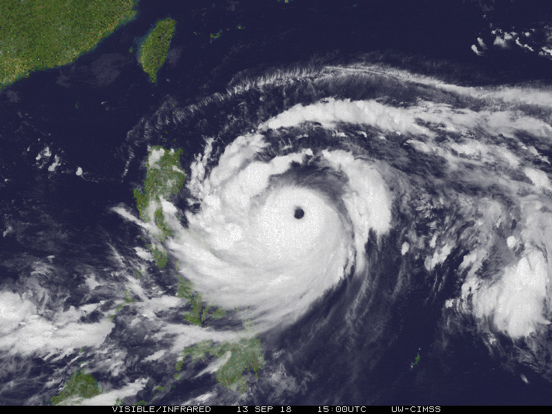
The most intense storm on Earth so far in 2018 is on track to hit the northern Philippine island of Luzon on Friday. Super Typhoon Mangkhut peaked in intensity at sustained winds of 180 miles per hour, equivalent to a Category 5 hurricane, and was expected to make landfall near full strength.
The big picture: On the other side of the world, Hurricane Florence is barreling towards the U.S. East Coast with sustained winds of 100 miles per hour. Mangkhut, with current sustained winds of 170 mph, is one of the most powerful typhoons to hit the Philippines since the disastrous Super Typhoon Haiyan ravaged the islands in 2013.

Why Florence is so unusual — and so dangerous


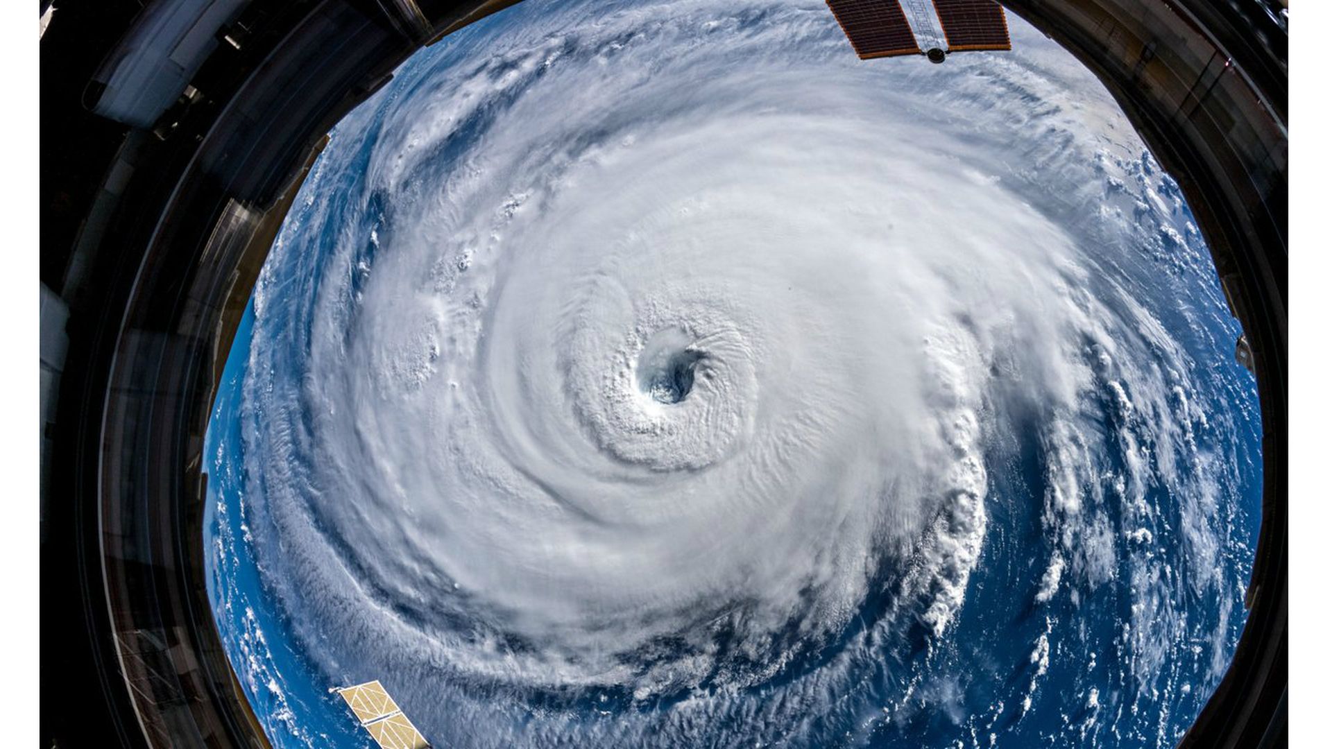

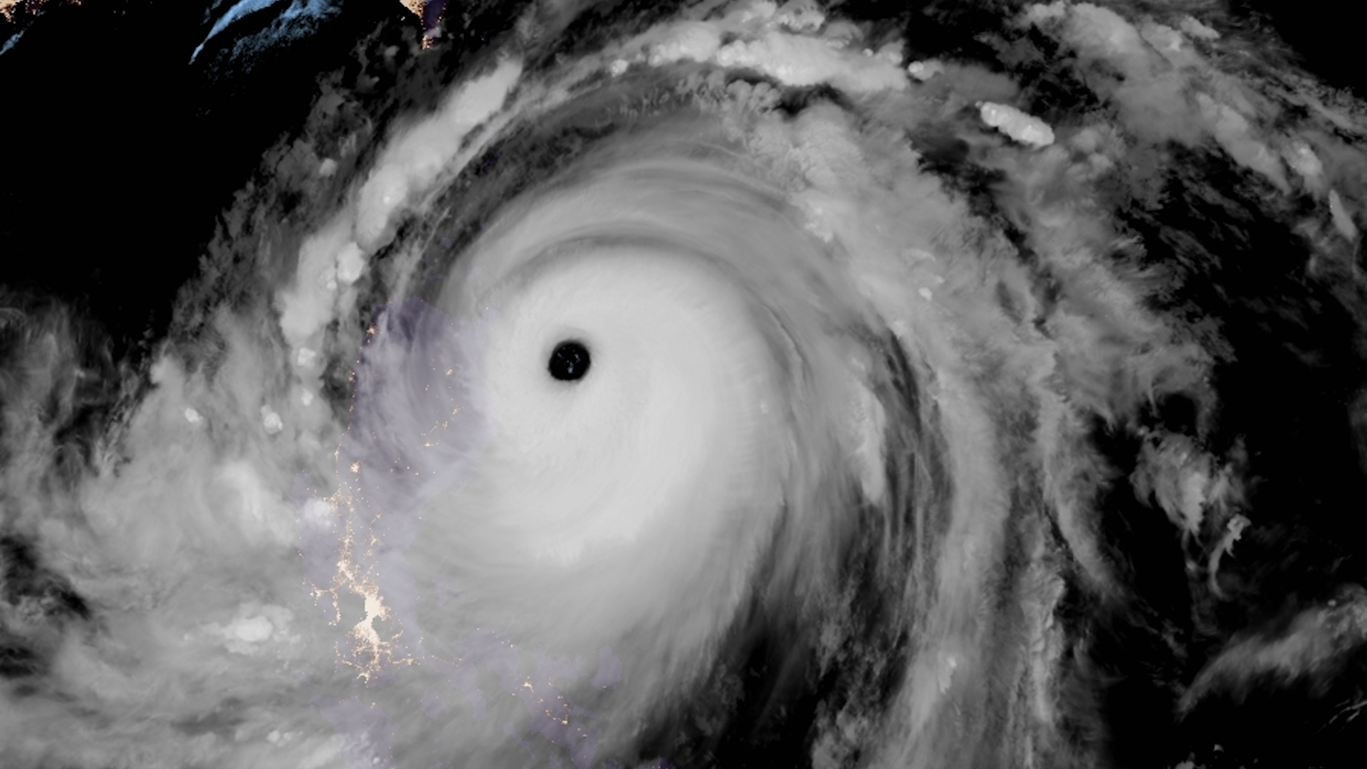
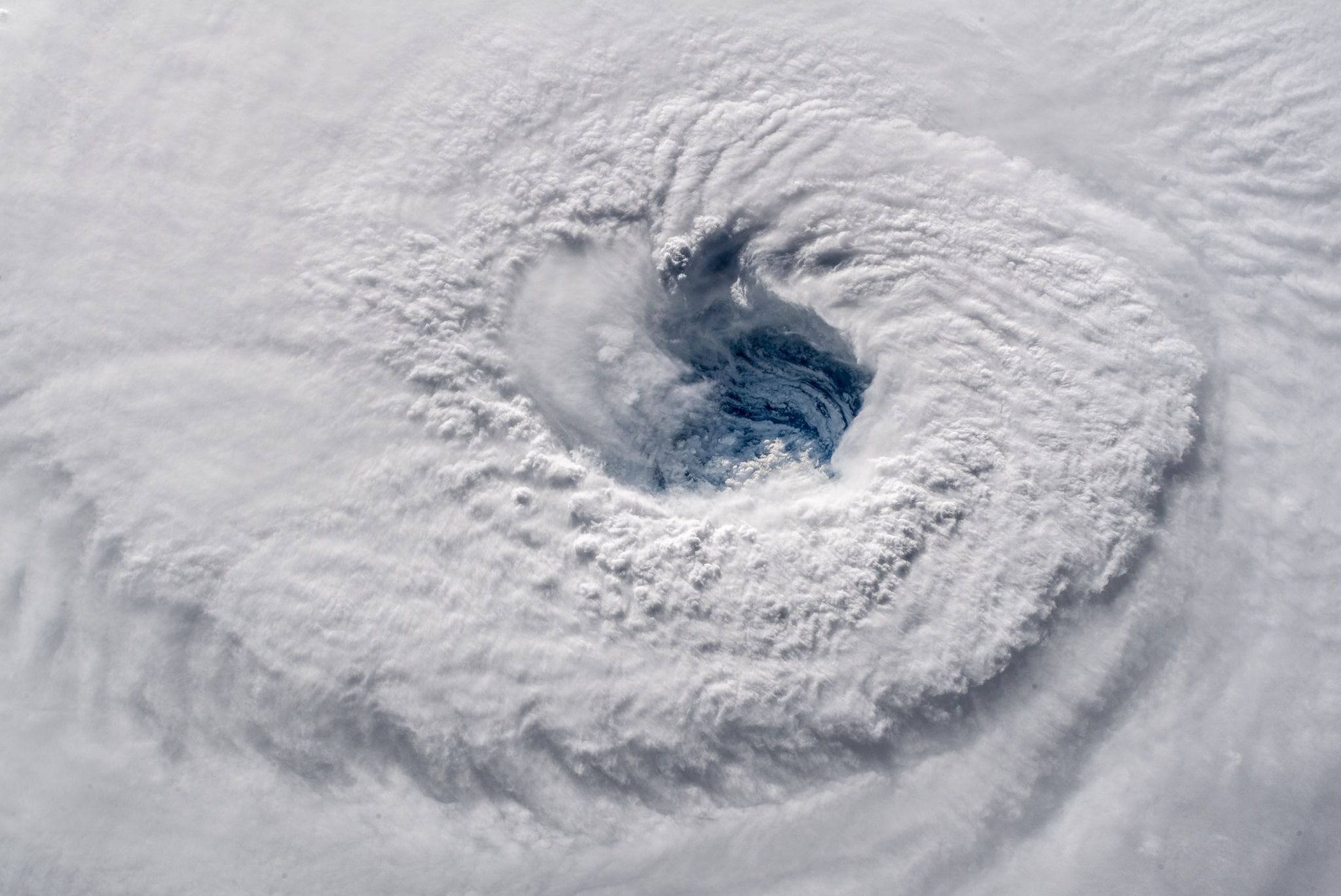
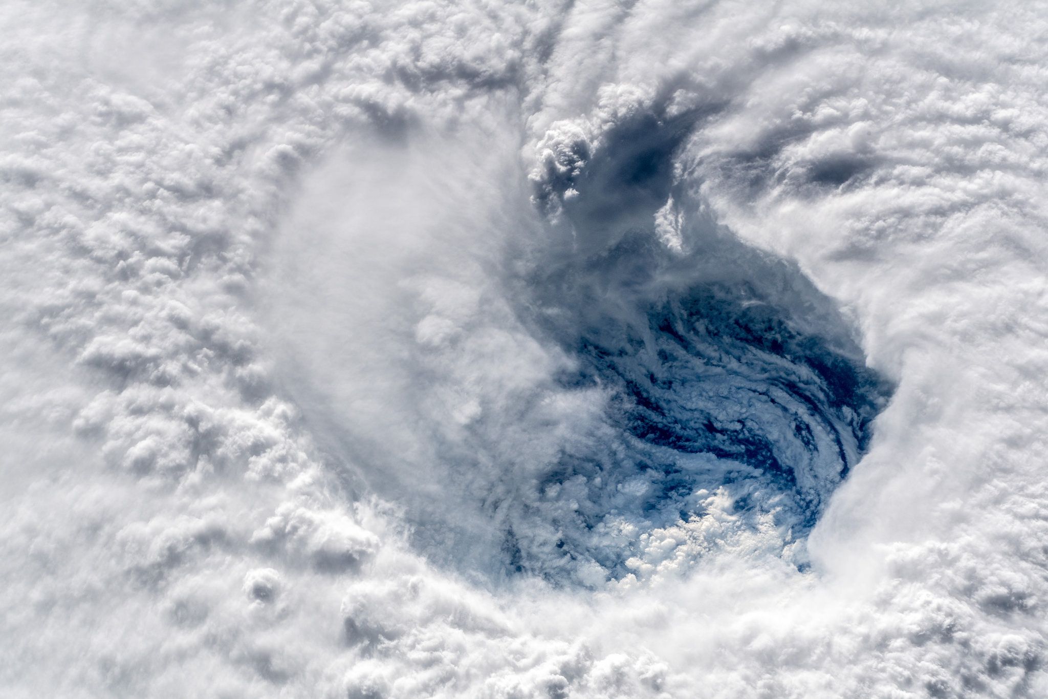
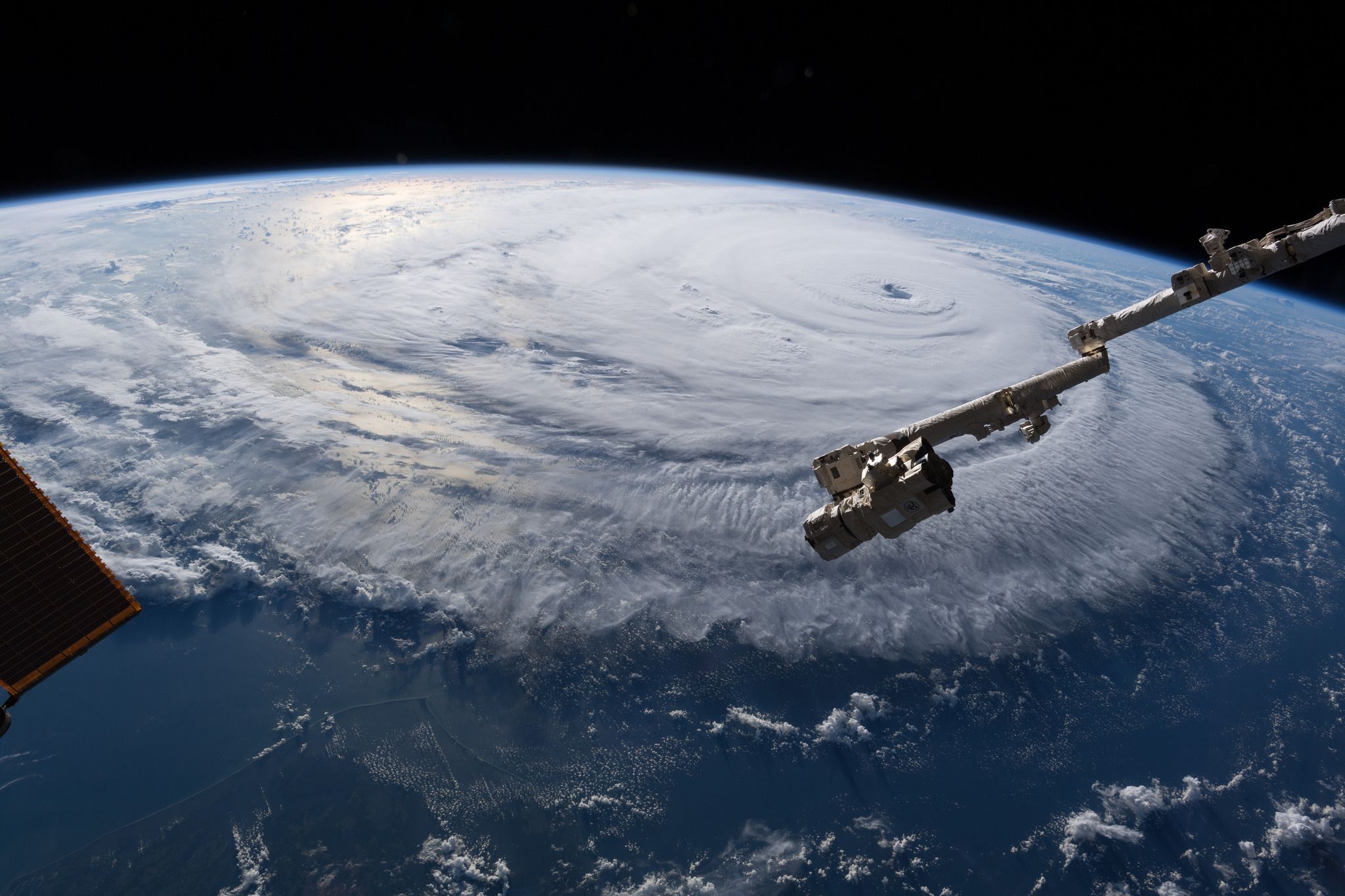
In photos: Astronaut peers into the eye of Hurricane Florence

On Wednesday morning, European astronaut Andrew Gerst captured a unique set of photos of the massive Hurricane Florence barreling towards the East Coast.
At the time of these pictures, Florence was a Category 4 storm with a 25-mile-wide eye, based on hurricane hunter aircraft flying inside the storm. Gerst used "a super wide angle lens from the International Space Station, 400 km directly above the eye" to capture the images. These are angles few people ever get to witness firsthand, and almost manage to make the destructive storm look beautiful and serene — almost.

Track the most up-to-date forecast information and analysis here.
Go deeper:
Hurricane Florence to cause "unbelievable destruction" in Carolinas.