New Orleans' blazing summer temps could set new heat record

Add Axios as your preferred source to
see more of our stories on Google.

Illustration: Brendan Lynch/Axios
New Orleans is on track to have one of its hottest summers on record, and "feels like" temps of 100+ are likely to continue into September, the National Weather Service says.
Why it matters: Better make that an iced pumpkin spice latte, y'all.
The big picture: This summer will likely be in the top 5 hottest summers on record, based on preliminary data, says Tyler Stanfield, a meteorologist with the National Weather Service in Slidell.
- NWS will crunch the numbers for June, July and August after this month ends to get the final ranking, he said.
- So far, August 2024 is the fifth hottest month on record, according to NOAA data, and the monitoring center at MSY broke the daily heat records four times this summer, Stanfield says.
- Last year holds the record for New Orleans' hottest summer, with August 2023 being the hottest month on record.
Threat level: 17 people have died statewide from heat-related causes so far this year, according to the Louisiana Department of Health. Last year, 69 people died.
- More than 3,600 emergency room visits this summer were due to heat-related illnesses, with primarily male patients, LDH says.
Zoom out: The extreme heat is even more concerning during the height of the Atlantic hurricane season.
- Any storm-related power outage will be more dangerous because of the oppressive heat, officials say, and evacuations will be a higher priority if the city is threatened.
- The tropics have been quiet for much of August, but predictions of a hyperactive 2024 hurricane season are still on track, forecasters warn.
- There have already been five named storms and more are likely to come, writes Axios' Andrew Freedman. In fact, the National Hurricane Center started tracking an Atlantic disturbance late Monday.
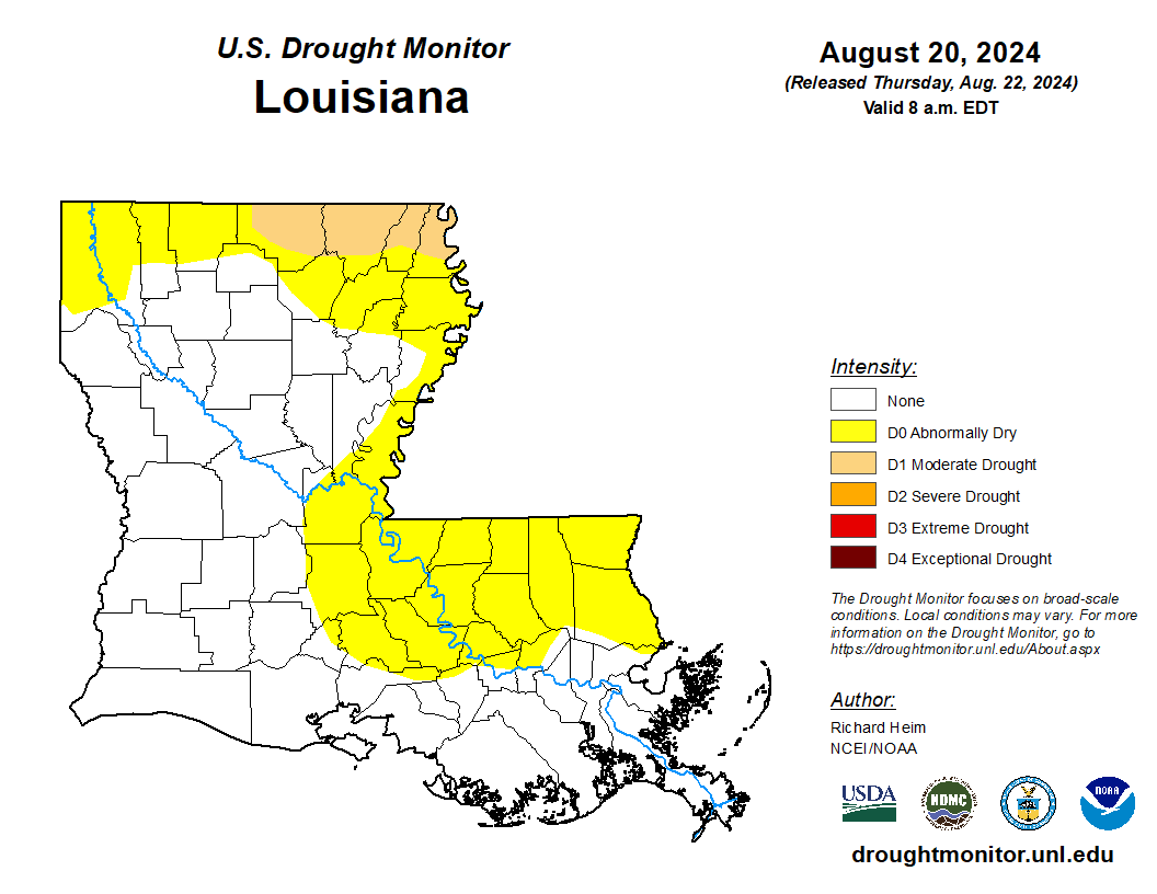
Zoom in: Drought conditions also are starting to creep across the state, according to the U.S. Drought Monitor.
- It's not nearly as dry as last year, but New Orleans is 4.6 inches below normal rainfall for August, according to data from the National Weather Service.
- Good news: Rain chances increase this week.
The big picture: New Orleans is in the process of creating its first-ever heat mitigation plan.
- The strategy is to help the city prepare "citizens and infrastructure for increased extreme heat events."
- And, it must work with other goals, such as improving the city's greenhouse gas emissions, reducing exposure to urban heat and addressing extreme heat threats on a neighborhood basis.
The backdrop: Human-caused climate change is altering the character of American summers.
- It's making heat waves far more likely and intense than they would have been without such high concentrations of greenhouse gases in the atmosphere.
What's next: The lower humidity last week gave us a nice taste of fake fall, but south Louisiana likely won't get crisp weather for several more weeks.
- It's likely to be hot and muggy through mid- to late-September, Stanfield says. New Orleans historically doesn't get consistent lows in the 60s until October.
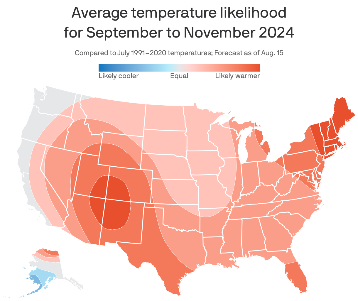
- The U.S. overall is expected to have above-average temperatures through November, NOAA says.
Go deeper: