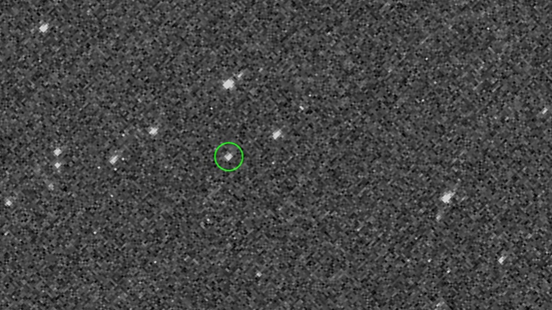
Last week, after almost a two-year trip, a NASA spacecraft captured its first look at the near-Earth asteroid Bennu from 1.4 million miles away. The image was released for the first time Friday.
The details: The asteroid sampling spacecraft, which has traveled 1.1 billion miles since launch, marks the agency's inaugural visit to a near-Earth asteroid. The goal is to "survey the surface, collect a sample and deliver it safely back to Earth," according to a NASA press release.
The Hubble Space Telescope captured an image of planetary nebula NGC 3918, which is a part of the the Centaurus constellation about 4,900 light-years from Earth, according to NASA.
Between the lines: A planetary nebula is a cloud of colorful gasses which surrounds a dying star — known as a red giant, according to NASA. The remnants of the star give off the light, which reflects in the gasses and creates the beautiful, dramatic colors seen in the photo.
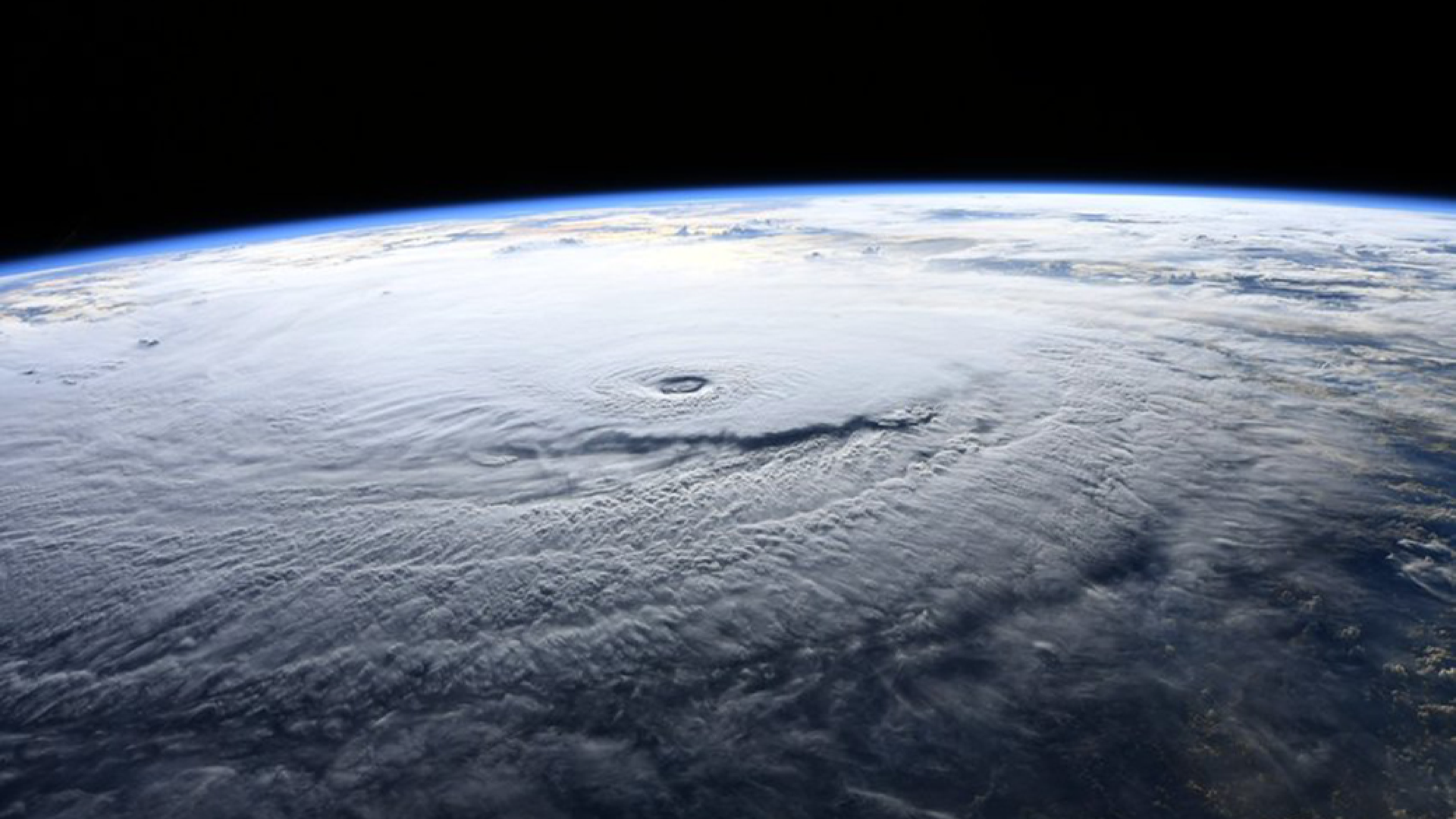
Hurricane Lane is already a landmark storm, having set a record for the strongest hurricane to get so close to Hawaii since modern records began. It could soon set more milestones if it moves within 65 nautical miles of Maui and Oahu on Friday and Saturday.
Why this matters: Hawaii has historically been protected against hurricanes because sea surface temperatures near the islands are typically too cold to support a significant tropical cyclone. That's not the case this year, and is not expected to be the case in the future as the ocean warms in response to increasing amounts of greenhouse gases in the air.
Editor's note: For live updates on Friday, August 24, see our current story here.
Category 3 Hurricane Lane is slowly churning northward toward Hawaii, affecting the Big Island and Maui on Thursday before lumbering toward Oahu and Kauai in coming days.
Why it matters: This storm is the most intense hurricane ever to come so close to Hawaii. The storm threatens the islands with upwards of 2 feet of rain, deadly surf of 20 feet or higher, and intense hurricane force winds.
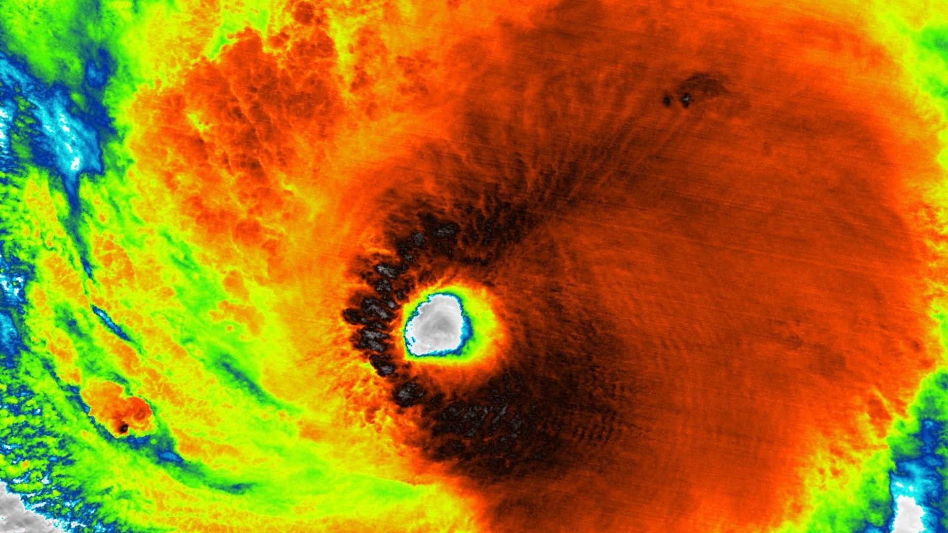
Hurricane Lane has come closer to Hawaii than any Category 5 storm has come in modern records, and it threatens to unleash life-threatening destruction as it approaches the islands starting late Wednesday and lasting into Saturday, according to the National Hurricane Center.
Why it matters: The storm's exact track is still uncertain, with some computer models projecting it will zip out to sea south of Hawaii, and others showing a devastating near-direct hit on one or more islands. Official forecasts show it will come close enough to produce damaging winds, deadly flash floods from upwards of 2 feet of rain, and pounding "extreme" surf. Waves could exceed 20 feet on south facing shorelines.