Utah winter outlook: Wet and possibly warm

Add Axios as your preferred source to
see more of our stories on Google.
Utahns should brace for another wet winter — but it may not be the same ski season boon as last year.
What's happening: A strong El Niño is setting up in the tropical Pacific Ocean as global ocean temperatures reach record highs, Axios Generate's Andrew Freedman reports.
- El Niño generally brings warmer, wetter winters to Utah — but the location of its effects tends to be unpredictable.
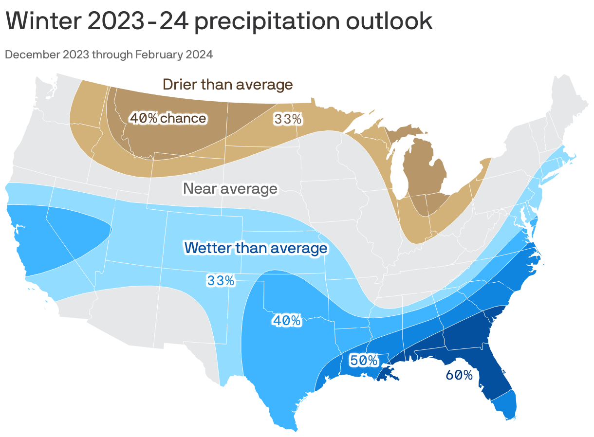
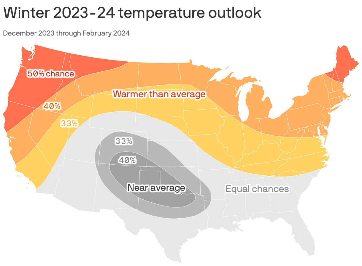
Zoom in: A wet winter is likeliest in southern Utah during El Niño, while warm temperatures are likelier in northern Utah — where most of the ski resorts are.
Yes, but: This year's El Niño could be the strongest on record, which could cause its jet stream to extend farther north, into central and northern Utah, said Christine Kruse, lead meteorologist for the National Weather Service's Salt Lake office. That would boost precipitation statewide.
- "We really need to see where that jet stream and that low-pressure area is set up as we go into November and December," Kruse said in a winter outlook released this weekend. "That will have a huge impact on what we'll see for this El Niño pattern."
Why it matters: Utah is on the heels of a prolonged drought, so another wet winter could help replenish water supplies and boost the receding Great Salt Lake.
- Extra water would be especially advantageous now because the soil is relatively moist after a wet spring and late summer. That means more runoff to Utah's reservoirs when the snow melts next spring, Kruse said.
Reality check: While this winter should be wet, "It's unlikely that Utah will experience another winter like the historic 2022–2023 winter," Kruse said.
Zoom out: It's not yet clear how record-warm global average temperatures will tip the scales in terms of U.S. air temperature and precipitation trends this winter. But they do raise the threat of surprises, and potentially extreme weather events.