Oregon braces for another hot, dry summer

Add Axios as your preferred source to
see more of our stories on Google.
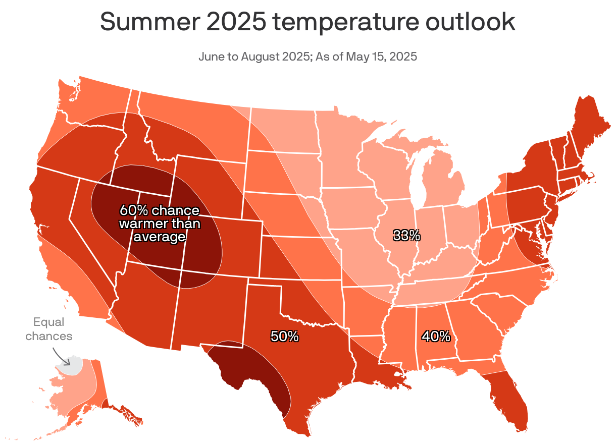
Most of Oregon is staring down a hotter and drier than average summer, according to new climate forecasts.
Why it matters: Warmer temperatures and less precipitation raises the chances of drought conditions, wildfire risk and the potential of heat-related deaths.
- The majority of Portlanders live on urban heat islands — parts of the city that are hotter and more dangerous than others on very warm days.
Driving the news: June through September has a 50-60% chance of being hotter than average for most Oregonians, according to the latest outlook from the National Weather Service Climate Prediction Center.
- Precipitation totals will also be about 40-50% lower during that time.
Zoom in: Historically, a normal summer day in Portland has a high of about 82 and a low of 59 for the month of July, per NWS.
- We typically see about 2.7 inches of rain during that month, too.
What they're saying: Portland recorded only 1 inch of rain in April, Anna Ruhl, a meteorologist with the National Weather Service, told Axios.
- The region normally sees roughly 3 inches during that month, so "on the drought monitor we are already at abnormally dry conditions," she said.
Threat level: What's expected in the coming months is eerily similar to last year's outlook, which produced a wildfire season that burned more acres than ever before in Oregon's recorded history.
- While the majority of wildfires are human-caused, fire weather — when it's hot, dry and windy — can amplify a single spark into a huge spread.