Wednesday's science stories


Oct 10, 2018 - Science
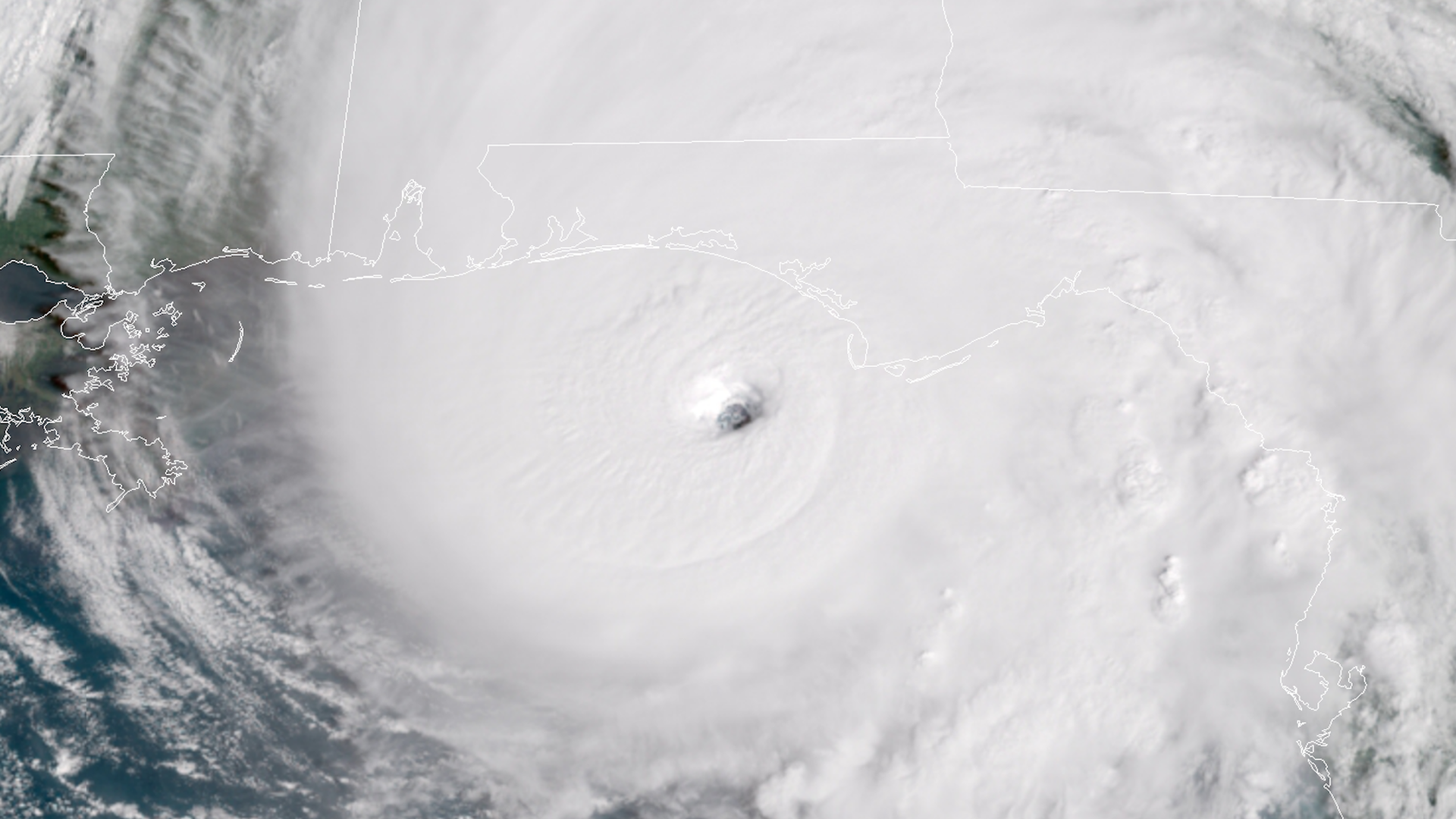
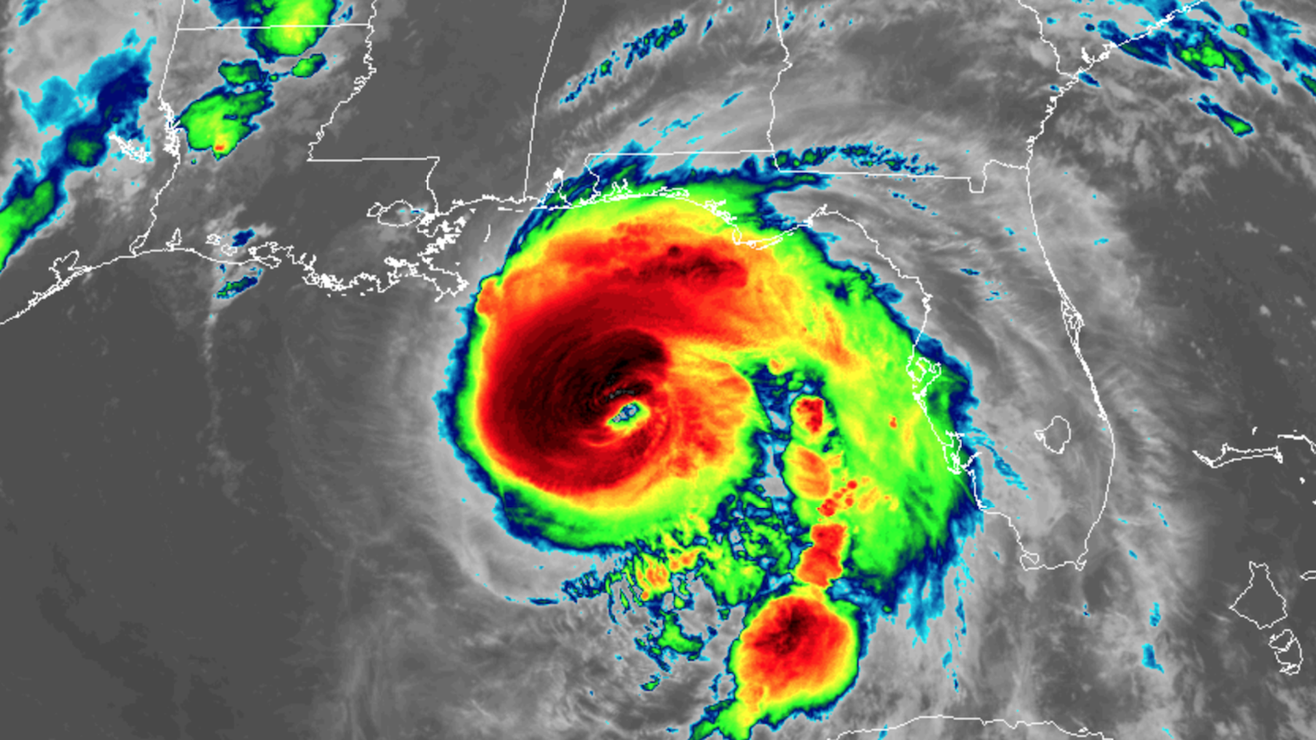
Hurricane Michael makes landfall in Florida with 155 mph winds
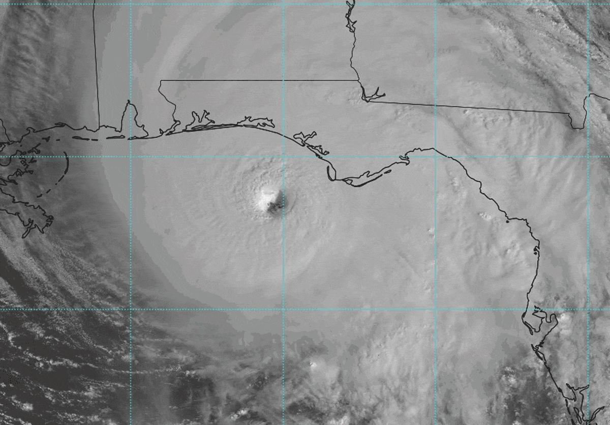
Hurricane Michael has made landfall near Mexico Beach, Florida, at 1:40 p.m., as a powerful Category 4 storm. Its minimum central air pressure of 919 millibars and maximum sustained winds of 155 miles per hour put it on the cusp of Category 5 status.
The big picture: The storm ranks as one of the strongest hurricanes ever to hit the U.S., with a minimum air pressure comparable to Hurricanes Camille, Andrew and Katrina. It is the most powerful hurricane ever to hit the Florida Panhandle, and catastrophic damage is expected near the landfall zone. Wind damage and power outages will extend inland to Tallahassee and southern Georgia.