How earthquake research can help save the PNW from "The Big One"

Add Axios as your preferred source to
see more of our stories on Google.
It's hard to plan a tsunami evacuation route if you don't know the size of the wave you're dealing with, or to design an earthquake-proof bridge when you don't know how long the shaking could last.
What's happening: A new research center in the Pacific Northwest aims to answer those questions and others, to help the region prepare for a possible magnitude 9 earthquake that is predicted to happen along the West Coast sometime in the future.
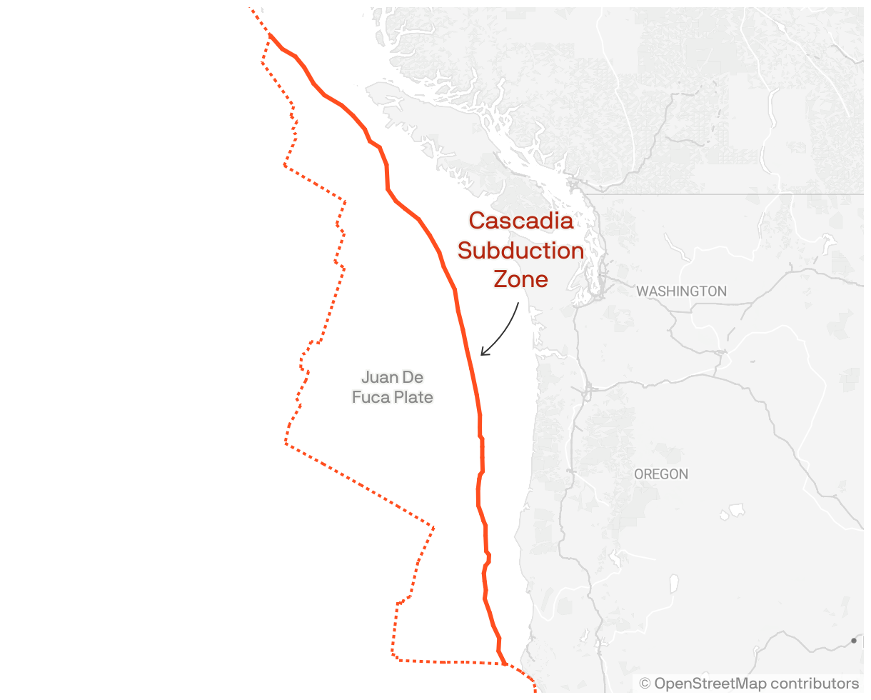
Why it matters: Historically, a destructive earthquake has occurred roughly every 550 years along the Cascadia subduction zone, a 700-mile-long fault that runs from Northern California to British Columbia.
- The last one was in 1700 — 323 years ago — which means a repeat event could happen any time, Harold Tobin, director of the Pacific Northwest Seismic Network, told Axios.
Yes, but: There's a lot we don't know about what the megaquake might look like, said Tobin, who is also a University of Washington professor.
- "If a community is on the coast, do they have to plan for 10 feet of potential water, or is it 40 feet? Or is it 100 feet? Those numbers make a big difference," Tobin said.
Details: The Cascadia Region Earthquake Science Center will bring together researchers from more than a dozen institutions, including the University of Oregon and the University of Washington.
- It plans to begin work next month, funded by a $15 million grant from the National Science Foundation.
- While many individual scientists have been studying earthquakes, the new center "forces a lot of people to work on related problems, and in that way, advance faster," the center's director, Diego Melgar at the University of Oregon, told Axios.
Between the lines: Part of the researchers' work will use high-performance computing to run thousands of models of a potential Cascadia quake, so "we can explore what really is possible and what is likely," Melgar said.
- The team will also need to send people out into the field to gather information about things like the movement of the earth's crust and the precise location of underwater faults to accurately inform those computer models, Tobin said.
Plus: The center will seek feedback directly from local governments, so that researchers can answer the types of questions that will best help local leaders prepare.
What they're saying: "If we prepare now — if we stiffen our building codes, if we plan our evacuation zones correctly, if we build our hospitals and schools and firehouses and police stations out of tsunami inundation zones — the next big earthquake isn't going to be pretty, but we can fare pretty well," Melgar said.
What we're watching: The $15 million grant is designed to last five years, but leaders of the center hope it gets extended beyond that, Tobin said.
What's next: More than 100 scientists plan to meet in late October to develop a strategic plan for the new research center and officially launch the project.
- The center also will focus on building the next generation of earth scientists through training programs.