Seattle had an unusually dry winter


Add Axios as your preferred source to
see more of our stories on Google.
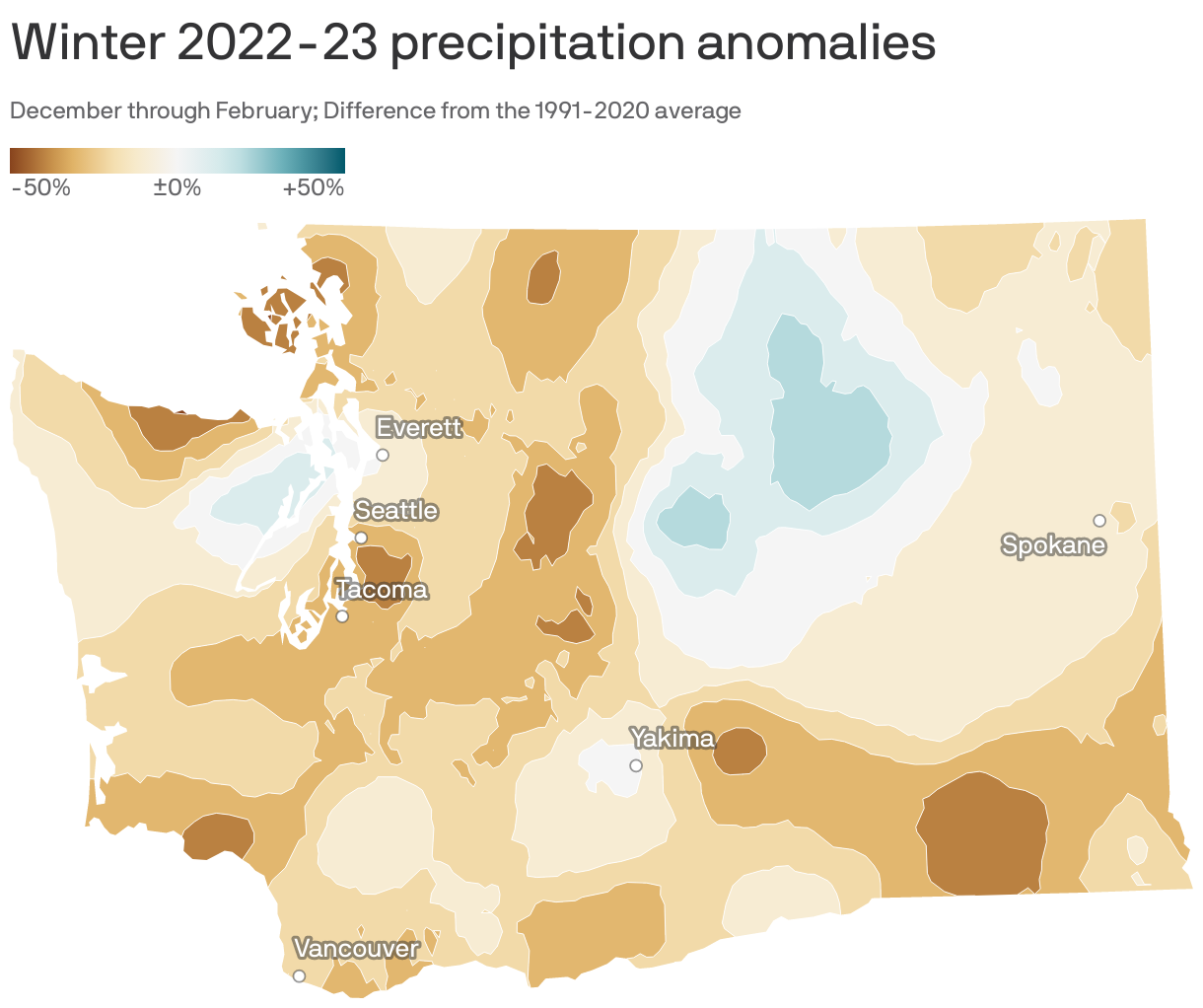
Seattle got 13 inches of precipitation this past winter — about 2 inches fewer than average.
- That's according to data from the National Oceanic and Atmospheric Administration.
Why it matters: Wintertime precipitation can cause hazardous conditions from blizzards and ice storms, which prevent travel and knock out power — but it can also alleviate drought, especially in mountainous areas that rely on melting snowpack each spring to replenish groundwater supplies.
The big picture: Nationally, a band of heavier-than-usual precipitation stretched from California to Minnesota:


- Much of California and the Midwestern United States had some of the wettest winter weather on record.
- The opposite was true in the Pacific Northwest and in parts of Texas and Florida, which were significantly drier than average.
Of note: For this analysis, "winter" is defined as Dec. 1, 2022 – Feb. 28, 2023.
Zoom in: January was a particularly dry month for Seattle, with only 3.09 inches of rain — 2.69 fewer inches than the historic monthly average, according to data from NOAA's National Centers for Environmental Information.
- That made for Seattle's driest January in 22 years, and the 12th driest on record.
The bottom line: Climate change is raising the odds and severity of precipitation extremes — both heavy rain and snow as well as prolonged and severe dry spells.
- However, it does not mean that every season — or even each year — will set a record.