How AI helps spot wildfires before 911 calls

Add Axios as your preferred source to
see more of our stories on Google.
Pacific Gas and Electric Company, a utility in central and northern California, uses Al-powered technology to monitor wildfire risk. Photo: Jason Henry/Bloomberg via Getty Images
As wildfires become faster moving and more destructive with climate change, agencies across the West are adopting AI-powered cameras, satellite systems and other weather predictive tools to help spot fires and deploy crews sooner.
Why it matters: The technology is designed to buy firefighters more time — often the most valuable resource during a wildfire. Earlier warnings not only save lives, but help prevent fires from growing larger and causing millions of dollars in damage.
- "Even two seconds makes a difference in detection and response," Leland O'Driscoll, director of Oregon Hazards Lab, told Axios.
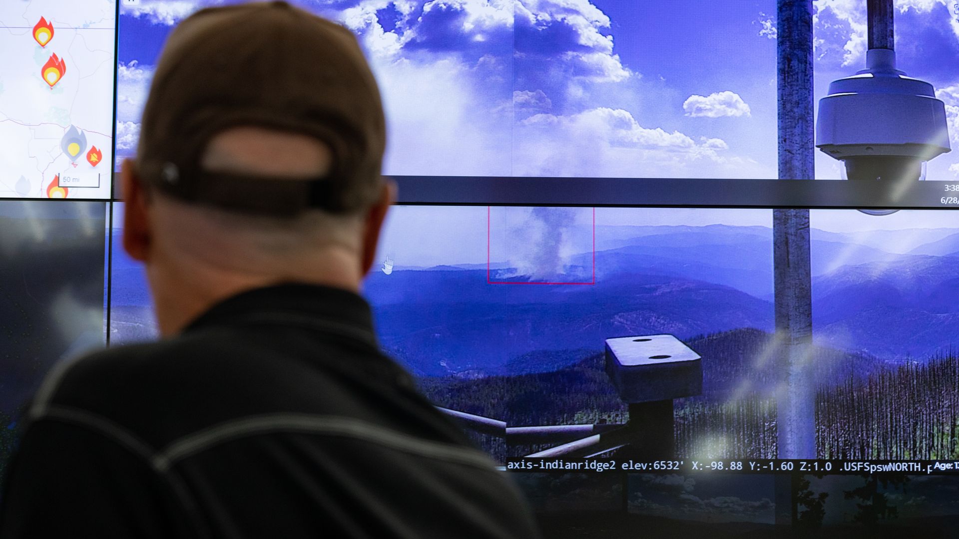
State of play: Millions of acres across the West are currently being watched by networks of AI-equipped cameras, which scan for smoke and other anomalies — such as changes in light patterns — around the clock.
- Many of those cameras (about 1,800) are operated through the Alert West platform, a partnership involving hundreds of local, state and federal fire agencies, as well as universities and utilities.
- It launched its AI wildfire detection model in 2023, and in the years since it's alerted fire officials to new ignitions — more than 900 in California last year alone — before they were reported through 911 calls or other public reporting channels.
Meanwhile, the National Oceanic and Atmospheric Administration recently debuted its AI-powered satellite imagery system, which can identify hot spots from space and track a fire's spread and intensity, even through clouds or smoke.
- Researchers are also using AI to analyze millions of historical wildfire records alongside climate, vegetation and infrastructure data to identify where future fires are most likely to ignite.
- Plus: Drones equipped with infrared sensors have been used by Forest Service officials since 2018 to identify areas at risk for reigniting.
Yes, but: "There's still a vast wildland area that's uncovered that needs monitoring, full stop," O'Driscoll, whose lab manages wildfire cameras across Oregon and Washington, said.
Reality check: Human operators still review AI-generated fire alerts before deploying crews, and technology can't replace the extensive on-the-ground mitigation work needed to reduce wildfire risk, O'Driscoll said.
What's next: The goal is to continue shortening the time between ignition, detection and response — a timeline O'Driscoll expects AI, predictive analytics and drones can collectively compress even further.