Dallas just had its second hottest September on record

Add Axios as your preferred source to
see more of our stories on Google.
A cool front is expected to bring rain and seasonally appropriate weather this week.
- Finally.
Why it matters: Dallas-Fort Worth recorded one of the hottest summers this year, and unseasonably high temperatures remained throughout September.
The latest: September was the second hottest on record in D-FW with an average temperature of 84.6. The record was in 2019 with an average temperature of 85.5.
- There were eight days with high temperatures at or above 100, per the National Weather Service.
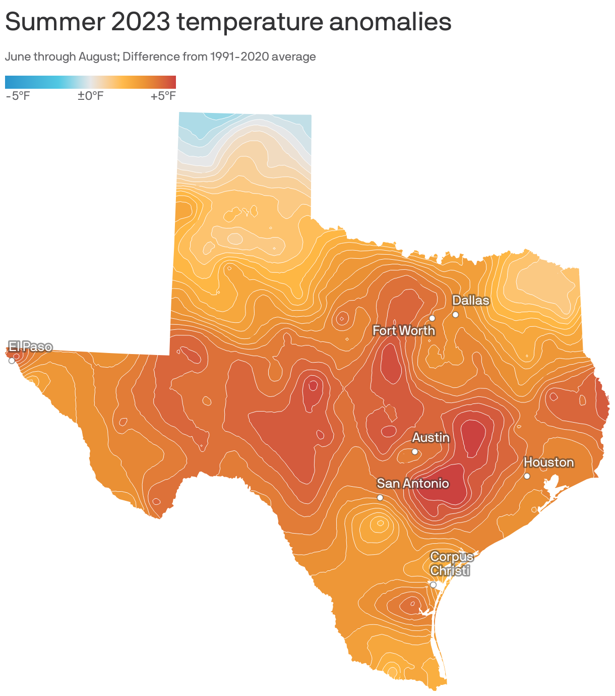
The big picture: Large swaths of the Sun Belt were hit by their hottest meteorological summer — June through August — on record.
- It was the warmest June, July and August on record globally, Axios' Erin Davis and Andrew Freedman report.
Zoom in: Temperatures were more than 4 degrees above the 30-year average between 1991 and 2020 in D-FW, according to National Oceanic and Atmospheric Administration data.
- It was the third hottest summer on record with an average temperature of 88.8, behind the hottest average of 90.5 set in 2011.
- 10 daily record highs were broken or tied from June to August.
Of note: Temperature measurements and records in D-FW started in 1899.
Meanwhile: It was also the fourth driest summer on record, with nearly seven fewer inches of precipitation than normal.
- Only 1.25 inches of rain were recorded.
Flashback: The high temperature at DFW Airport reached 101 on Sept. 23, well above the typical September high in the upper 80s.
What's next: The National Weather Service predicts October will likely have above-normal temperatures and may have slightly more rainfall than typical.
- The normal seasonal high in October is about 78, with lows in the upper 50s.
Editor's note: This story has been corrected to reflect that the baseline temperature measurement is the 30-year average between 1991-2020, not 1981-2020.