Feb 17, 2022 - Real Estate

Chicago redlining: then and now

Map of segregation

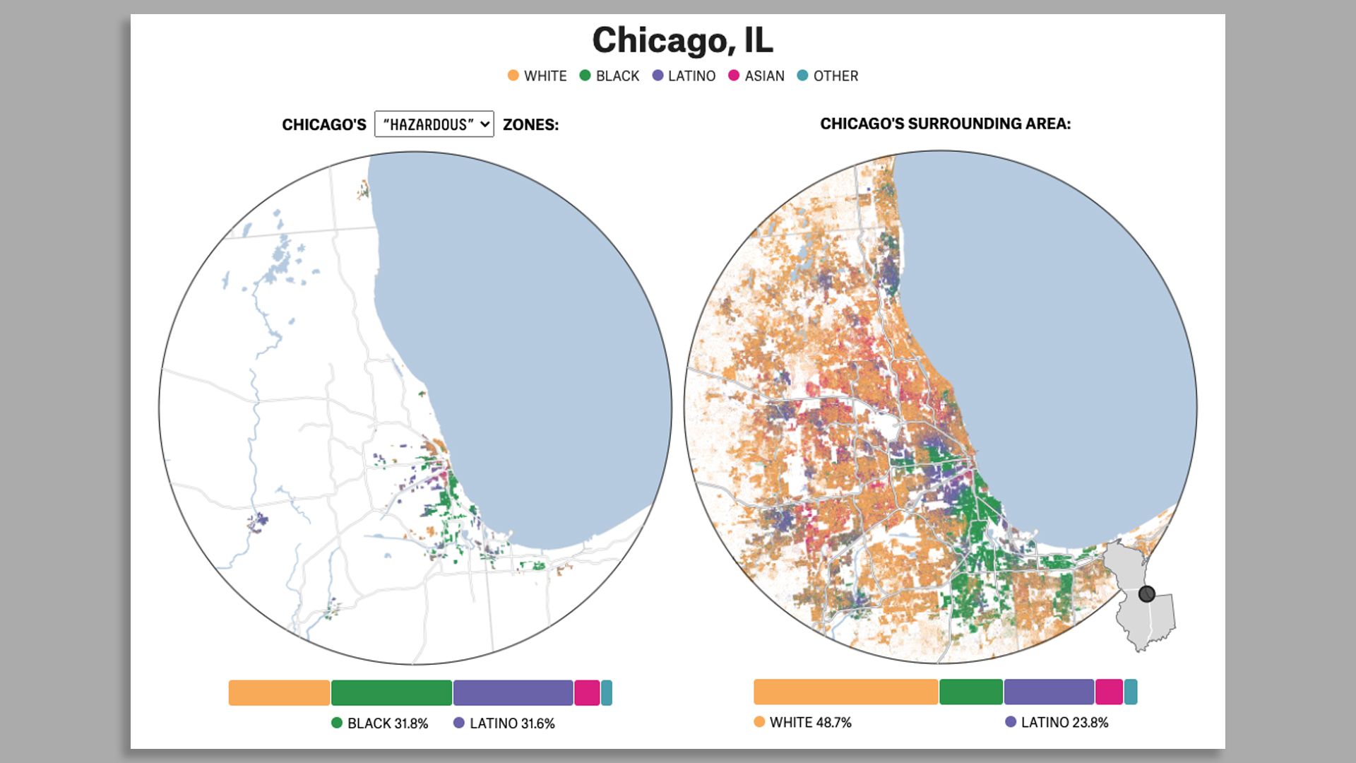
Chicago's "hazardous" redlined areas compared to present-day segregation. Graphic: FiveThirtyEight and ABC News analysis

It's no secret that Chicago is historically one of the most segregated cities in the country. A new report shows that not much has changed.

Why it matters: Data from FiveThirtyEight and ABC News shows that Black residents are still living in the same neighborhoods deemed "hazardous" by the redlining mapmakers of the 1930s.

Context: In 1939, a group called the Home Owners' Loan Corporation created maps that classified neighborhoods in major U.S. cities by the categories best, desirable, declining, and hazardous.

  • Redlining was the practice of banks marking with a red line the “hazardous” neighborhoods and determining them not worthy of loans.
  • This led to Black communities missing out on owning property and accruing generational wealth after they were forced to stay in the hazardous neighborhoods, reinforcing segregation.

State of play: The practice of housing discrimination is outlawed, but a WBEZ report in 2020 showed that modern-day redlining is still happening in Chicago.

  • There are 90% more Black Chicagoans nowadays in redlined communities compared to the surrounding area.

Bigger picture: Chicago neighborhoods continue to be segregated as other American cities like Philadelphia and Washington, D.C., see redlined zones go through gentrification.

Closer look: Here is an actual report from 1939 that focuses on Washington Park. Warning: it's racist.

avatar

Get more local stories in your inbox with Axios Chicago.

🌱

Support local journalism by becoming a member.

Learn more

More Chicago stories

No stories could be found

Chicagopostcard

Get a free daily digest of the most important news in your backyard with Axios Chicago.

🌱

Support local journalism by becoming a member.

Learn more