Atlantic hurricane season to feature duel between likely El Niño and hotter Atlantic

- Andrew Freedman, author ofAxios Generate
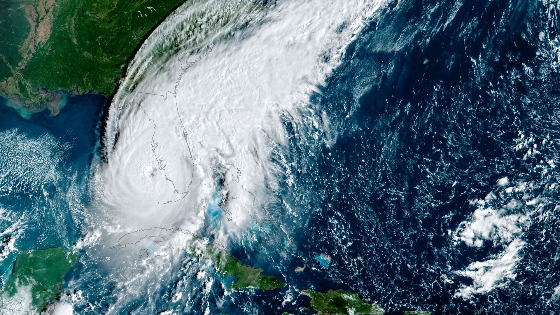
Satellite view of Hurricane Ian as the storm approached Florida on Sept. 28, 2022. Image: NOAA via Getty Images)
The upcoming Atlantic hurricane season, which officially kicks off June 1, is set to feature a tug of war between a developing El Niño in the Pacific, and unusually warm waters throughout the Atlantic, NOAA forecasters say.
Why it matters: The seasonal outlook, released Thursday, helps inform storm planning for the federal, state and local governments.
Zoom in: The NOAA 2023 hurricane season outlook calls for a 40% chance of a near normal hurricane season, and a 30% chance of either a below or above average season.
- In terms of numbers, the agency calls for 12 to 17 named storms to form, of which 5 to 9 will become hurricanes and 1 to 4 will be "major" storms of Category 3 intensity or greater.
- This compares to the 30-year average of 14 named storms, 7 hurricanes and 3 major hurricanes.
Between the lines: A developing El Niño in the equatorial tropical Pacific Ocean would typically indicate a below average Atlantic hurricane season, and above average eastern Pacific season, is likely.
- El Niño events can reduce Atlantic tropical storm and hurricane activity by increasing winds in the upper atmosphere over the tropical Atlantic.
- Such wind shear can disrupt incipient storms before they can strengthen.
- However, heading into this summer, sea surface temperatures in the typical hurricane forming regions of the Atlantic along with most other areas are unusually warm for this time of year.
- That would suggest an unusually active season lies ahead.
What they're saying: For now, NOAA is threading the needle between the two influences, in addition to others.
- “It’s kind of like a clash between those big factors,” said NOAA hurricane seasonal forecaster Matt Rosencrans at a press conference.
- He added that the sea surface temperature anomalies are likely to stick around, particularly in the tropical Atlantic, through the summer.
The intrigue: The Atlantic is still in the midst of a largely natural multi-decade upswing in hurricane activity, though human-caused climate change is driving an increase in sea surface temperatures there and around the world.
- Globally-averaged ocean temperatures have been off the charts during April into May.
Threat level: Climate change is already having detectable changes to nature's largest and most powerful storms.
- A warmer atmosphere can carry more water vapor, which gets wrung out as heavy rains over land. On average, storms are now wetter than they used to be.
- In addition, increasing ocean and air temperatures are leading to more high-end, major hurricanes, but are not thought to be increasing the total number of storms overall.
- As was seen with Hurricanes Ida, Michael and Ian in recent years, hurricanes are exhibiting a greater tendency to rapidly intensify, leaping storm categories in short periods of time and potentially catching emergency managers off guard.
- Also, the magnitude of storms' rapid intensification is increasing in many parts of the world.
Of note: Some studies show that tropical storms and hurricanes are moving more slowly at landfall, related to slackening steering currents, though this is an area of active research. Slow-moving storms have a greater potential to cause inland flooding.
The big picture: Other forecast groups have also been seeking a balance between the potential El Niño and Atlantic sea surface temperatures.
- The University of Pennsylvania put out a new outlook calling for between 12 and 20 named storms, with a "best guess" of 16.
- A separate early outlook issued last month from forecasters at Colorado State University projects a slightly below-average Atlantic hurricane season
Yes, but: While the seasonal outlook helps spur storm preparation activities, it provides little to no guidance on where such storms may ultimately strike.
Editor's note: This story has been updated with additional reporting.