Humberto strengthens into Category 1 hurricane


Add Axios as your preferred source to
see more of our stories on Google.
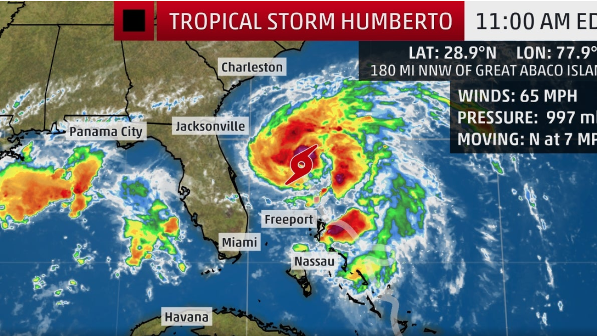
Photo: Courtesy of the National Weather Service
Humberto strengthened into a hurricane as it moved east into the Atlantic Ocean Sunday night, and the National Hurricane Center warns Bermuda is set to be impacted with heavy rain from the Category 1 storm.
The latest: Humberto was moving at 3 mph 785 miles west of Bermuda at 11 p.m., with sustained winds of 75 mph. It lashed the Hurricane Dorian-devastated Bahamas with 70 mph winds as it scraped past, but the NHC said the nation escaped the bulk of the storm.
- The northwest Bahamas would see 1 to 2 inches of additional rain from Humberto's outer rain bands "with isolated storm total amounts of 6 inches," the NHC said.
What's next: Humberto may bring periods of heavy rain to Bermuda from late Wednesday, the hurricane center said at 11 p.m. Sunday.
- Potentially life-threatening swells generated by Humberto were set to affect the northwestern Bahamas and the southeastern coast of the United States from east-central Florida to North Carolina during the next few days, the NHC said.
The big picture: Humberto is the third Atlantic hurricane to form in 2019. The first was Barry which spent a brief period as a Category 1 hurricane in July.
- Barry dumped heavy rain across Louisiana after making landfall, triggering flooding, before weakening back to a tropical storm.
- Dorian twice made landfall in the Bahamas as a Category 5 storm, killing at least 50 people, after becoming the second Atlantic hurricane to form. It's tied with a 1935 hurricane as the strongest Atlantic hurricane on record.
Of note: Hurricane season for the Atlantic Basin continues through November.
Go deeper: The Atlantic Basin's tropical storms and hurricanes in 2019
Editor's note: This article has been updated with more details on Humberto.
