Tampa Bay braces for landfall as Hurricane Ian nears Category 5 strength


Add Axios as your preferred source to
see more of our stories on Google.
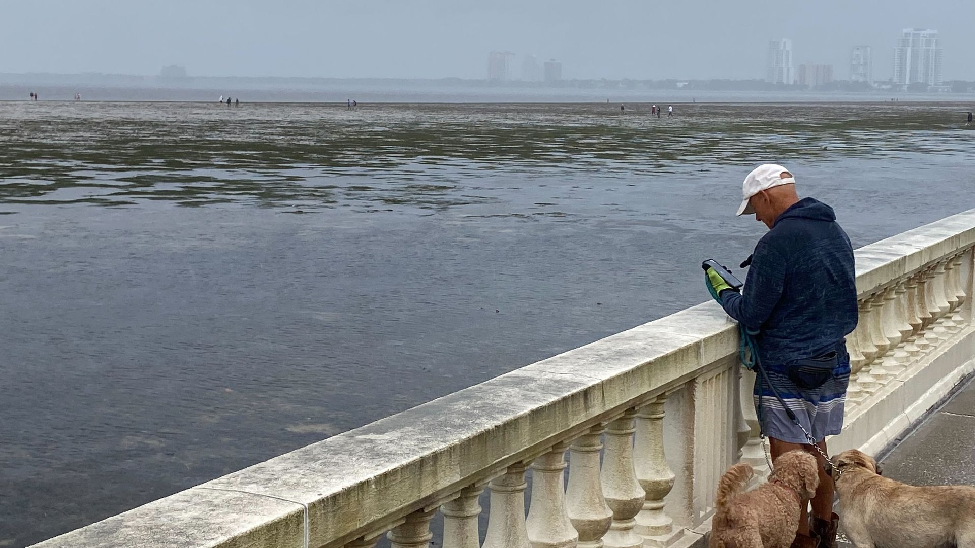
A resident visits Tampa's Bayshore Boulevard on Wednesday morning to see how the water has retreated. Photo: Ben Montgomery/Axios
There's still some uncertainty, but the latest storm forecast is good news for the Tampa Bay area.
- As the first heavy clouds of Hurricane Ian, now an "extremely dangerous" hurricane nearing Category 5 status, start racing across the Tampa Bay region this morning, the eye is churning toward a more southerly landfall, near Lee and Charlotte counties.
Why it matters: With Ian coming ashore to the south later today, the Tampa Bay area avoids the major storm surge that was forecast to flood thousands of homes and deluge the region.
- While flooding depends on the timing of the surge and the tidal cycle, the National Hurricane Center's 11am forecast predicts a surge of 4 to 6 feet in Tampa Bay, from the Anclote River to Longboat Key — lower than yesterday's estimate of 5 to 10 feet.
Yes, but: Our neighbors to the south face a more intense storm, with maximum sustained winds of 155 mph. Damage will be catastrophic, per the National Hurricane Center.
The latest: Ian's center is expected to move onshore this afternoon. More than 2 million people in Florida are under evacuation orders.
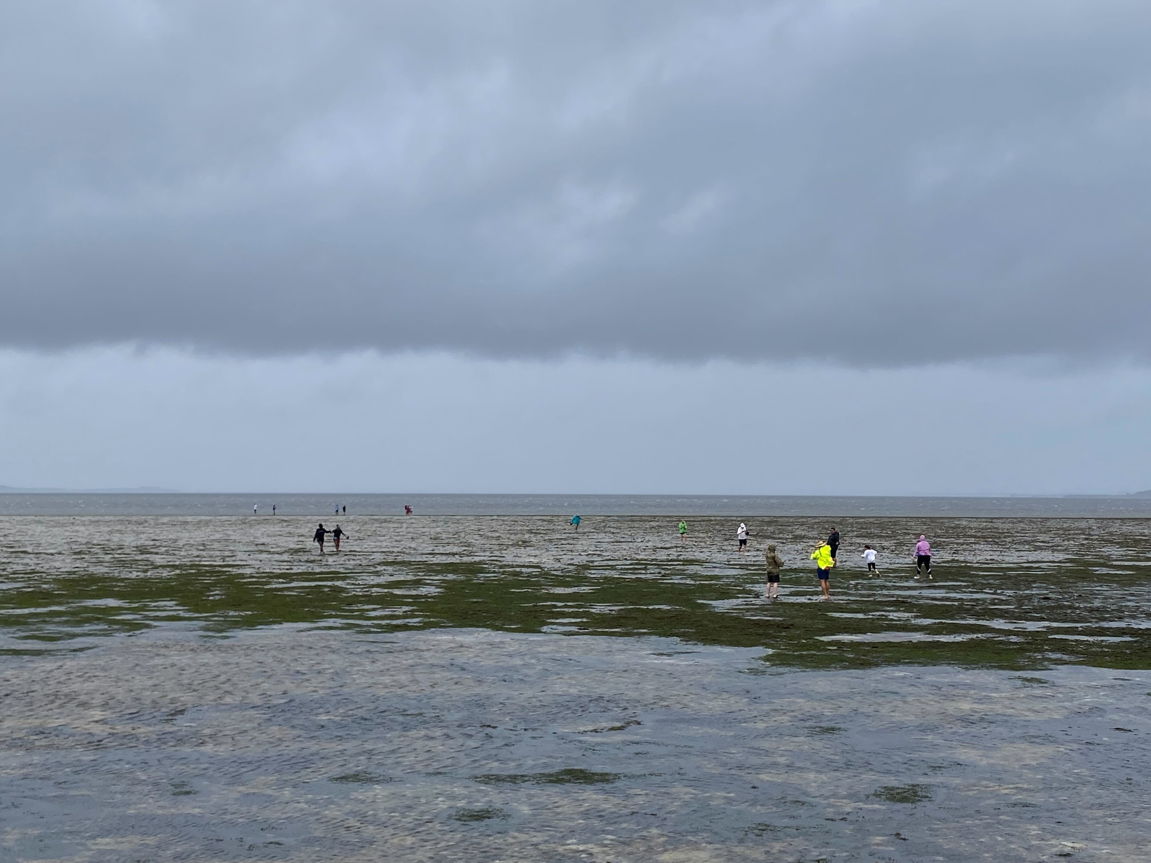
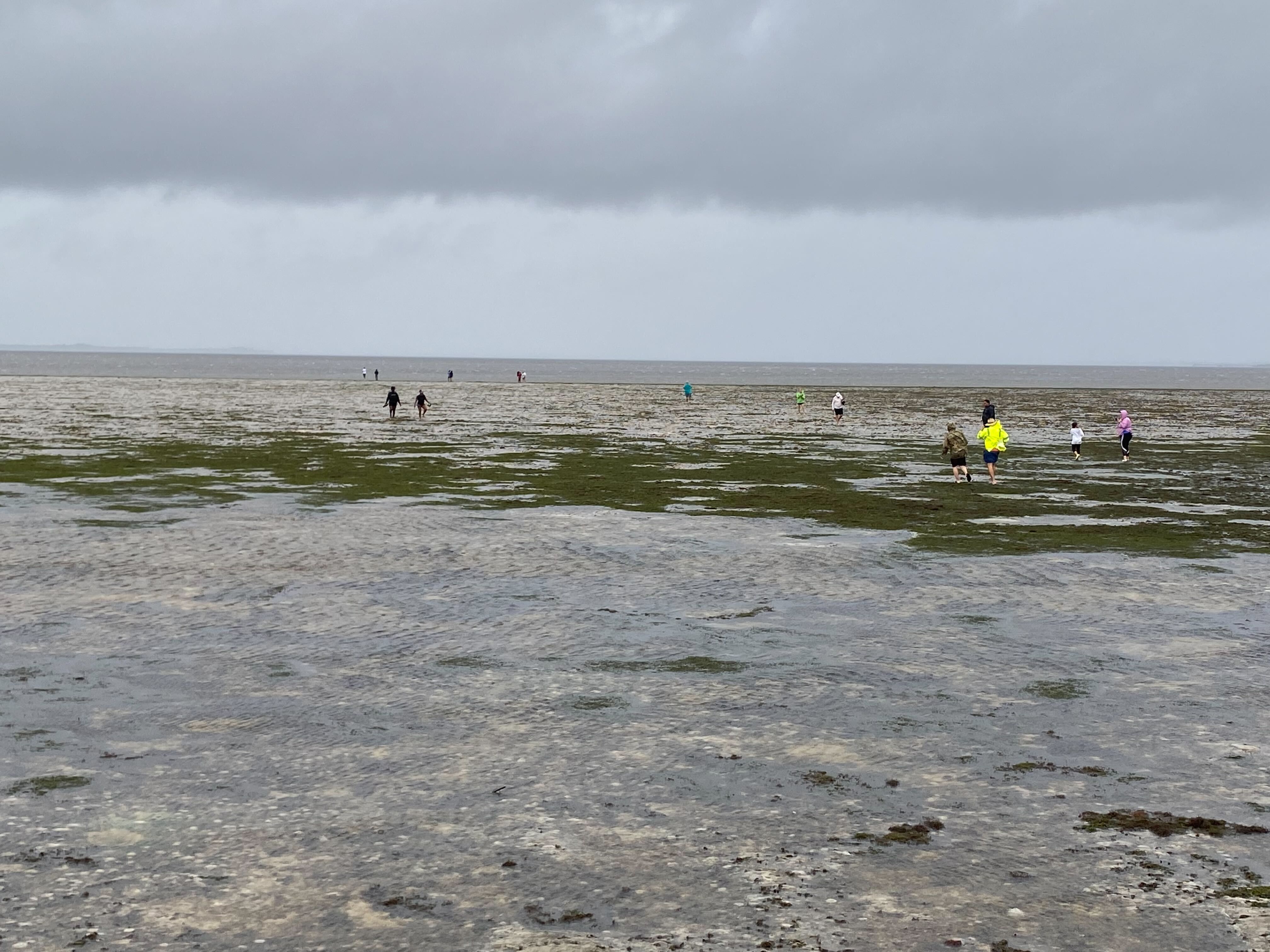
- The approaching storm and a falling tide began emptying the shallows of the Hillsborough River, Old Hillsborough Bay and parts of Upper Tampa Bay Wednesday morning.
- Along Tampa's Bayshore Boulevard, the water had retreated from the seawall about 50 feet in places, like it did when Hurricane Irma streaked east of the region in 2017.
- The water will begin to return, but strong southerly winds could keep water offshore for longer.
- Hundreds of people came out to Tampa's Bayshore Boulevard Wednesday morning to see how the water had retreated.
What to expect: Strong sustained winds and heavy driving rain all day. Localized flooding.
- We could get 12 to 18 inches of rain, per NHC.
Threat level: One of the biggest threats is surge flooding at the coast, which has prompted mandatory evacuations in some areas.
- A storm surge warning was in effect for a heavily populated stretch of coastline that includes Tampa Bay, Fort Myers, Naples, Port Charlotte, St. Petersburg and Sarasota.
- The surge between Chokoloskee and Bonita Beach, including Charlotte Harbor, is predicted to be the highest, at 8 to 12 feet above normally dry ground.
- A hurricane warning is in effect from Chokoloskee to the Anclote River, which includes Tampa Bay.
Editor's note: This story has been updated to include new forecasting and local response details.