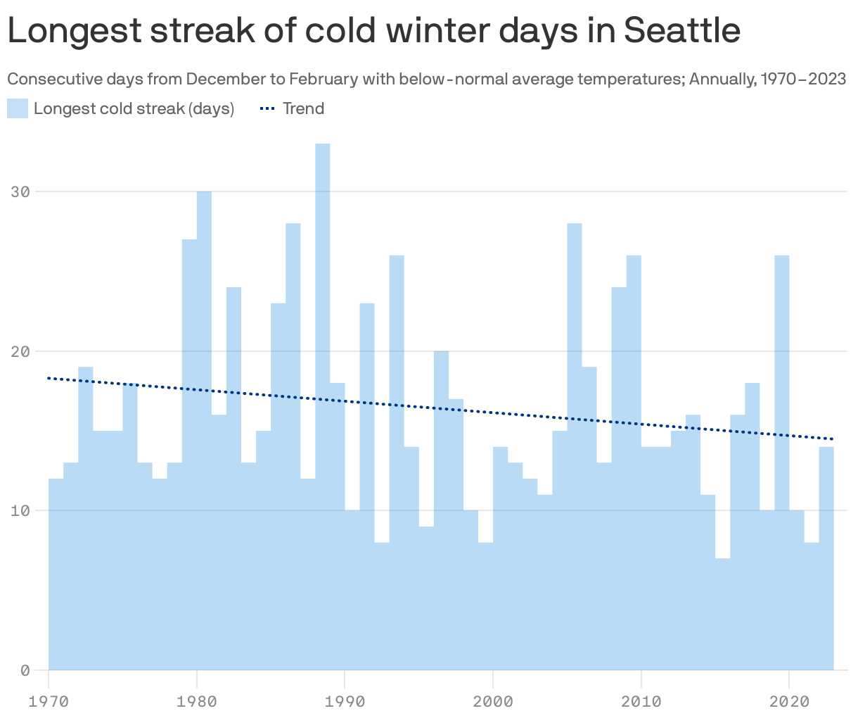
Seattle's cold streaks are getting shorter


Add Axios as your preferred source to
see more of our stories on Google.
High temperatures in Seattle may be a few degrees below average right now, but data shows our winter cold snaps aren't lasting as long as in past decades.
By the numbers: Cold weather streaks in Seattle have gotten four days shorter on average since 1970, per a new analysis from Climate Central, a climate research and communications nonprofit.
Why it matters: Few people love chilled-to-the-bone cold snaps, but extended periods of chilly weather are key for some farmers and winter sports lovers, and for building essential snowpack.
Reality check: Prolonged cold snaps still happen; Seattle's longest of 2023 lasted 13 days.
Flashback: The city's longest cold streak between 1970 and 2023 came in 1988, lasting 33 days.
The fine print: Climate Central defines a "winter cold streak" as "at least two consecutive December–February days with average temperatures below the 1991–2020 winter normal average temperature" at a given location.
The big picture: Cold streaks are largely getting shorter on average nationwide, per the recent Climate Central report.
- "Winter's longest cold streaks have gotten shorter since 1970 in 98% of 240 U.S. locations analyzed," per the report.
- "Nearly half of the locations analyzed ... have seen their longest winter cold streaks shrink by at least one week since 1970."