Sep 22, 2025 - News
Utah redistricting maps show Dem-heavy SLC split in two

Add Axios as your preferred source to
see more of our stories on Google.
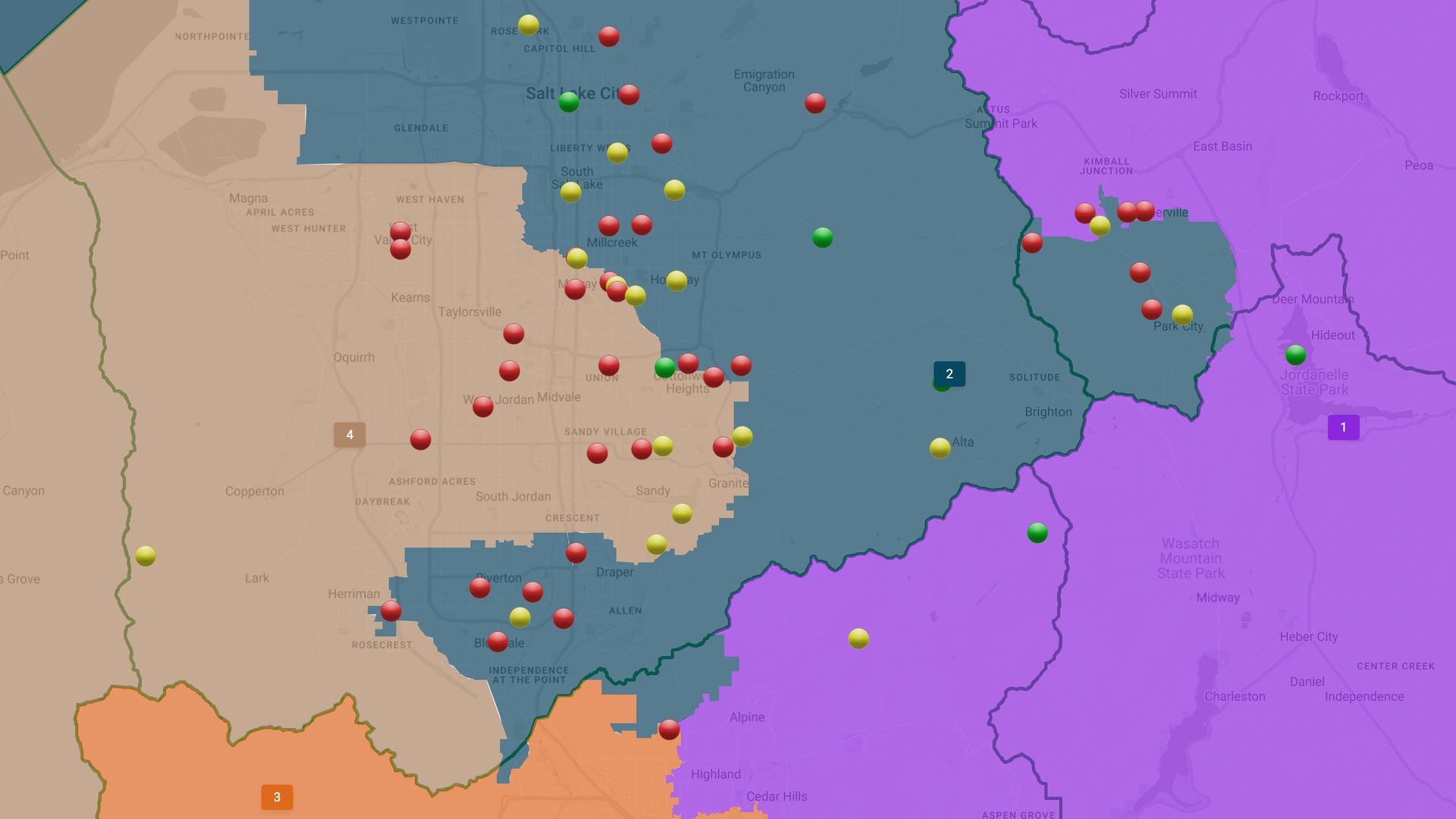
The proposed map for Option E, which groups eastern Salt Lake and Davis counties, and western Salt Lake and Tooele counties. Dots represent public comments. Image via the Utah Legislature.