July marks second-hottest month on record in Philadelphia

Add Axios as your preferred source to
see more of our stories on Google.
If you've felt like it's been too hot lately, you're not wrong: We just made it through the second-hottest month ever recorded in Philadelphia, according to National Weather Service data.
Why it matters: This is all part of a wider acceleration in the pace and intensity of extreme weather events across the globe and here in the U.S., Axios' Andrew Freedman reports.
- When it rains, it rains harder. When it's hot, it gets hotter and stays that way longer than it used to.
- We have long designed our infrastructure as if the climate conditions and extremes of the past would hold true in the future. With climate change, that is no longer the case, as outlier events trend closer to the norm.
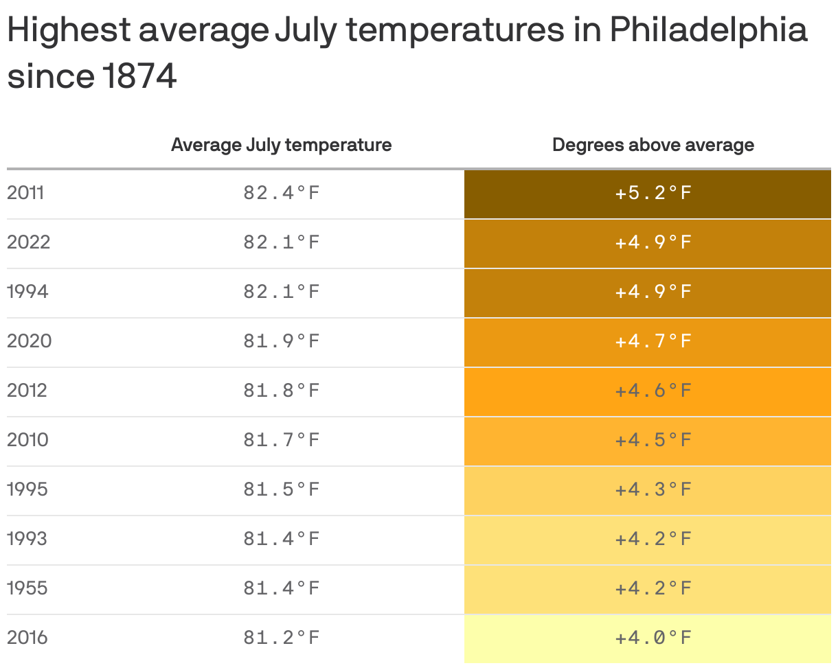
By the numbers: July's average temperature clocked in at 82.4°F, outpaced only by July 2011. That was 3.4°F above normal for the month.
- We didn't get relief at night either. Overnight lows were the warmest on record.
The big picture: Nine of Philly's 10 hottest months — all Julys — have occurred in the last 30 years.
- NWS' average temperature records for the area stretch all the way back to 1874.
What's next: We're staring down even more extreme heat here at the start of August.
- The NWS is warning of "oppressive" and "dangerously high" temperatures Thursday as heat indexes peak near 103°F, with little relief at night thanks to oppressive humidity.