When to expect New Orleans' first freeze


Add Axios as your preferred source to
see more of our stories on Google.


It's feeling more like pumpkin spice weather in New Orleans, but it will still be several weeks before we'll likely get our first freeze.
The big picture: New Orleans' average first freeze is Dec. 22, nonprofit climate research group Climate Central says.
- That's the average first day temperatures hit 32°F or below between 1991 and 2020.
Zoom out: First freeze is slightly different from "first frost," which is related not just to temperature, but also to the amount of moisture in the air.
- Dec. 7 is the median date of the first frost in New Orleans, according to the Midwestern Regional Climate Center. That's when we could see a light icy coating on grass, windshields and roofs.
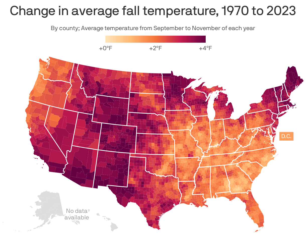
The intrigue: Fall is getting warmer in southeast Louisiana and the rest of the country, a new analysis finds.
- Fall temperatures rose 2.3°F on average in Orleans Parish in a new Climate Central report looking at data between 1970 and 2023. They rose 2.5°F on average across 234 U.S. locations.
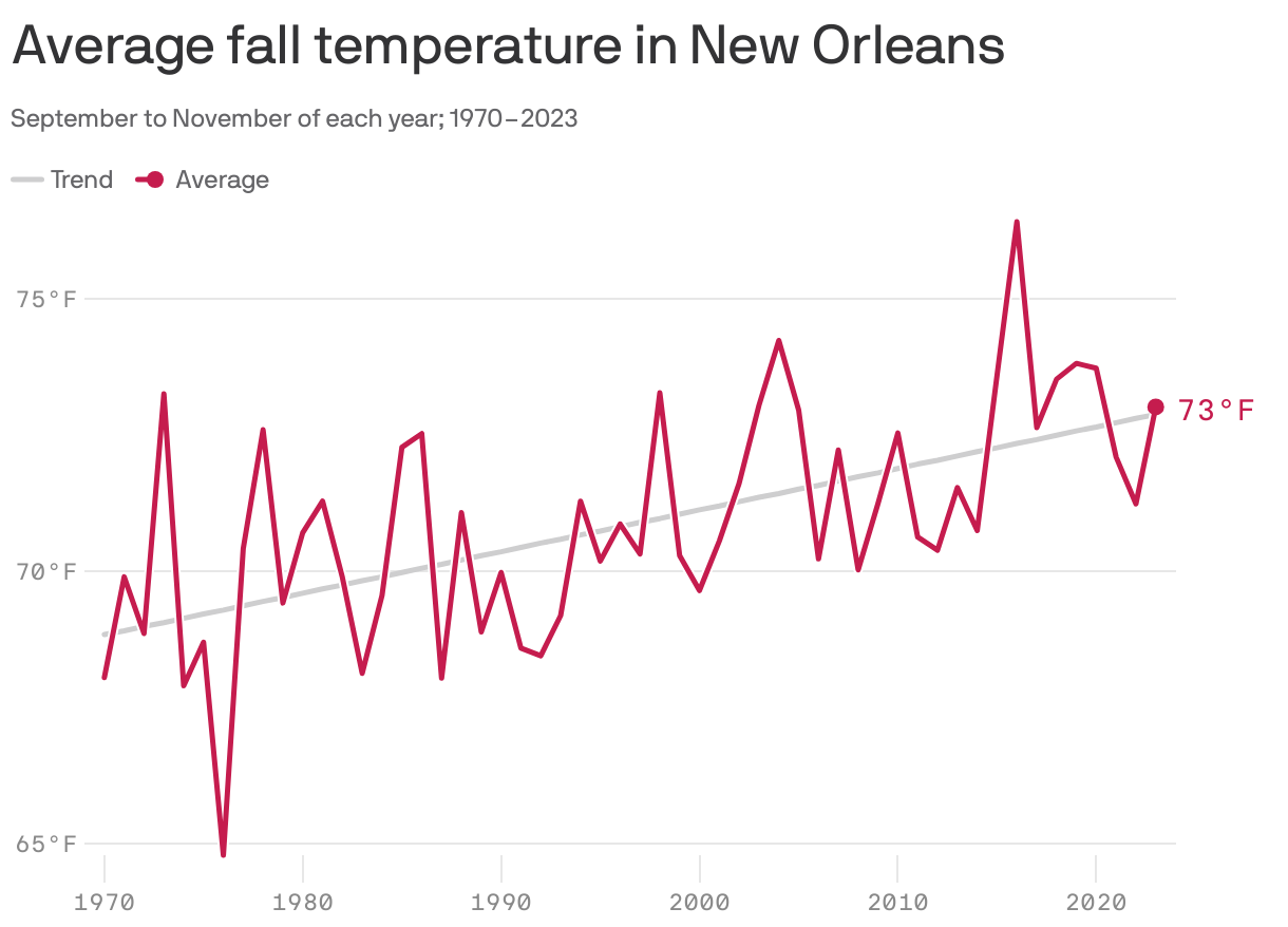
- The analysis is based on average temperatures between September and November of each year.
- Above-normal temperatures are expected across much of the country this fall, per NOAA's seasonal outlook.
Between the lines: The fall trends are consistent with climate science findings showing how the planet is responding to human-caused increases in greenhouse gases, such as carbon dioxide.
- All other seasons are also warming.