A warm fall in Indianapolis is likely on the way


Add Axios as your preferred source to
see more of our stories on Google.
After a summer in Indy that got dangerously hot at times, Hoosiers should keep their shorts and tank-tops handy as warmer-than-average temperatures linger a bit longer.
Why it matters: Prevailing weather conditions during the September-through-November period could clinch records for the warmest year in some cities while affecting multibillion-dollar industries such as agriculture.
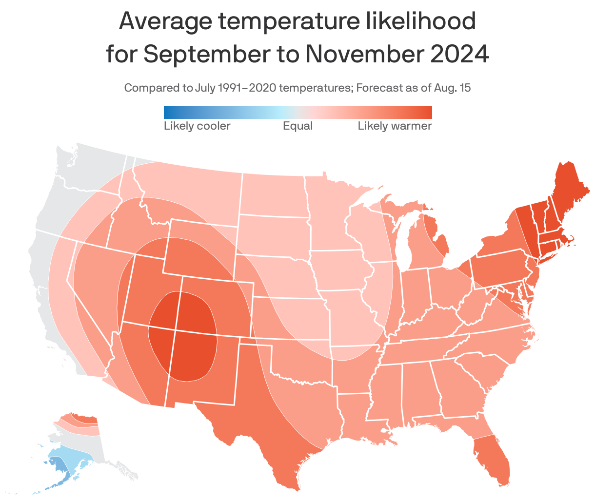
Driving the news: According to the NWS' Climate Prediction Center, fall 2024 is likely to feature above-average temperatures across much of the country, particularly in the Northeast and Southwestern states.
- For Indianapolis, the normal September temperature is 67.8 degrees, according to the NWS.
- The Indianapolis area is also expected to see below normal precipitation along and north of the Interstate 70 corridor.
State of play: August 2024 will go down as the 39th warmest on record in Indianapolis.
- Daily temperatures were above normal on 17 days, and below normal on 14 days.
Zoom in: Some Indianapolis neighborhoods are feeling the heat more than others.
- 38% of Indianapolis residents live in an area where the "urban heat island" effect raises temperatures by 8 degrees or more, per Climate Central.
- That's higher temps for more than 465,000 people.
The latest: Those eager for hoodie season to officially begin can count on the unpredictability of Indiana weather to give them plenty of cold bursts amid the warm-up.
- The NWS says after a week of rising temperatures in Indianapolis, a cold front will move in that could send conditions this weekend plummeting into the low 40s in some parts of Central Indiana.
The bottom line: Enjoy a few more weeks of al fresco dining in Indy, and dress light during college football tailgating this season.