When New Orleans can expect the first frost of the season

Add Axios as your preferred source to
see more of our stories on Google.


Another cold front is on the way for New Orleans, but it will likely be several more weeks before the first frost of the season.
Driving the news: The National Weather Service in Slidell says a cold front could arrive Monday, dropping highs from the 80s into the 60s and 70s for the week.
- Overnight lows in the 50s are possible on the south shore.
Zoom out: Our first frost isn't expected until December.
- Dec. 7 is the median date of the first frost in New Orleans, according to the Midwestern Regional Climate Center. That's when we could see a light coating on grass, windshields and roofs.
- The average first freeze, when the temperature is 32°F or below, happens Dec. 12, NWS says. A freeze requires protection for people, pets and sensitive plants.
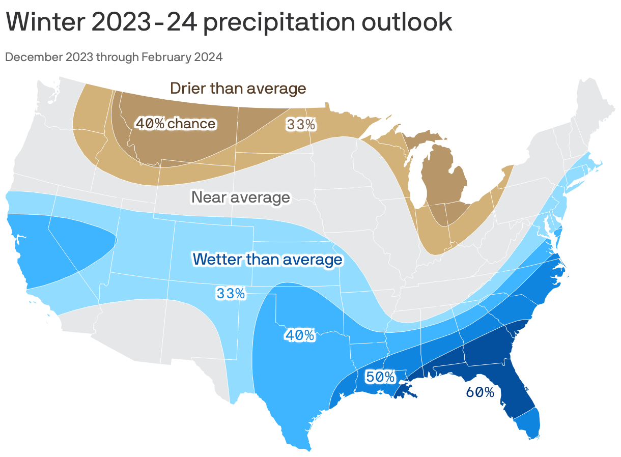
The big picture: NOAA forecasters say New Orleans could have a wetter winter than average this year.
- It's welcome news to a region that's in a severe drought and battling marsh fires and saltwater intrusion.
- This is one of the driest years on record so far in New Orleans, NWS meteorologist Mike Efferson tells Axios. New Orleans is more than 26 inches below normal rainfall for the year.
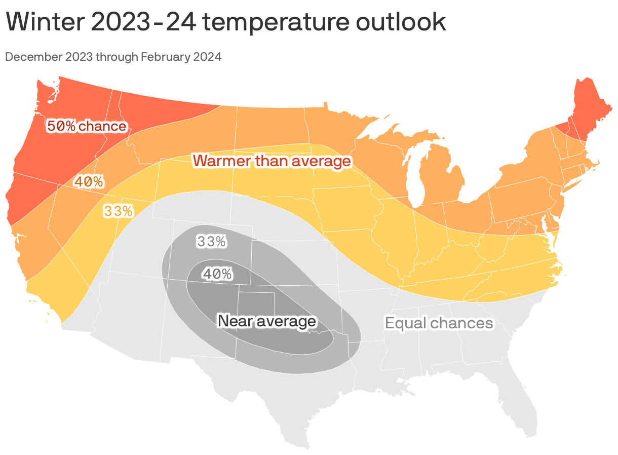
Mild winter? The temperature outlook is less clear for New Orleans. We have equal chances of having an average, warmer or colder winter, according to NOAA.
The intrigue: It's not yet clear how record-warm global average temperatures will tip the scales in terms of U.S. air temperature and precipitation trends this winter, writes Axios' Andrew Freedman.
- But they do raise the threat of some surprises, potentially in the form of extreme weather events.
Go deeper:
Prepare for a turbulent El Niño winter — with a major wild card