Tips from National Hurricane Center about interpreting long-range forecasts

Add Axios as your preferred source to
see more of our stories on Google.
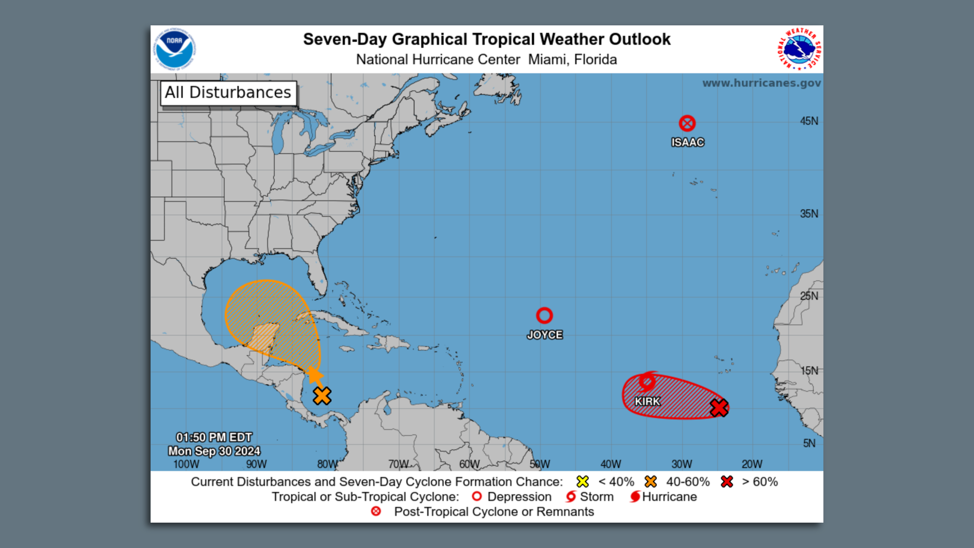
This is the 7-day tropical weather outlook from the National Hurricane Center. Image: NHC
Meteorologists are cautioning residents about what they should and shouldn't be taking away from long-range hurricane outlooks.
Why it matters: There's another tropical disturbance heading into the Gulf, and we're on high alert after Hurricanes Francine and Helene.
The big picture: The National Hurricane Center was tracking five systems Monday, including a Caribbean disturbance forecast to enter the Gulf of Mexico.
- It could become a tropical depression later this week or weekend, NHC says, but it is too early to tell if it could reach Louisiana.
What to do: It's good to pay attention and know a threat may be on the horizon, National Weather Service meteorologist Lauren Nash tell Axios.
- Have supplies ready, and know where you would go if you need to evacuate, she said.
- She cautioned about using social media as your main source of hurricane updates. Two trustworthy and free sources are the National Hurricane Center and the National Weather Service's office in New Orleans.
- It's also important to understand that a forecast can change daily.
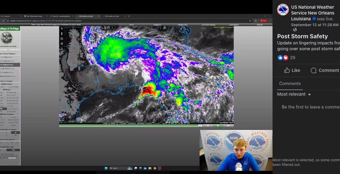
What they're doing: NHC is communicating on more platforms than ever before, NHC director Michael Brennan tells Axios New Orleans. The agency is doing research with social scientists about what resonates with residents.
- "We made products that meteorologists liked because we were meteorologists," he said, noting that things must change.
- They are redesigning their images and products with different colors and studying the phrases and words they use, he said. They are also studying how those elements resonate with people in different parts of the country.
How it works: The National Hurricane Center puts out 7-day tropical weather outlooks four times a day during the Atlantic hurricane season. These long-range forecasts give a general idea of spots to watch.
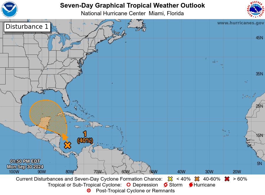
- Storms can develop anywhere within the shaded area, which usually covers a large swath of water and land.
- NHC initiates advisories when there's a potential storm or a tropical depression forms. This includes the storm's track and hazard warnings for people on land.
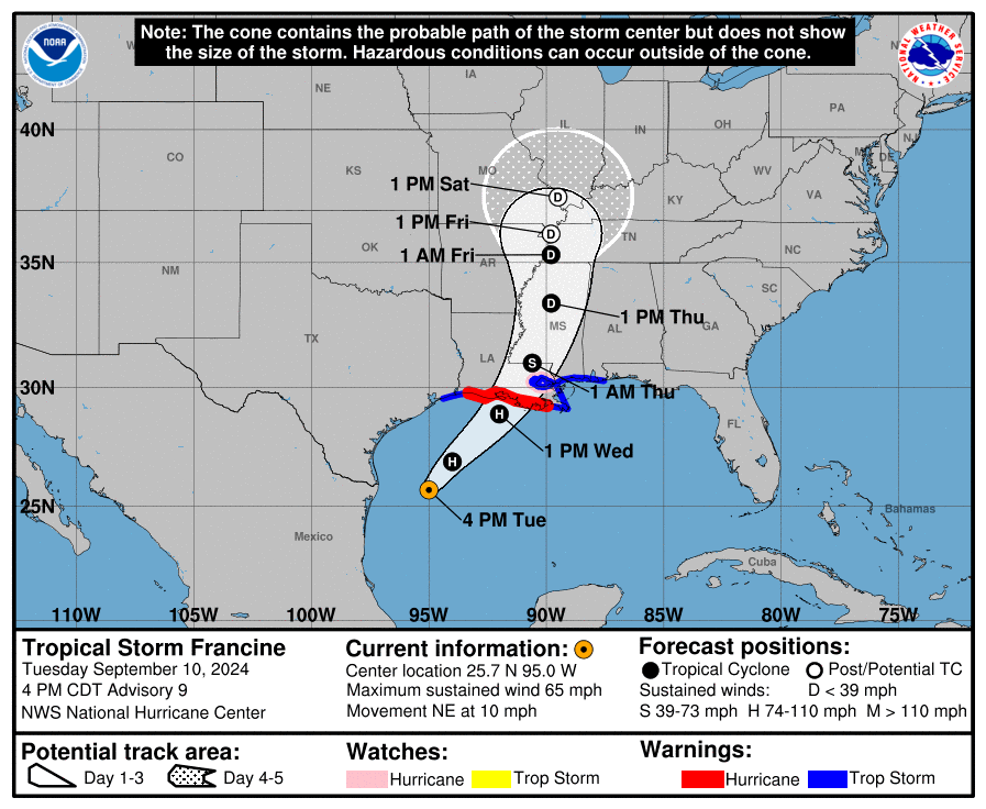
The fine print: The margin of error is greater the further away landfall is. Meteorologists refine the track and hazards as landfall gets closer.
- The key, they say, is to look at the entire "cone of uncertainty" and not focus on the center line.
Between the lines: NHC doesn't put out so-called "spaghetti models," those graphics that are frequently shared online and plot where various models say the eye could go.
- They don't show the size or intensity of the storm, Nash says, but they are helpful to get an idea of the possibilities.
Subjective interpretations of warnings
The intrigue: People usually interpret warnings based on their personal experiences, Brennan says.
- Did they flood during a previous tropical storm? If not, they may not be as as concerned about a future threat, even when a "tropical storm warning is not something to take lightly," he said.
- "Most people are very focused on the spot right where they are," he says. "It's down to almost personal levels of experience."
Zoom out: NHC is looking at the "broad picture" with storms, he said, and focusing on the hazards.
- The center can shift, and the intensity can fluctuate, he said, as it did for Hurricane Francine, which hit Louisiana in September.
- "Watches and warnings account for that uncertainty," he said. These usually give a range of what to expect for wind, rainfall and storm surge.
The bottom line: Hurricanes are a part of life on the Gulf Coast. Hope for the best, and prepare for the worst.