People overestimate precision of hurricane forecasts

Add Axios as your preferred source to
see more of our stories on Google.
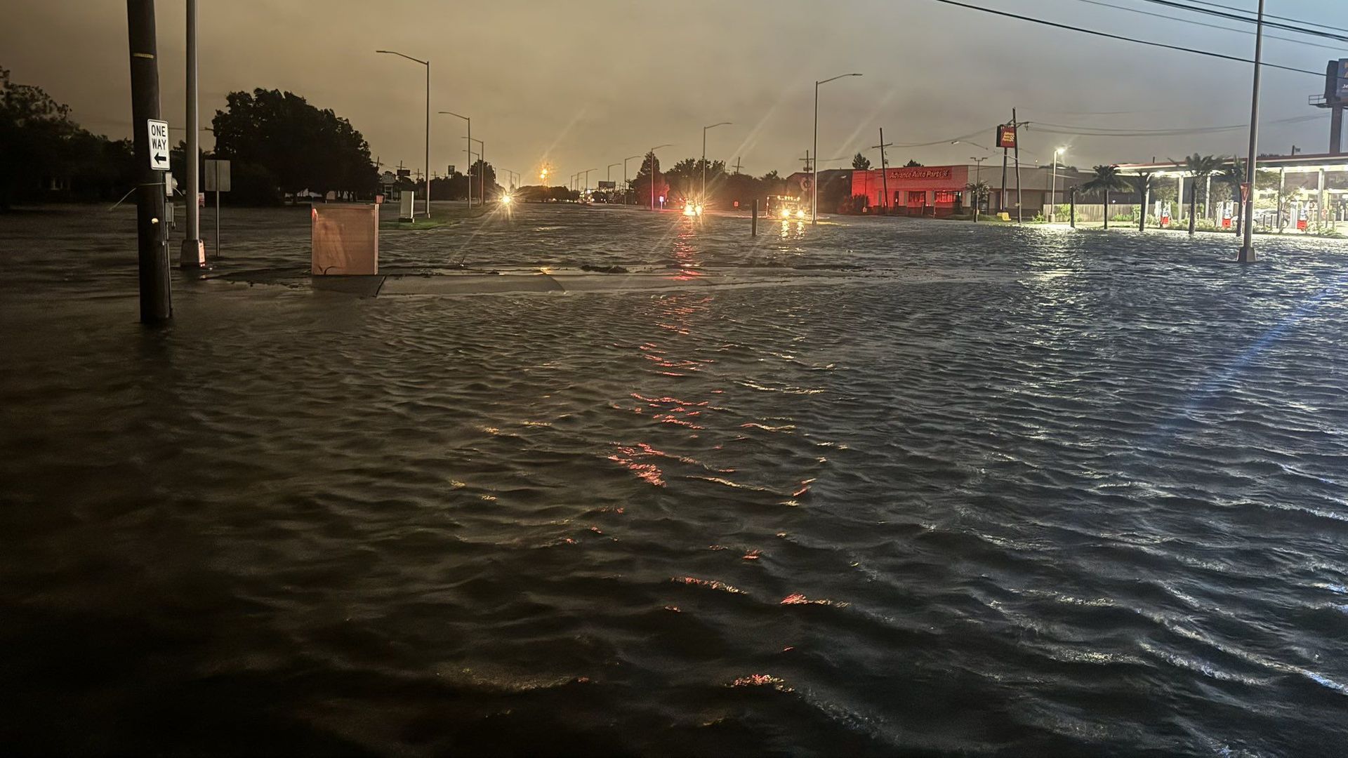
Many streets flooded in Metairie during Hurricane Francine. Photo via Parish President Cynthia Lee Sheng
Experts are pushing back against the armchair meteorologists who say they weren't warned about Hurricane Francine in metro New Orleans.
Why it matters: Technology like weather apps and social media could give people a false sense of preparedness when it comes to storms.
The big picture: Phone apps tell you down to the minute when it's going to rain so people expect an hourly breakdown of what will happen at their house, said Fox 8 meteorologist Zack Fradella.
- "This is not possible for a hurricane that wobbles its way along a path," Fradella said. "Unfortunately, the expectation is for that type of precision and, well, precision is the enemy of accuracy."
Catch up quick: Francine's eyewall passed near New Orleans, dropping 8 inches of rain in two hours in some places and causing widespread street flooding.
- The airport set a record with 7.23 inches of rain, reports Axios' Chelsea Brasted.
- "It was something else," said Collin Arnold with NOLA Ready.
- Jay Grimes, the state climatologist, said the rainfall amounts in New Orleans were "a little more significant than we expected," citing the shifted track and a slower speed.
Zoom in: Jefferson Parish Council President Scott Walker said Francine was a perfect example of "you never know."
- "It's important to never underestimate and never lose track of what's out there, and pay attention to what could be headed your way, because in an instant, it will be headed your way, " Walker said Thursday. "And we ended up seeing a little bit more, I think, absolutely flooding wise, than we expected."
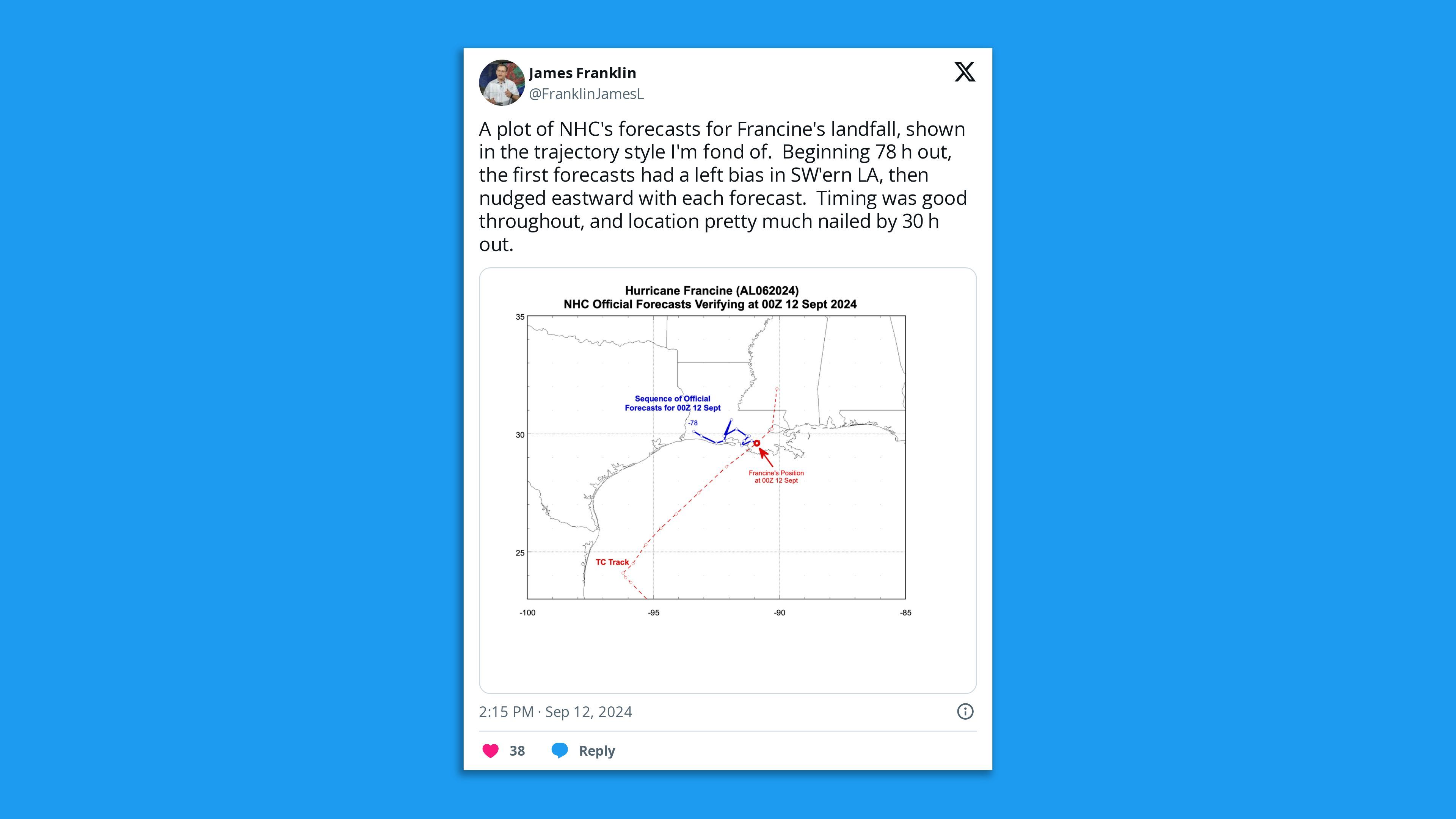
Friction point: Experts beat back the idea from some residents and colleagues that the National Hurricane Center got Francine's forecast wrong.
- The first track on Sunday included southeast Louisiana, and Fradella said it "was very good awareness for the threat incoming."
- The NHC said they had low confidence in the early tracks and changes were likely. Indeed, the track shifted east throughout the week, ending up near Baton Rouge and New Orleans.
- "I've always expressed frustration with the center line on these track cones," Fradella tells Axios. "We preach 'focus on the cone, focus on the cone' and then we put a line down the center which by human nature takes our focus away from the cone set forth by a typical margin of error."
The intrigue: "People have got to pay attention," said Margaret Orr, who recently retired as WDSU's chief meteorologist but was still tweeting forecasts throughout the storm.
- The problem, she says, is people saw a forecast Sunday for a possible tropical depression near Texas and they perhaps didn't check back in.
- "The NHC did not get it wrong," she tells Axios.
What he's saying: NHC's track and intensity forecasts were "more accurate than usual" for Francine, said University of Miami climatology researcher Brian McNoldy.
- "I actually suspect that some of the problem is that many people underestimate what a tropical storm is," he told Axios on Thursday. "You can get a 3-foot storm surge, a foot of rain, 70 mph sustained winds and 95 mph gusts and that's still a tropical storm."