North Texas had a warm, dry winter

Add Axios as your preferred source to
see more of our stories on Google.
February brought temperatures well above average to Dallas-Fort Worth — and less rain than typical.
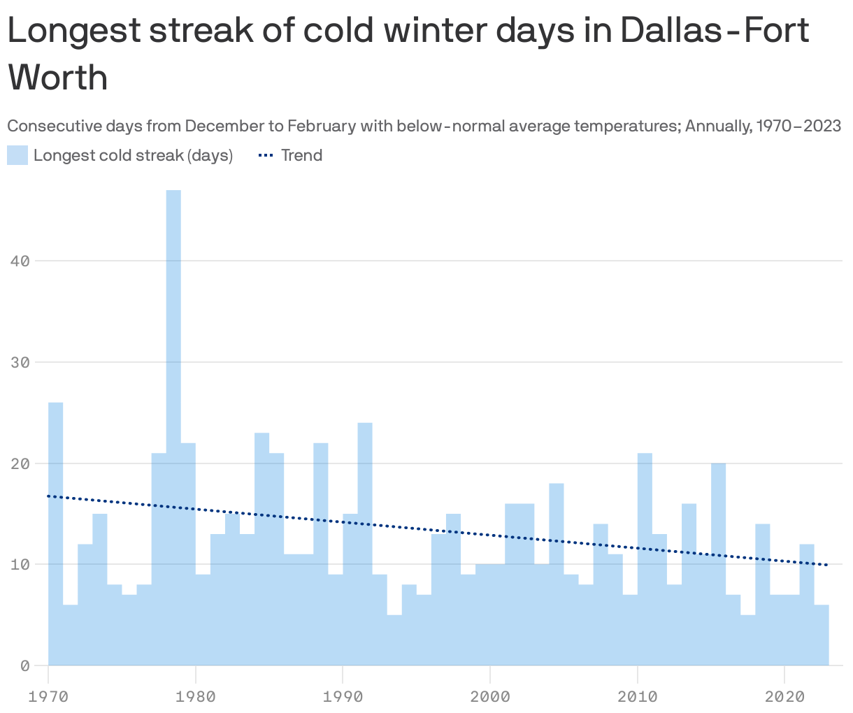
The big picture: D-FW sees fewer consecutive days of below-normal winter temperatures than the region did decades ago.
- Cold snaps were seven days shorter in 2023 than similar streaks were in 1970.
Zoom out: Cold streaks are largely getting shorter on average nationwide, per a recent report from Climate Central, a climate research and communications nonprofit.
- Most major U.S. cities set their longest cold streaks in the 1980s.
The latest: February's average daily temperature in Dallas-Fort Worth was about 7.5 degrees above average, per the National Weather Service.
- And the average daily high temperature was 9 degrees above normal through the first 28 days of the month, meteorologist Jennifer Dunn tells Axios.
State of play: January was cold and rainy, though the month ended with temperatures above average.
- February was much warmer than usual and saw nearly an inch less rain than typical.
By the numbers: Monday's high of 94 at DFW Airport set a new daily record for the highest temperature recorded on Feb. 26. The previous record was 90 on Feb. 26, 1917.
- A higher temperature has only been recorded two other times in February — 95 on Feb. 21, 1996, and 96 on Feb. 25, 1904.
- Overnight temperatures were also above average. Tuesday's low was 66 at DFW Airport, matching a daily record set in 2011.
- Not-so-fun fact: 2011 holds the record for the most 100-degree days with 71.
What's next: The area will be back in the 70s on Friday and reach the 80s over the weekend, before a mild cool front moves in with slightly lower temperatures and a chance of rain early in the week.
- The first part of March is predicted to be rainy but overall the month is expected to be drier than typical, per the weather service.