Ohio dodges drought as much of the U.S. dries out

Add Axios as your preferred source to
see more of our stories on Google.
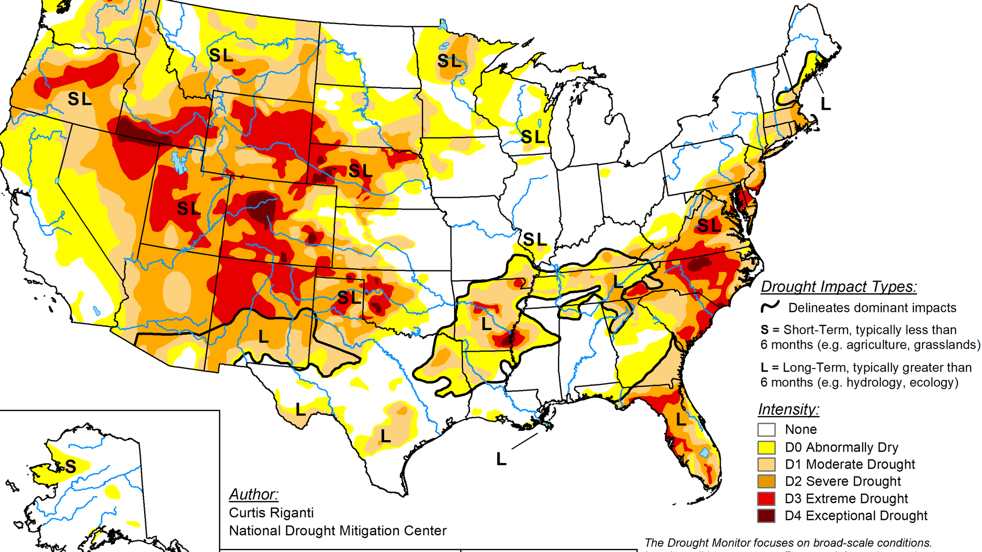
The U.S. Drought Monitor is jointly produced by the National Drought Mitigation Center at the University of Nebraska-Lincoln, the United States Department of Agriculture, the National Oceanic and Atmospheric Administration and the National Aeronautics and Space Administration. Maps: Courtesy of NDMC.
Drought is sweeping across most of the U.S. this summer, but for the first time in a while, Ohio is actually doing OK.
Why it matters: Prolonged dry conditions have widespread impact, from damaged crops to crispy lawns and gardens and potentially higher water bills.
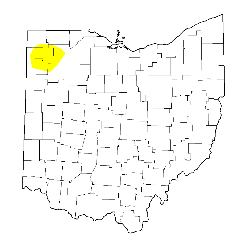
The big picture: Ohio is one of just a handful of states currently without major drought, based on U.S. Drought Monitor maps released every Thursday.
Zoom in: Despite a hotter-than-normal July, Columbus' unusually rainy and cool May has kept things moist enough to prevent issues — at least for now.
- Last year, drought first struck Ohio at the very end of summer, records show. "Abnormally dry" conditions lingered in Central Ohio through fall.
- Northwest Ohio was hit hardest, remaining in "extreme drought" from September to March.
Flashback: Summer 2024 brought the worst drought our state has experienced since 1988, while 2023 brought "moderate drought" in June and October.
- 2021 was the last time conditions were relatively normal the entire year locally.
Yes, but: Current conditions can change quickly. Peak summer heat is here and June and July precipitation has been below average, National Weather Service meteorologist Matthew Campbell tells Axios.
- The Climate Prediction Center's seasonal outlook didn't favor above- or below-average temperatures or precipitation for Ohio, so it's hard to say what comes next.
Fun fact: Remember all that snow we got in January? It didn't do much to help our situation.
- It contains much less liquid than you'd expect, as it's mostly air, Campbell says.
Case in point: January 2026's 13.1 inches of snow amounted to just 1.63 inches of precipitation, about half of what's normal (exactly 3 inches).
Up next this week: The other end of the Ohio weather spectrum — highs in the 90s and no rain for the foreseeable future. Stay hydrated.
Editor's note: A caption in this story has been corrected to show a portion of Northwest (not Northeast) Ohio was "abnormally dry."