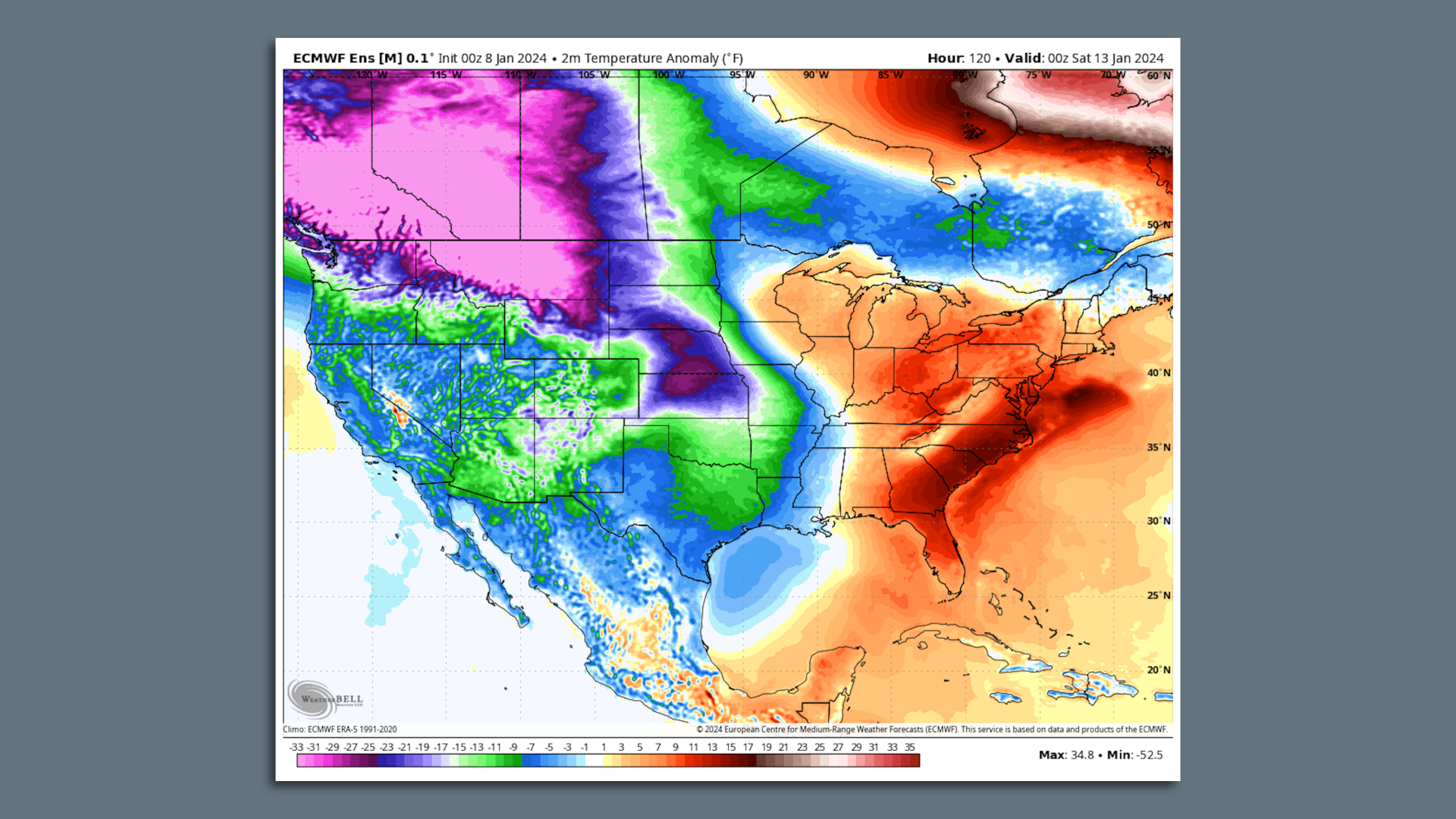
The next two weeks will feature multiple "powerhouse" storm systems and a polar vortex event that together will affect the U.S. from coast to coast, snarling travel, threatening lives and causing damage.
Threat level: The first storm is poised to bring multiple hazards from Monday through Wednesday, including a "ferocious blizzard" in the Plains, plus torrential rain, severe weather and high winds on the Gulf and East Coasts.
Some of the upcoming extremes have clear ties to climate change.
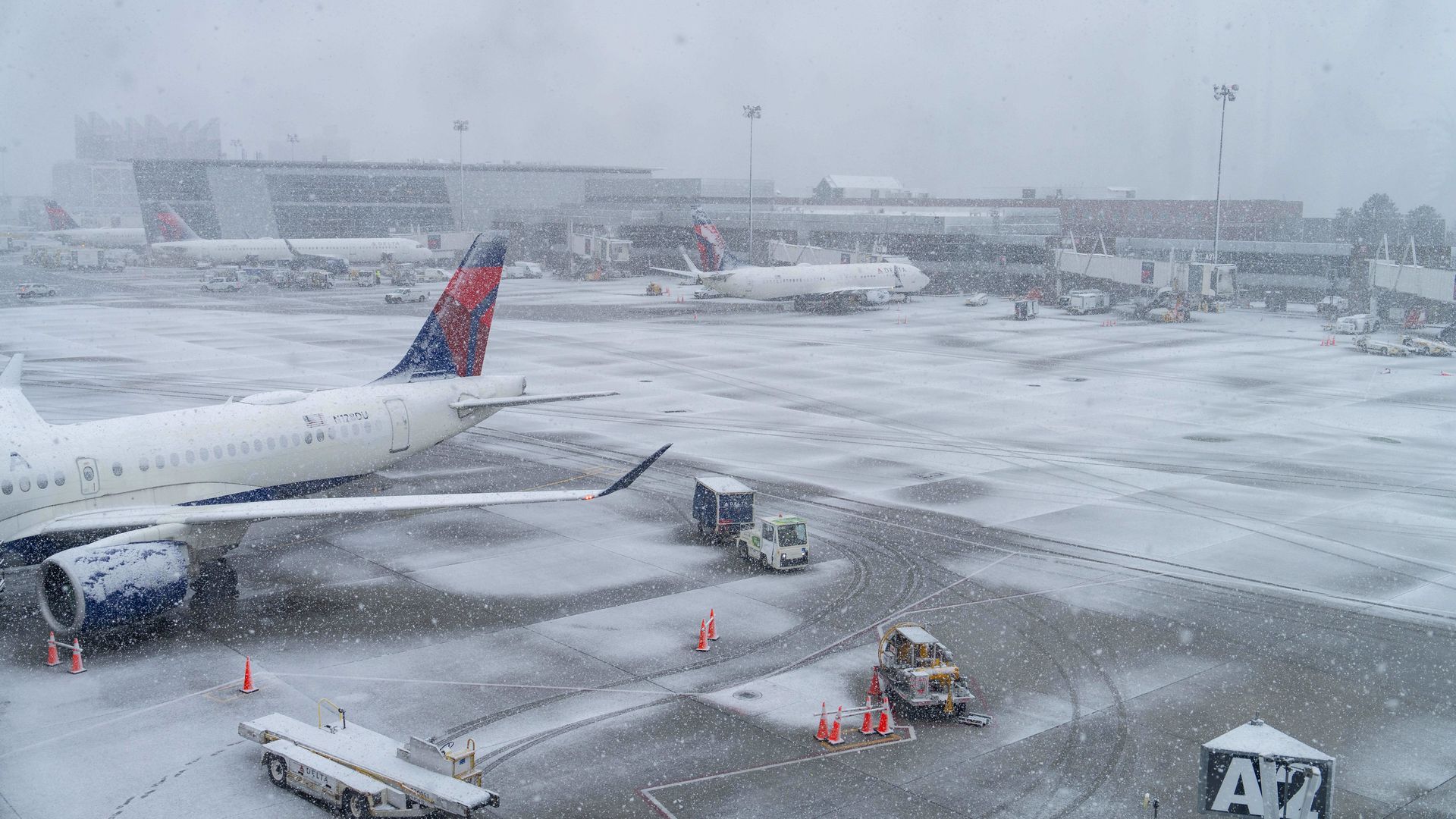
Heavy snow and strong winds were lashing New England and other parts of the U.S. — leaving nearly 17 million under winter storm warnings, from the Northeast to Northern Arizona Sunday evening.
The big picture: The first in a series of storms to hit the East Coast has caused travel disruptions as it brought over a foot of snow to portions of Massachusetts, New York and Pennsylvania on Sunday ahead of a second storm arriving Tuesday, per NOAA.
Threat level: This storm is just the start of an extreme and dangerous weather week across the country that could feature nearly every weather hazard, from flooding rains to hurricane force winds and blizzard conditions.