Hurricane Melissa, world's strongest storm of 2025, closes in on Jamaica

Add Axios as your preferred source to
see more of our stories on Google.
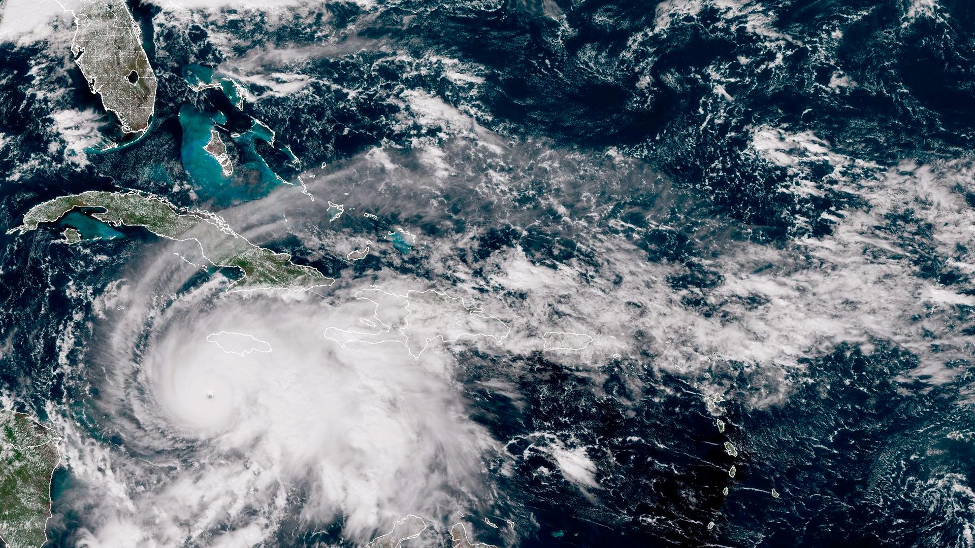
A satellite image of Hurricane Melissa churning northwest through the Caribbean Sea captured on Oct. 27. Photo: NOAA via Getty Images
Editor's note: For the latest on Hurricane Melissa, click here.
Hurricane Melissa strengthened into the world's most powerful storm of 2025 on Monday fueled by warmer ocean temperatures, as the Category 5 behemoth closed in on Jamaica ahead of its expected Tuesday landfall.
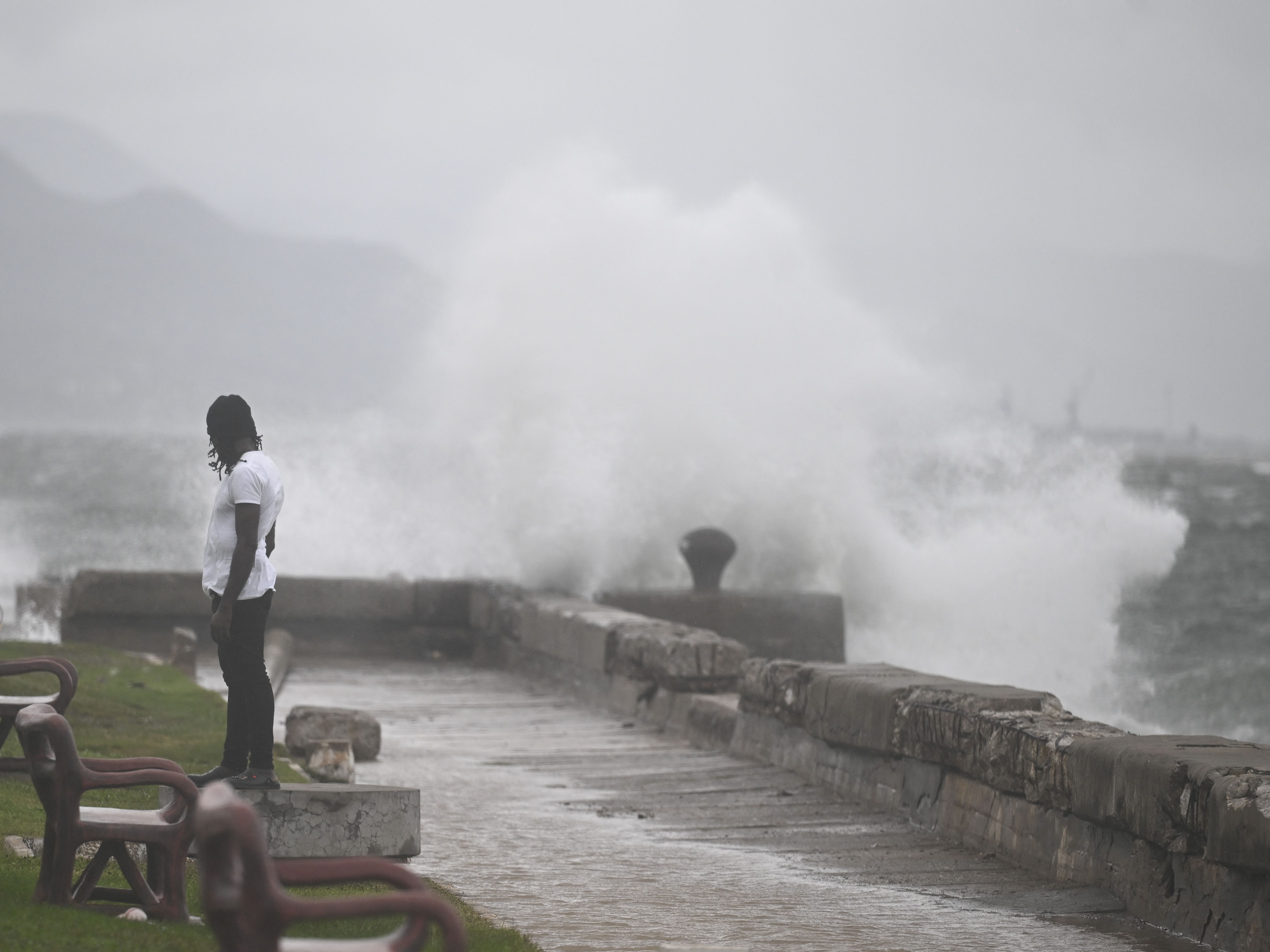
The big picture: The impacts of the storm that forecasters described as "catastrophic" were already being felt in Jamaica and three storm-related deaths were reported, the Jamaican Ministry of Health and Wellness said on X Monday evening.
- Forecasters warned of "catastrophic and life-threatening" winds, flooding and storm surge on Monday night, which Jamaica's Prime Minister Andrew Holness said on Facebook would likely impact all of the country.
- Jamaican officials ordered mandatory evacuations for "vulnerable coastal and flood-prone communities," including in parts of the capital, Kingston, ahead of the storm that killed three people in Haiti and a fourth person in the Dominican Republic.
Stunning stat: Category 5 is the highest storm category, requiring sustained winds of at least 157 mph.
- Melissa's winds have been much higher than that throughout Monday and the storm had maximum sustained winds of near 175 mph, with higher gusts, as of 11pm Monday ET, per a National Hurricane Center forecast discussion.
Threat level: Hurricane warnings were in effect for Jamaica, Cuba and the southeastern and central Bahamas and a hurricane watch was in effect for the Turks and Caicos Islands.
- "Some fluctuations in intensity are likely before Melissa makes landfall on Jamaica" early Tuesday, according to the NHC.
- "However, Melissa is expected to reach Jamaica and southeastern Cuba as an extremely powerful major hurricane, and will still be at hurricane strength when it moves across the southeastern Bahamas."
- In addition to "catastrophic flash flooding" from extremely heavy rainfall, the NHC warns "numerous landslides are likely."
Zoom in: Tropical storm conditions are expected to start in eastern Cuba on
Tuesday, with hurricane conditions set to begin in the hurricane warning area starting Tuesday evening into Wednesday morning.
- Tropical storm conditions are expected in Haiti, which lies just southeast of Cuba and remains under a tropical storm warning, late Tuesday or early Wednesday, per the NHC.
- NHC director Michael Brennan said in a video forecast discussion Jamaica could potentially see storm surge of up to 9-13 feet when the hurricane makes landfall.
By the numbers: The NHC said the storm is expected to bring rainfall of 15-30 inches to parts of Jamaica and 6-12 inches for southern Hispaniola through Wednesday, "with storm total local maxima of 40 inches possible."
Situation report: The hurricane turned in a north-northeasterly direction toward Jamaica and was moving at just 2 mph about 150 miles southwest of Kingston, Jamaica, Monday evening.
- Its speed was expected to increase now after its turn toward Jamaica, said Evan Thompson, principal director of the Meteorological Service of Jamaica, at a Monday briefing.
Of note: Hurricane Gilbert holds the record of the strongest storm to make landfall in Jamaica, hitting the country as a Category 3 storm in 1988, Thompson noted.
Between the lines: The storm's rapid intensification reflects how warmer ocean temperatures are fueling stronger late-season hurricanes, according to Jim Chen, a professor of marine and environmental sciences at Northeastern University.
- "When a hurricane moves slowly, it dumps a tremendous amount of rain in that particular area. In Jamaica, that means we'll likely see rain-induced flooding and landslides," Chen said in a Monday evening email.
- "The slow movement also means strong winds continue blowing over buildings and structures for a long time, causing greater damage," he added.
- "Widespread damages to the infrastructure, such as the international airport and ports along the Jamaica's southern coast, by the storm surge and ocean waves are expected."
Flashback: Chen noted that Hurricane Harvey released "enormous rainfall that led to widespread inland flooding exacerbated by storm surge" in 2017.
- Rainfall from this storm that struck the Houston area was at least 15% heavier due to human caused climate change, a study found.
Go deeper: Climate change is increasing hurricane wind speeds, study finds
Editor's note: This is a breaking news story. Please check back for updates.
