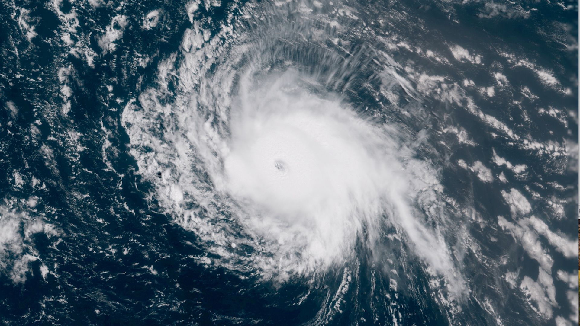
Forecast trends suggest that Hurricane Florence, which is currently swirling away as a Category 4 storm in the open Atlantic, could make a run at the East Coast by early next week — though there's still a great deal of uncertainty.
What we're watching: Weather patterns across the Atlantic as well as a broader cycle of atmospheric circulation, known as the Madden-Julian Oscillation, are combining to make the Atlantic far more favorable to storm development than it has been all season.
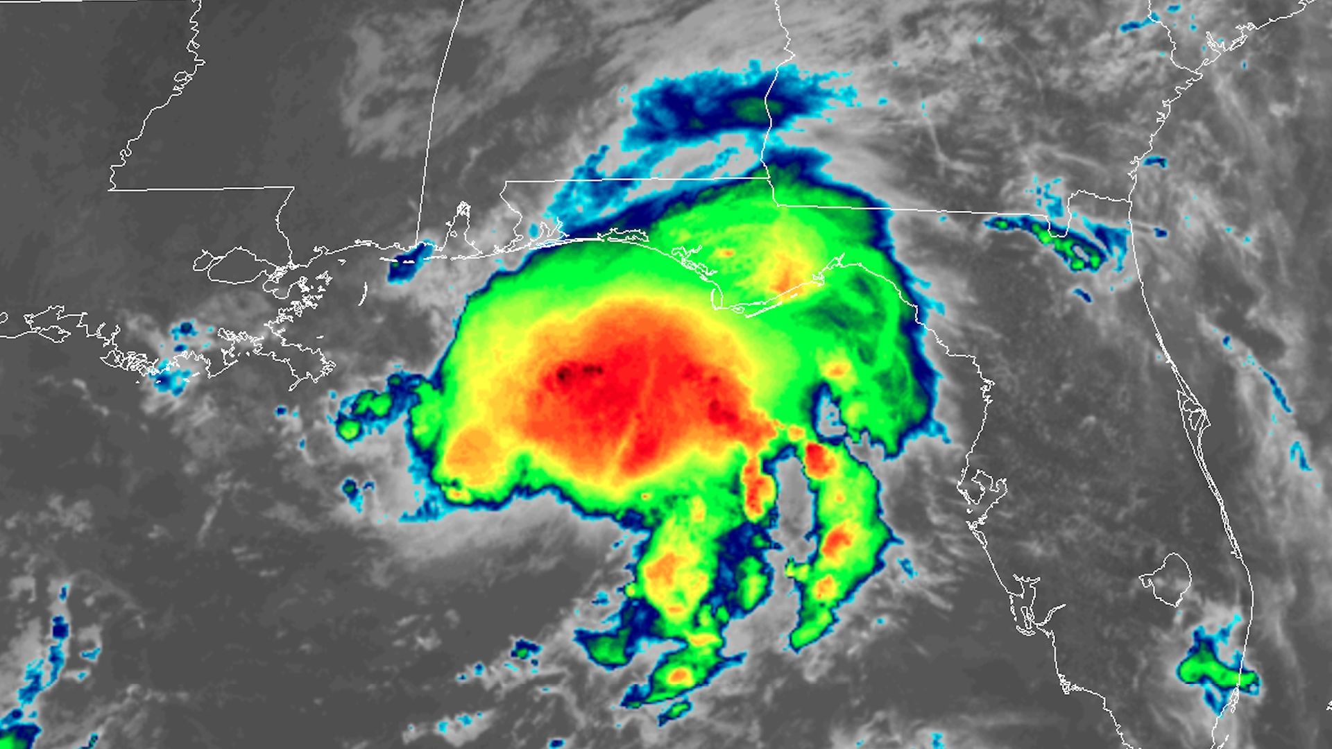
Tropical Storm Gordon is showing signs of intensifying as it approaches the Gulf Coast. It is forecast to make landfall as a Category 1 hurricane early Wednesday in southern Mississippi, bringing storm surge flooding, high winds and heavy rains.
What we're watching: The storm has shown signs of intensification on Tuesday, including a burst of thunderstorms near the center of the storm, and increasing wind speeds as observed via satellite, radar installations and hurricane hunter aircraft.