Hurricane Maria will be "potentially catastrophic" as it hits Puerto Rico and the U.S. Virgin Islands as a "likely" Category 5 storm over the next 24 hours, according to the National Hurricane Center.
The biggest threats: Maria currently packs sustained winds of 165 mph and is forecast to deluge the islands in its path with about a foot of rain and seven to nine feet of storm surge. In its latest update, the NHC branded the storm as "life-threatening," and urged those in its path to "rush to completion" any remaining preparations prior to landfall.
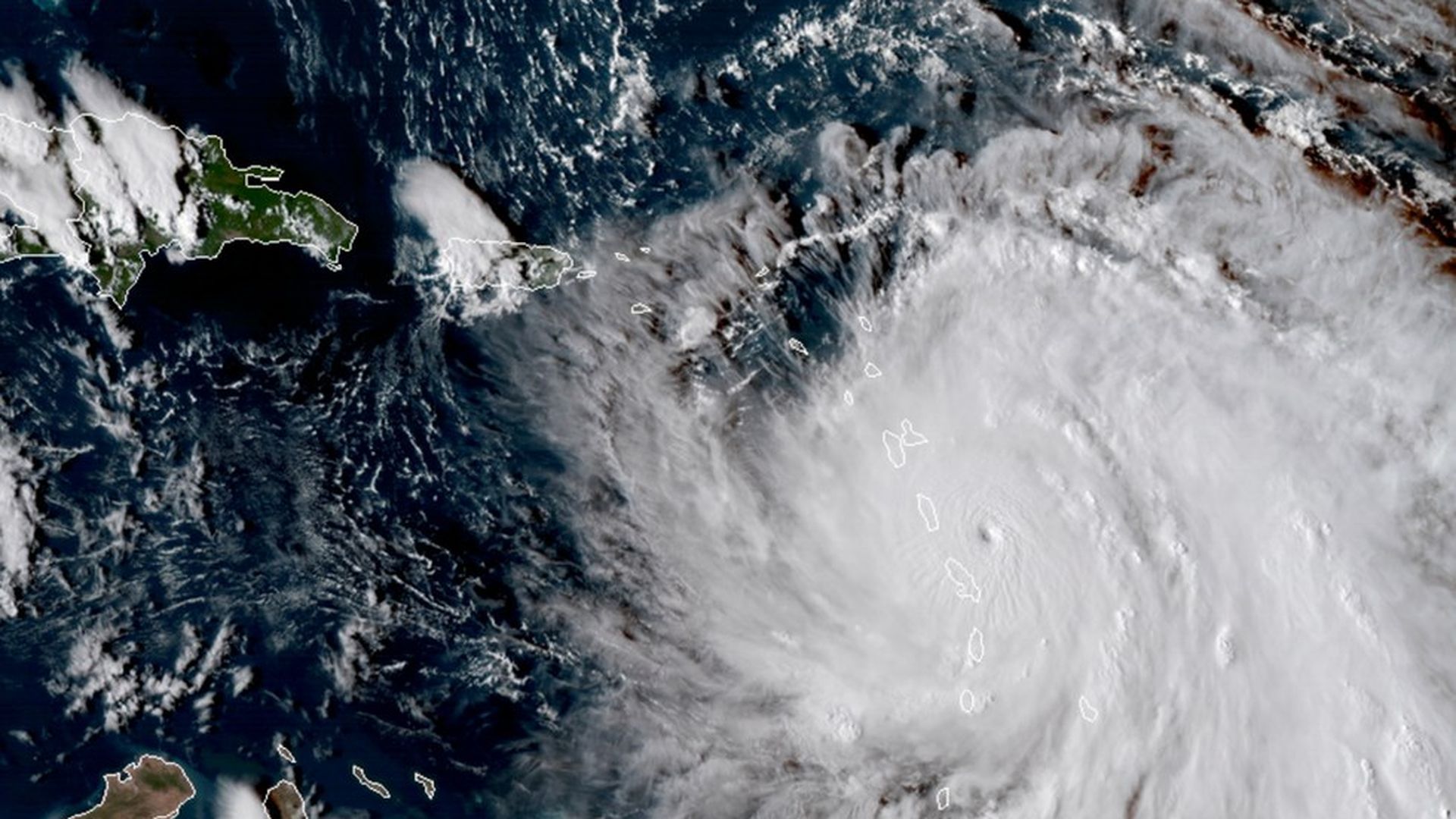
Hurricane Maria ripped through the Caribbean as a Category 5 storm yesterday, making landfall on the island of Dominica with winds reaching 160mph, per The Telegraph. Roosevelt Skerrit, the prime minister of Dominica, wrote in a Facebook post early Tuesday morning that the island has "lost all what money can buy and replace" and initial reports are of "widespread devastation."
Maria's path: The storm is expected to travel along roughly the same route as Hurricane Irma, including Martinique, Puerto Rico, the U.S. and British Virgin islands, Barbuda, Anguilla, Barbados and the Eastern Dominican Republic, according to the National Hurricane Center. The storm could make landfall in Puerto Rico as early as Tuesday night.
Hurricane Maria has strengthened into an "extremely dangerous" Category 5 hurricane as it bears down on Caribbean islands already ravaged by Hurricane Irma, per the National Hurricane Center.
In its path: Puerto Rico, the U.S. Virgin Islands, and the British Virgin Islands are all under a hurricane warning with Maria's effects expected Tuesday into Wednesday.
The effects: Potentially a Category 5 storm by the time it hits Puerto Rico, Maria could dump around a foot of rain, along with a massive storm surge of six to nine feet. Maria's winds will likely top 130 mph — but, in one bit of good news, its strongest winds remain confined to a small area near the eye.
Not a surprise: National Geographic points out that — though this hurricane season was forecast to be more active than usual thanks to atmospheric and thermal conditions — it's not exactly out of the ordinary for the Atlantic.

/2017/12/15/1513305596022.gif?w=3840)

/2017/12/15/1513305578191.gif?w=3840)