A plan for an elevated walkway to Dix Park gains momentum

Add Axios as your preferred source to
see more of our stories on Google.
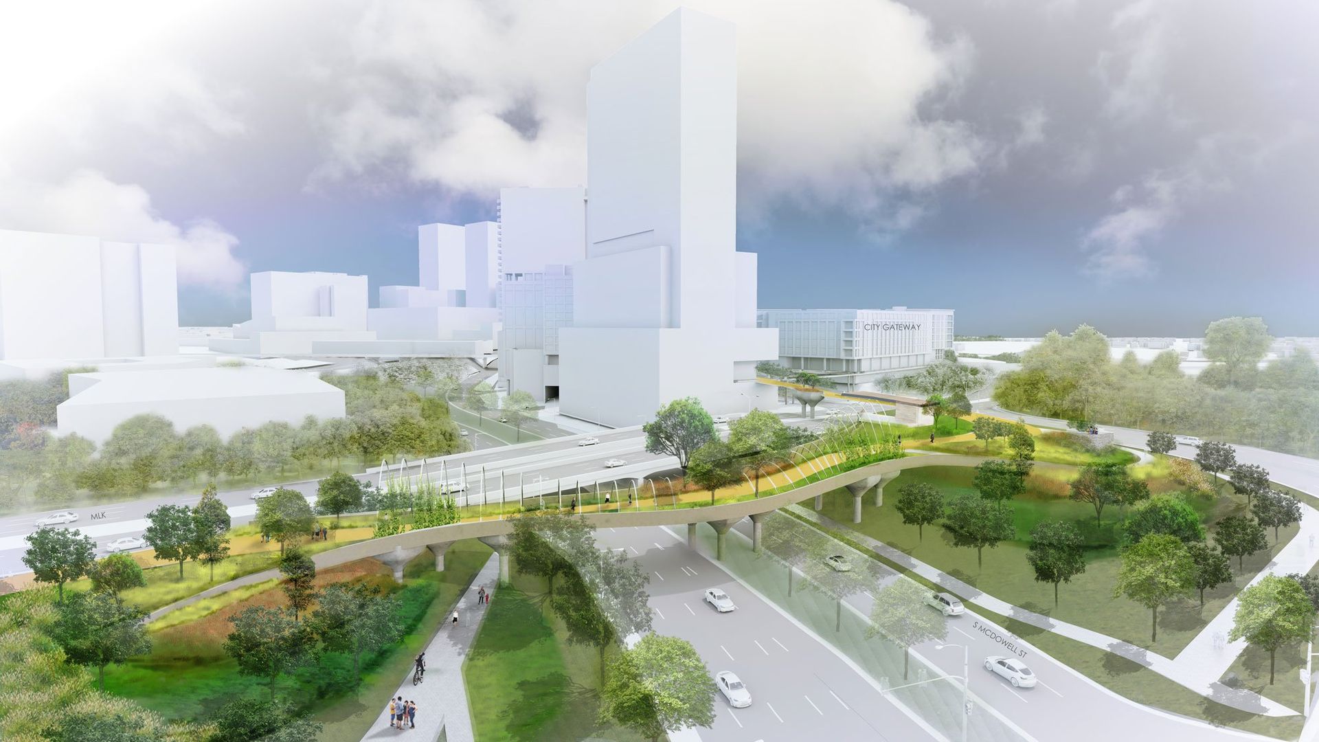
Rendering: Courtesy of SfL+a Architects, Surface 678 and Preston Montague.
An ambitious effort to connect downtown Raleigh to Dix Park via an elevated walkway is gaining momentum.
Why it matters: For years, city leaders have been working through ideas of how to best connect the 300-acre Dix Park to downtown proper.
- Though the park is just one mile from Raleigh Union Station, a four-lane road makes it tricky for pedestrians and cyclists to get there.
Driving the news: The latest idea city leaders are rallying around is The Oakline, an elevated walkway that would trace mostly state- or city-owned land between the Martin Marietta Center for the Performing Arts and the southern entrance to Dix Park at South Saunders Street.
- The idea was presented at this year's Downtown Raleigh Alliance meeting by the developers of the City Gateway project and the architecture and landscape architecture firms SfL+a Architects, Surface 678 and Preston Montague.
- It has an ally in Raleigh City Council Member Mitchell Silver, who previously served as Raleigh's planning director and New York City's parks commissioner.
What they're saying: "I was approached by a team of architects and landscape architects," Silver told Axios. "We were looking at connections to Dix — like a gondola — and they said, "We believe we have a solution that will work.'"
- "I sat down with them, and I said, 'You got it. You cracked the code.'"
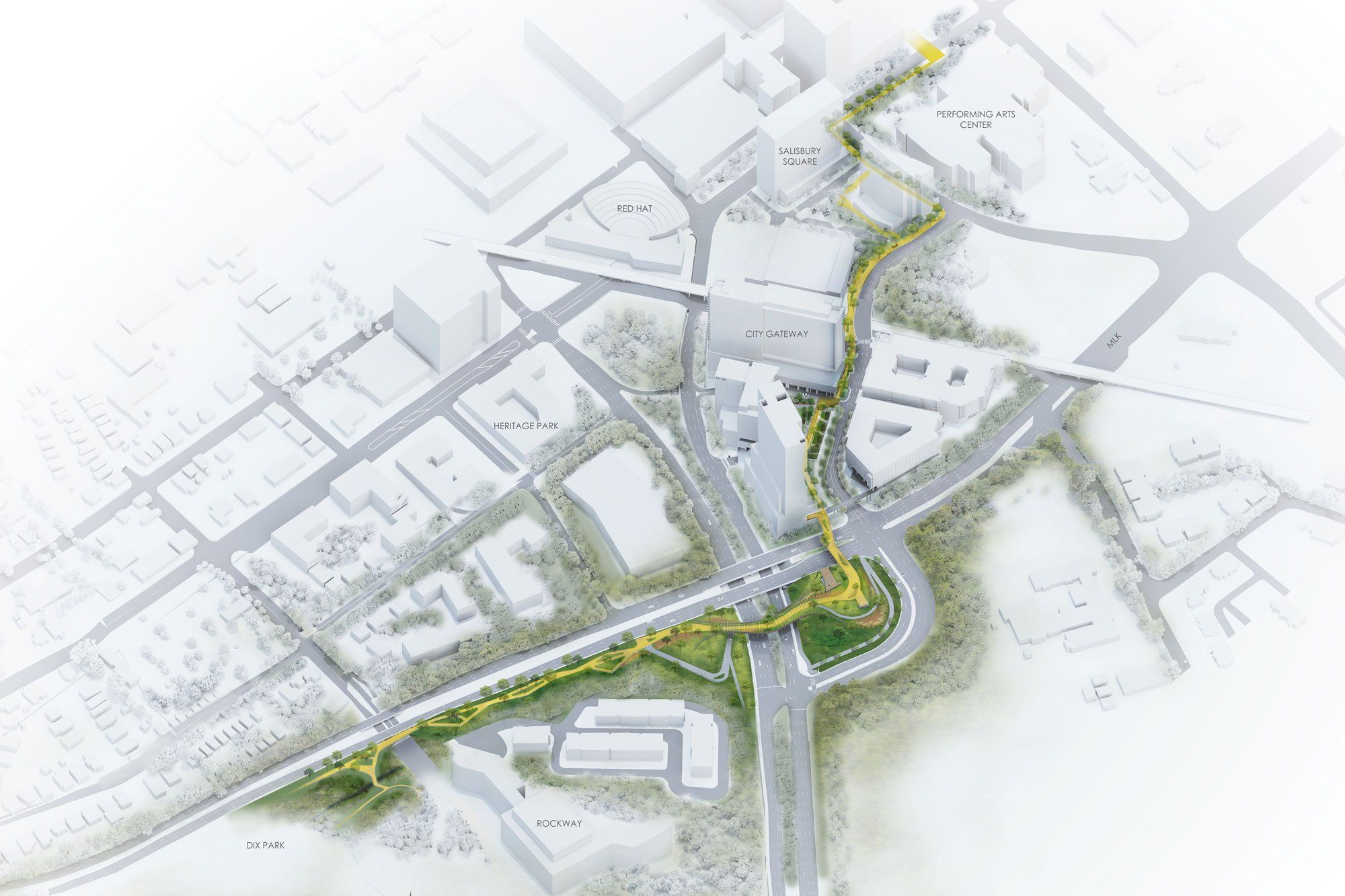
Zoom in: Silver said he believes The Oakline's elevated walkway over Martin Luther King Jr. Boulevard solves a lot of issues with building at ground level.
- But it also creates an attraction, with the entire elevated trail providing views of downtown and Dix Park. In presentations, it is presented as a 16-minute walk between downtown and Dix via The Oakline.
The big picture: Raleigh is not the only city in the Triangle grappling with how to best overcome the obstacles vehicle infrastructure creates for pedestrians.
- In Durham, city leaders recently reviewed a study of how to transform the Durham Freeway, which runs through downtown Durham and whose construction led to the demolition of the historic Hayti community.
- One idea: build a freeway cap over the road to create a new public space and walkway.
What's next: A lot needs to happen for The Oakline to become a reality. Its organizers hope to launch a feasibility study this fall for the idea — which could cost up to $90 million in its current design, Silver said.
- The state, which owns many of the rights of way, would have to agree to any plan for it to become a reality.
- And then money would need to be found. The Raleigh City Council has asked to add The Oakline to the city's Capital Improvement Program.
- Silver believes that ultimately a project of this scope would require city, state, federal and private funding. That playbook has worked at Dix Park already, where both private and public money has fueled projects like the popular Gipson Play Plaza.