Winter storm could bring snow, ice to central North Carolina

Add Axios as your preferred source to
see more of our stories on Google.
Source: National Weather Service
A winter storm is expected to make its way toward central North Carolina Friday, with snow to begin Friday afternoon and evening, followed by an icy and treacherous topping, the National Weather Service says.
Why it matters: The storm could bring hazardous road conditions through Saturday, though black ice may be possible through Sunday and Monday.
Driving the news: As of this morning, a winter storm warning will go into effect at 1pm Friday and run through 10am Saturday for most of central North Carolina.
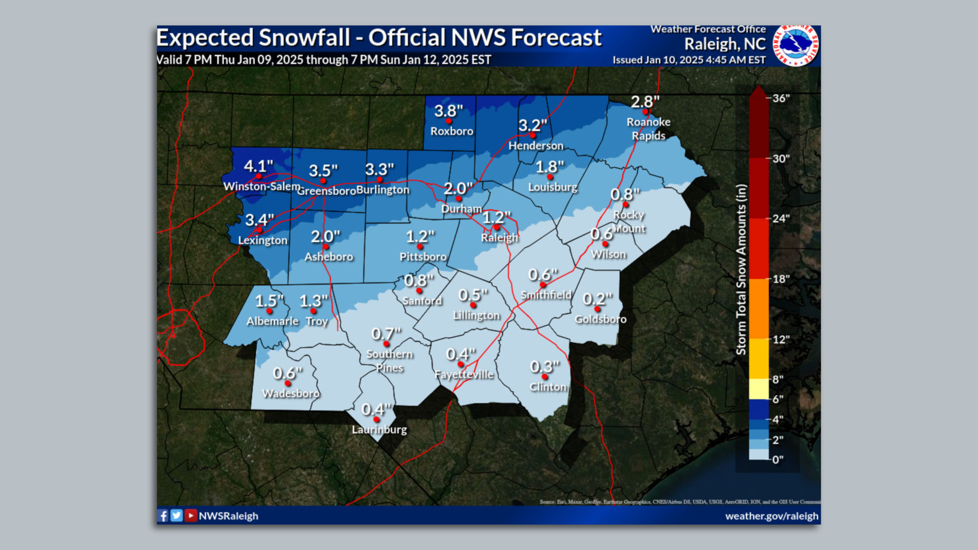
- The region could get up to two inches of snow and sleet, followed by up to two-tenths of an inch of ice into tomorrow morning, per NWS's 4am forecast.
The latest: Wake County Public Schools will dismiss three hours early on Friday due to the winter storm.
- Chapel Hill-Carrboro City Schools will dismiss two hours early on Friday, and Durham Public Schools will be closed.
- Also due to the anticipated winter storm, Gov. Josh Stein canceled his inaugural ceremony and other related events planned for this weekend and declared a statewide state of emergency.
Zoom in: The best chance for snow will be along the I-85 corridor, while most of central North Carolina is expected to see black ice and hazardous road conditions, the National Weather Service said Thursday.
- It also cautioned to not focus on specific snow totals, as most locations will have a mix of snow and ice.
Zoom out: The last time the Triangle had a measurable amount of snow was on Jan. 29, 2022, per WNCN.
Threat level: Expect slick roads and walking surfaces throughout the Triangle through the weekend.
- The National Weather Service also cautioned that ice accumulation could down trees and power lines, saying, "numerous power outages will also be possible."
Editor's note: This story has been updated with the latest weather forecast as of 4am Friday.