Photo: Courtesy of the National Weather Service's Raleigh office
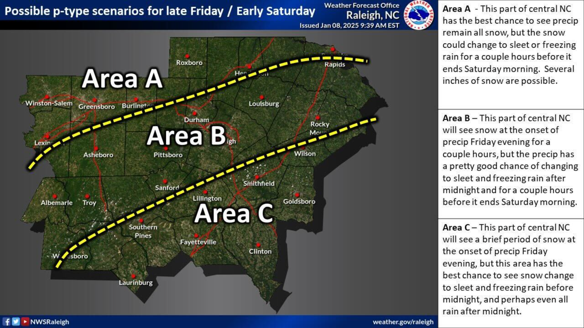
Much of the Triangle should experience some light snow on Friday evening before turning into sleet or freezing rain, according to the latest forecast from the National Weather Service's Raleigh office.
Why it matters: While the storm's precipitation is expected to be light, it could create hazardous travel on the roads on Friday afternoon through Saturday, as well as scattered power outages, according to NWS Raleigh.
Zoom in: The NWS said the forecast could still change and that it is too early to predict the amount of precipitation the Triangle will see — though it repeatedly called the potential precipitation light, perhaps one to two inches of snow.
The northern parts of the Triangle — north of Interstate 85 — are expected to see the most snow.
Areas that include the majority of Durham, Raleigh and Chapel Hill are likely to see light snow transition into sleet and freezing rain.