Flash flood warnings surge in New Orleans metro


Add Axios as your preferred source to
see more of our stories on Google.


The National Weather Service in New Orleans is having one of its more active years in terms of flash flood warnings since 1987.
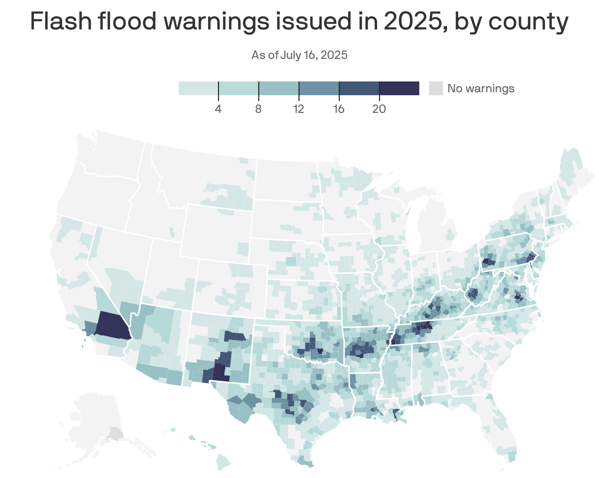
The big picture: Meteorologists at the office have issued 41 warnings so far this year, according to a tracker at Iowa State University's Iowa Environmental Mesonet.
- Flash flood warnings are issued when such an event is imminent or already occurring.
- Several warnings came last week during the tropical system, while others were in April, when a rainstorm dumped more than 6 inches on the West Bank.
- The totals are for the office's entire coverage region, which includes part of south Mississippi.
By the numbers: New Orleans has had 40.89 inches of rain as of Friday morning, which is nearly 5 inches above normal, NWS data shows.
Between the lines: Mike Efferson, who has been a meteorologist at the local NWS office since 2008, tells Axios New Orleans he's noticed a change in culture since the 2016 floods in Baton Rouge.
- Meteorologists are now more proactive and cognizant about the potential impacts of storms, which leads to more warnings, he says.
- "Society in general is taking flooding more seriously," he says, mentioning how there are more preemptive school closures for severe weather than 30 years ago.
Meanwhile, rainstorms in New Orleans are getting more intense, according to data from Climate Central.
- Hourly rainfall intensity increased 8.7% between 1970 and 2024, writes Axios' Chelsea Brasted.
- Climate change can amplify rainstorms, as warmer air can hold more water.
Zoom out: Nationally, NWS offices have issued a record number of year-to-date flash flood warnings in 2025, according to a tracker at Iowa State University's Iowa Environmental Mesonet.
What they're saying: "2025 has been the year of the flood," meteorologist Michael Lowry writes.