New Orleans rainstorms are getting more intense

Add Axios as your preferred source to
see more of our stories on Google.
/2025/04/22/1745334697681.gif)
If it feels like New Orleans' rainstorms are getting more intense, you're right, and new data from Climate Central proves it.
Why it matters: A Monday evening storm was the perfect illustration, popping up and staying put long enough to dump more than 6 inches of rain on some parts of the metro.
The latest: We can expect to see another round of storms Tuesday and Wednesday, says National Weather Service meteorologist Phil Grigsby.
- Once Thursday hits, the weather should dry out, but it'll get pretty hot, he says.
- "We could have a heat index into the 90s over the weekend," he says.
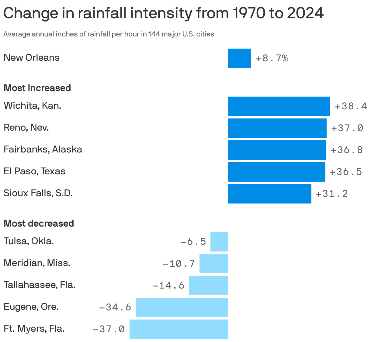
The big picture: Hourly rainfall intensity increased between 1970 and 2024 in nearly 90% of the 144 locations Climate Central analyzed, according to the report.
- Over that period in New Orleans, the average annual inches of rainfall per hour increased by 8.7%. See more averages.
Threat level: If you were out and about on Monday night, you saw exactly what a strong, short rainstorm can do.
- The average rainfall across Algiers, the Lower 9th Ward and St. Bernard Parish was between 5 and 6 inches, Grigsby said. The French Quarter and Bywater neighborhoods got between 4 and 5 inches of rain.
- That created some significant street flooding during peak commute hours, with water overtopping canals, cars stalling out and the Crescent City Connection coming to a standstill as drivers couldn't get on or off the bridge.
Between the lines: Human-driven climate change is resulting in warmer air, which holds more moisture and thus can drive more intense precipitation.
- Hotter temperatures also evaporate more water vapor from lakes, oceans and vegetation.