New Orleans under tropical storm watch ahead of Francine: What to expect

Add Axios as your preferred source to
see more of our stories on Google.
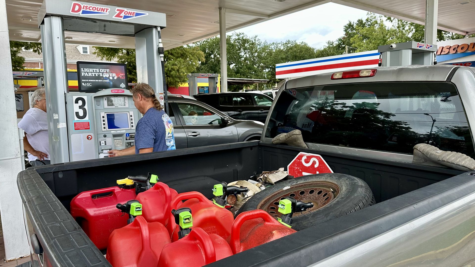
Residents were filling up their vehicles and gas cans Monday in Metairie in advance of Tropical Storm Francine. Photo: Carlie Kollath Wells/Axios
New Orleans metro is forecast to get flash flooding, gusty winds and storm surge from Tropical Storm Francine, which is expected to make landfall in Louisiana on Wednesday as a Category 2 hurricane.
Why it matters: Now is the time to prepare.
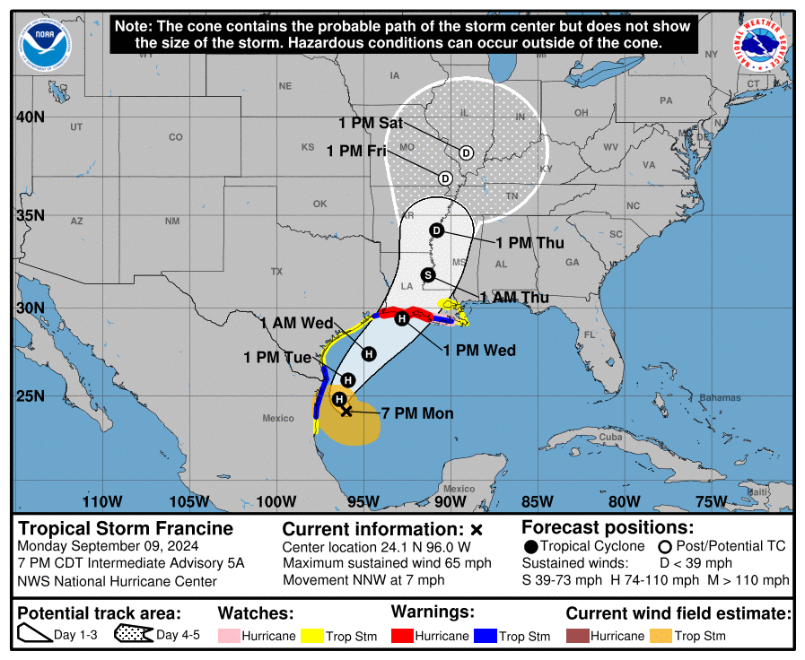
The big picture: Francine strengthened Monday and is expected to become a hurricane soon, the National Hurricane Center said in its 7pm update.
- It has max winds of 65 mph and "significant strengthening is forecast over the next couple days," the advisory said.
- Francine was about 425 miles southwest of Cameron, Louisiana, as of 7pm Monday. Landfall is forecast around 1pm Wednesday.
- Lafayette, Houma and Louisiana's coast are expected to get the worst of the storm on its current track. See the latest path.
Threat level: Gov. Jeff Landry declared a state of emergency Monday and encouraged residents to be "cautious and vigilant." Leaders in New Orleans and Jefferson Parish did the same. Go deeper.
- Hurricane watches and warnings are in effect for Louisiana's coast. New Orleans is under a tropical storm watch as of Monday night.
- A storm surge up to 10 feet is forecast for parts of the coast, along with damaging hurricane-force winds and "considerable" flash flooding from up to 12 inches of rain, the National Hurricane Center said in the 7pm forecast.
- Grand Isle has issued evacuation orders, and schools have started announcing closures in South Louisiana.
- See the school closure list for New Orleans metro.
Timing, rain forecast for New Orleans

Here's what to expect in New Orleans with the current path, which could shift.
Timing: The winds could reach New Orleans metro as early as Tuesday night, NHC says.
- The mostly likely arrival, though, is Wednesday morning.
Rain: New Orleans could get 3-6 inches of rain into Thursday morning, with more in localized areas.
- The ground is already saturated from last week's rain, the National Weather Service said, so flash flooding and runoff are likely.
Wind: Winds of 10 to 20 mph are possible, with gusts up to 35 mph, according to the National Weather Service. There's a potential for wind up to 57 mph.
- Unsecured lightweight objects will be blown around, large tree limbs may break off, and damage to porches, sheds and unanchored mobile homes is possible, NWS says.
- Scattered power outages are possible, NWS says, along with hazardous driving conditions on bridges.
Storm surge: A storm surge up to 4 feet is possible on Lake Pontchartrain and Lake Maurepas, NHC says.
- A storm surge watch is in effect for both lakes. That means there is a possibility of life-threatening inundation from rising water moving inland from the coastline during the next 48 hours.
- Some roads and parking lots may be covered in surge water, NWS says, especially Lakeshore Drive and the vicinity of West End Park, Breakwater Park and around Lakefront Airport.
- See the forecast map.
Tornadoes: There's potential for a few tornadoes, NWS says. Make alternative plans if you don't have a safe shelter.
Zoom out: See more details about New Orleans' impacts and more impact forecasts for other parts of Louisiana.
Editor's note: This is a developing story and has been updated to reflect the 7pm forecast Monday from the National Hurricane Center.
Go deeper
- How New Orleans officials are prepping the city
- 5 ways to prep for Tropical Storm Francine right now
- Hurricane prep tips for Louisianans
- Here's the status of New Orleans' levees and power grid
- What's in our hurricane emergency kits.
