Flood worries hang over East Bank redevelopment

Add Axios as your preferred source to
see more of our stories on Google.
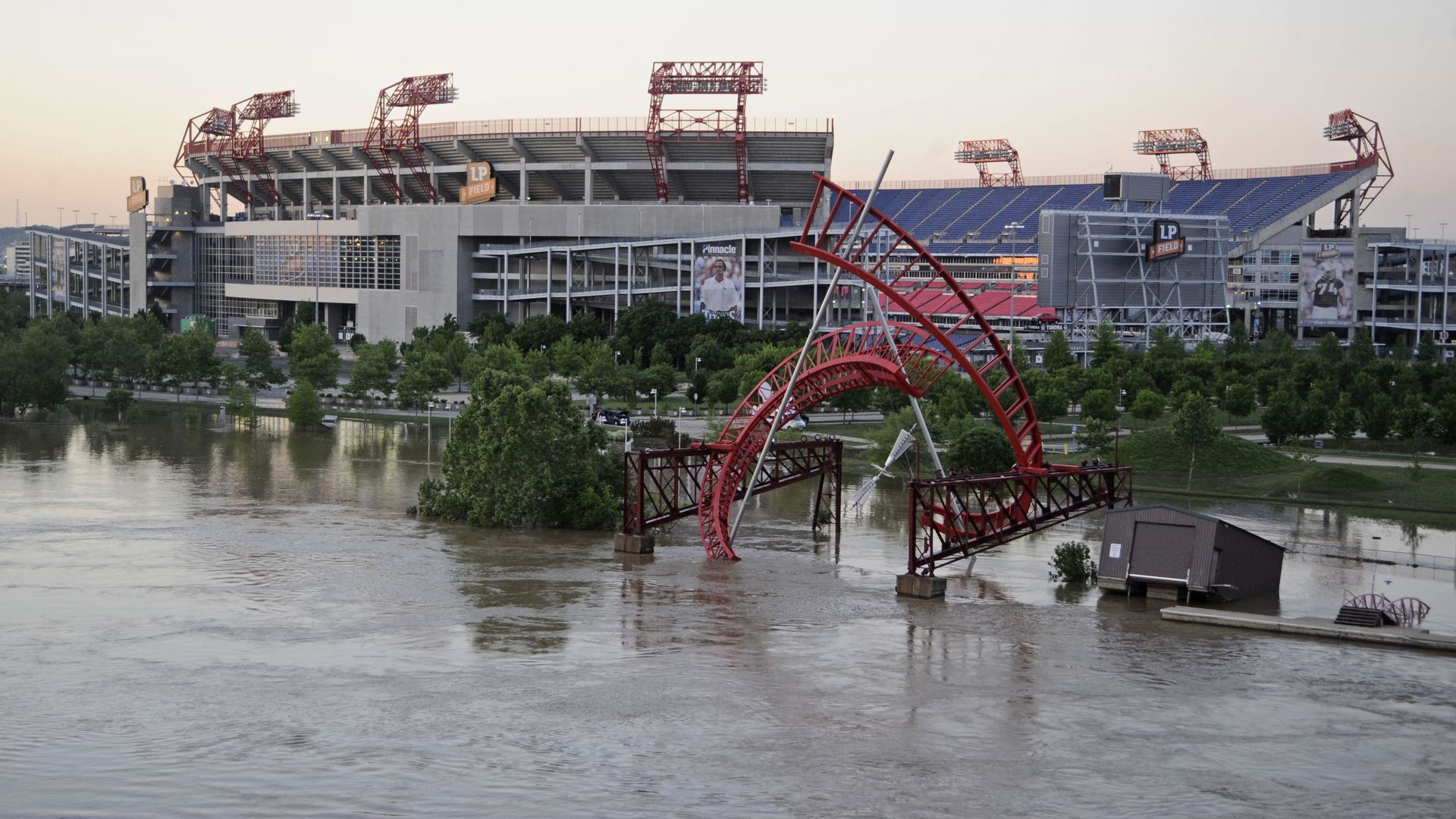
Flooding in May 2010. Photo: Jeff Gentner/Getty Images
The East Bank may be ripe for redevelopment, but it is also where the Cumberland River spilled over its banks during the catastrophic flooding in 2010.
Driving the news: At last week's critical Metro Council East Bank and Stadium committee meeting, some council members questioned the city's plans for building billions of dollars' worth of public and private investment on mostly vacant land near the river because of the flooding concerns.
- The conversation is happening as Mayor John Cooper's administration is pressing forward with plans to build a new domed Titans stadium surrounded by a reimagined East Bank full of greenways, sidewalks, bike lanes and other public infrastructure.
What they're saying: Metro Councilmember Thom Druffel asked top officials during last week's meeting about the flooding risks at the site being eyed for a new stadium.
- "One of the appealing things of potentially moving the stadium [to the west, farther away from the river] is it would allow us to take a district-wide approach to stormwater management," deputy mayor Sam Wilcox said in response to Druffel's concerns.
Flashback: Councilmember Bob Mendes, who chairs the committee, highlighted an aerial photo showing the proposed East Bank redevelopment area entirely underwater from the 2010 flood, with the exception of where the new stadium would sit.
- "There's only so much mitigation you can do if the whole thing's underwater," Mendes said.
- Wilcox pointed out the Imagine East Bank plan also seeks to add a large number of new residential units.
- "That picture scares me, too," Wilcox said. "We should acknowledge that if we were going to actually reimagine the East Bank and build this, there are going to be more valuable assets over there than a new enclosed stadium that we are going to be highly interested in protecting."
Zoom in: The redevelopment plan details the city's approach to mitigating flooding.
- Stormwater regulations prohibit any new development in the low-lying floodplain. The proposed East Bank boulevard and the new stadium would each be built at elevations above the 2010 flood levels, Metro Planning's Harriet Jameson Brooks tells Axios.
Details: The plan points out that because the East Bank is largely undeveloped, the city has the opportunity to design a stormwater management approach for the entire district as opposed to a single parcel of land.
- One strategy will include adding greenways next to the river, which will double as recreation space for the public and a flood-reduction tool because the greenery absorbs water.
- The plan also calls for sophisticated riverbank engineering, which experts believe would reduce flood risks.
Between the lines: Although climate change has made catastrophic storms like Nashville saw in 2010 more likely, such flooding events are still rare.
- Brooks tells Axios that 34 of the East Bank area's 338 acres are within the 100-year flood plain, which means there's a 1% chance of flooding each year.
- The 2010 flood is considered a 500-year event, Brooks said. The 200 acres within the 500-year flood plain carry a 0.2% chance of such flooding annually.