La Niña could enhance hurricane season

Add Axios as your preferred source to
see more of our stories on Google.
The National Oceanic and Atmospheric Administration (NOAA) issued a La Niña watch, indicating that the current strong El Niño may be headed for the exits.
Threat level: A La Niña tends to create more favorable conditions for hurricanes to form and intensify, Axios' Andrew Freedman reports.
- Some of the busiest seasons on record have occurred during La Niña years.
Zoom in: The El Niño still underway features milder-than-average ocean waters in the tropical Pacific Ocean and associated shifts in the atmosphere. There are increasing signs that a transition is afoot.
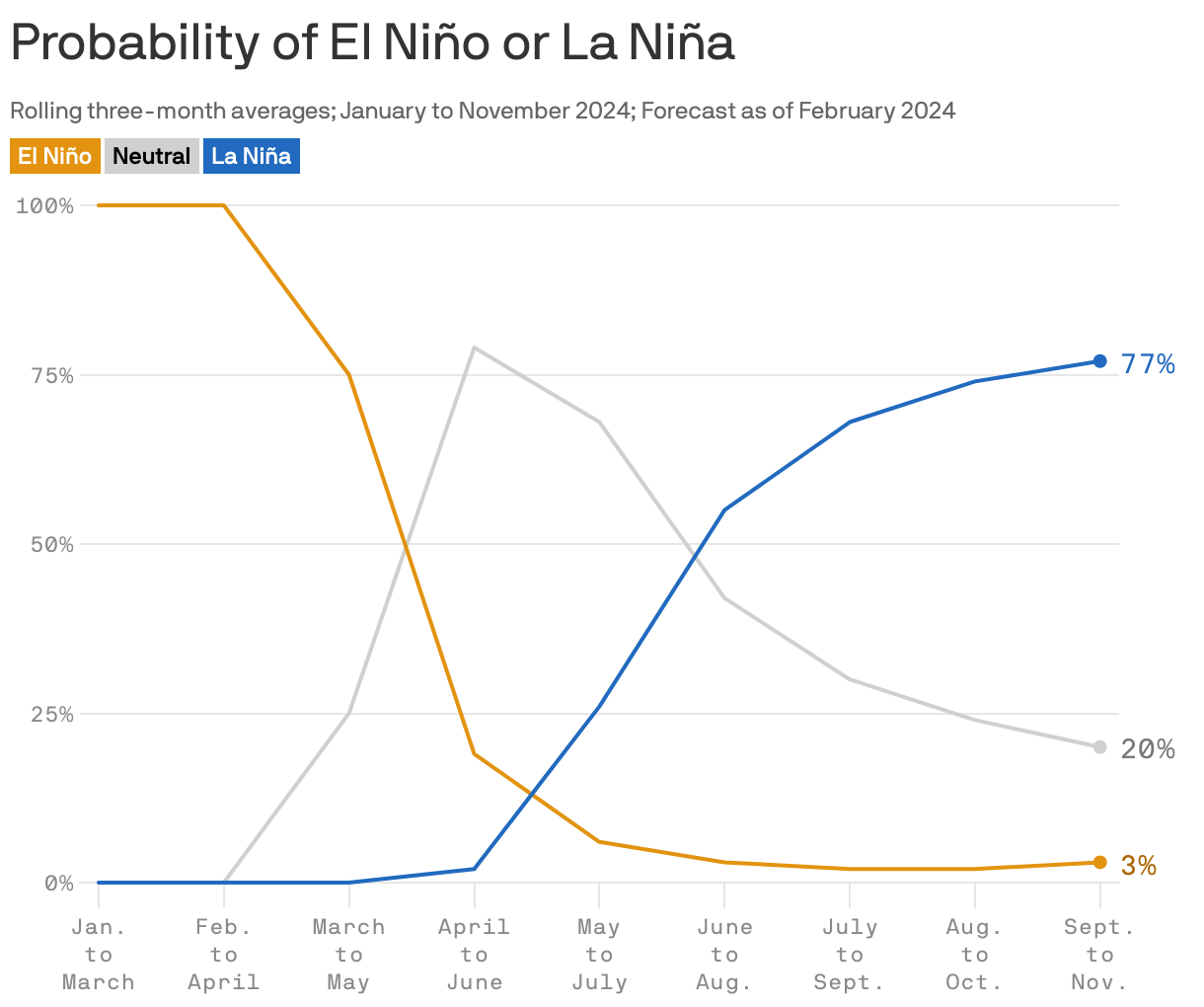
- In its new forecast discussion, NOAA estimates that by the fall, there's a 77% chance of a La Niña developing.
Between the lines: La Niña conditions also tend to favor drought along the southern tier of the Lower 48 states.
- The scorching 2011 drought that led to devastating and unprecedented wildfires across Texas, including in the Houston area, coincided with a La Niña.
💭 Andrew's thought bubble: During a La Niña, the jet stream shifts farther to the north across the U.S., bypassing much of the Southwest, South and Southeast. This means Texas stays warmer and drier.
- With hurricane season, a La Niña can decrease the amount of wind shear, which can weaken or dissipate tropical storms and hurricanes, over the tropical Atlantic Ocean.
- Concerns are also growing over the upcoming hurricane season due to the presence of much warmer-than-average ocean waters in the tropical Atlantic. If the ocean enters the storm season with such conditions, it could be primed for an unusually active season.