Florida governor declares emergency as heavy rains flood state's south


Add Axios as your preferred source to
see more of our stories on Google.
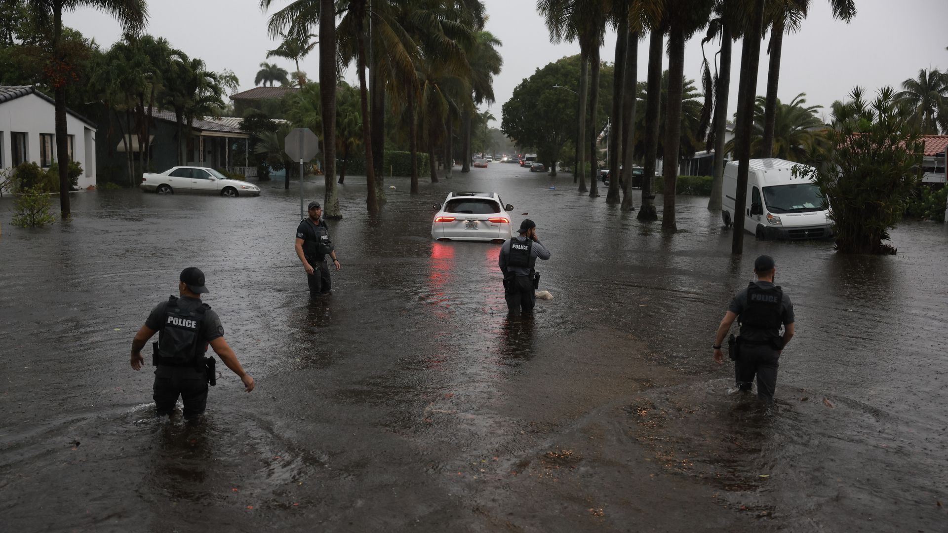
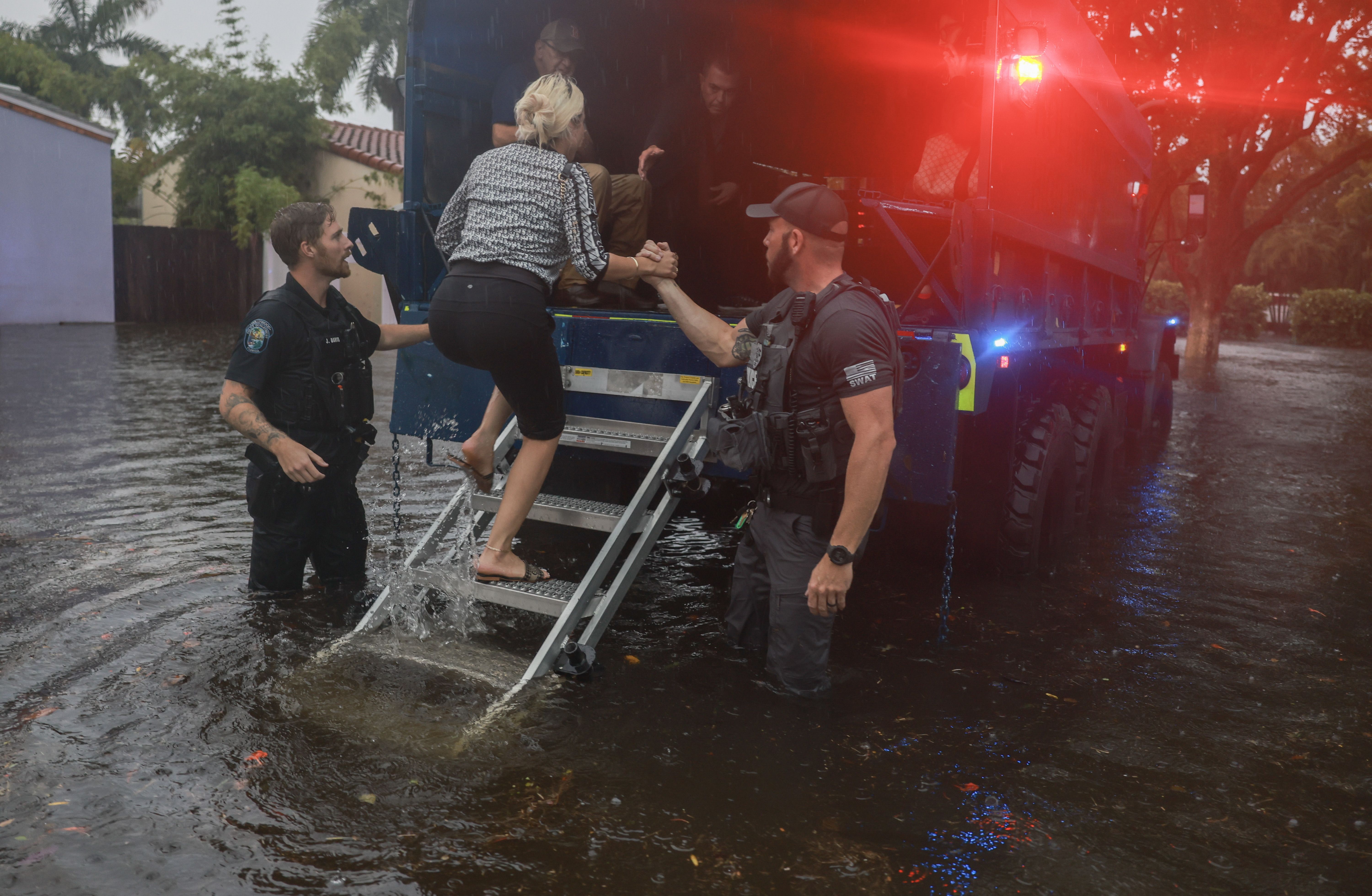
Members of the City of Hollywood SWAT team look for people who may need help being evacuated from a flooded area in Hollywood, Florida, just north of Miami, on Wednesday, June 12. Photo: Joe Raedle/Getty Images
Editor's Note: The most updated information on South Florida flood coverage can be found here.
Torrential downpours in South Florida over the past 24 hours have flooded roads throughout the region, creating life-threatening conditions — and forecasters warned heavy to excessive rainfall was expected to last through Friday.
The big picture: Florida Gov. Ron DeSantis declared an emergency in Broward, Collier, Lee, Miami-Dade and Sarasota counties "due to major flooding" soon after the mayors of Miami and Fort Lauderdale both declared local states of emergency on Wednesday evening.
- Numerous flash flood emergencies were issued Wednesday as rainfall totals approached 12 inches in some spots, while the extreme weather prompted a ground stop at Miami International Airport, flight delays and road closures — including parts of a major highway.
- A total of 9.54 inches of rain fell in Fort Lauderdale, which amounts to a typical June's worth of rain in just one day. "Another 3-5 inches is expected overnight," the city of Fort Lauderdale said on X.
Context: This is the result of a firehose of tropical moisture flowing from southwest to northeast across the unusually warm waters of the Gulf of Mexico.
- As the climate warms, extreme precipitation events such as this one are becoming more frequent and intense, studies show.
Threat level: The NWS Miami office had as of 5:30pm issued seven flash flood emergencies — the most dire flood alert the NWS issues, indicating an imminent threat to life and property.
- It later issued flood warnings for portions of Broward, Miami-Dade, Collier and Hendry counties through 8am Thursday ET after the flash flood emergency expired.
- Computer models project more heavy rainfall on Thursday, which would quickly lead to more severe flooding.
Zoom in: The heaviest rain was focused on South Florida in part because of an area of circulation, referred to as Invest 90L, embedded within the tropical moisture due to its potential to develop into a tropical storm.
- State of play: Miami-Dade and Broward counties had been under a flood watch for most of the week after heavy rainfall began Tuesday, but the situation escalated dramatically Wednesday afternoon as torrential rains fell.
- Fort Lauderdale International Airport reported 11.19 inches of rain since midnight on Wednesday, according to the NWS. Some weather stations near Hollywood, Fla., eclipsed 13 inches of rain since midnight Wednesday.
- The NWS Weather Prediction Center issued a forecast discussion just before 5:30pm Wednesday saying "catastrophic and life-threatening flash flooding" was expected to continue into the evening across South Florida
over the highly urbanized and densely populated I-95 corridor from Fort Lauderdale south through Miami and Homestead. - The agency warned an additional 4 to 8 inches of rain could fall in the Miami area, "with isolated 10+ inch amounts."
- "For some locations, this will bring multi-day storm totals upwards of 15 to 20+ inches. Significant and life-threatening flash flooding is ongoing and is expected to continue as a result over the next several hours," the agency stated.
Transport disruptions: More than 600 flights to and from Miami and Fort Lauderdale's international airports had been canceled as of about 9pm Wednesday, per Flight Aware. Another 560 were delayed, including the Florida Panthers' flight to Edmonton for Game 3 of the Stanley Cup Finals on Thursday.
- Fort Lauderdale International Airport reported flooding on roadways and taxiways as rainfall rates of upwards of 5 inches per hour inundated the region. The same airport flooded last year and was forced to close for days.
- The Florida Highway Patrol shut down parts of I-95 in Broward County on Wednesday afternoon.
- Drivers had resorted to some unsafe tactics to avoid flood waters — like navigating dangerously close to the high-speed Brightline train tracks in Hollywood.
Closures: Broward County Public Schools, the 6th-largest school system in the U.S., said on X that all public schools and offices in the area would close on Thursday and all school activities were canceled.
- The city of Fort Lauderdale said on X its administrative offices will remain closed until 12pm Thursday and the NWS Miami office noted on X that portions of Broward and Miami-Dade were continuing to see "life-threatening flooding with widespread road closures & impacts to homes/businesses."
- Meanwhile, the Broward Sheriff's Office Parkland District said on X that the severe weather had forced officials to postpone the planned demolition of Marjory Stoneman Douglas High's classroom building that was the scene of the 2018 shooting that killed 17 people.
What to expect: Storms were expected to move into the Florida Keys overnight before "reloading for another round of storms on Thursday and Friday," the NWS said in a forecast discussion.
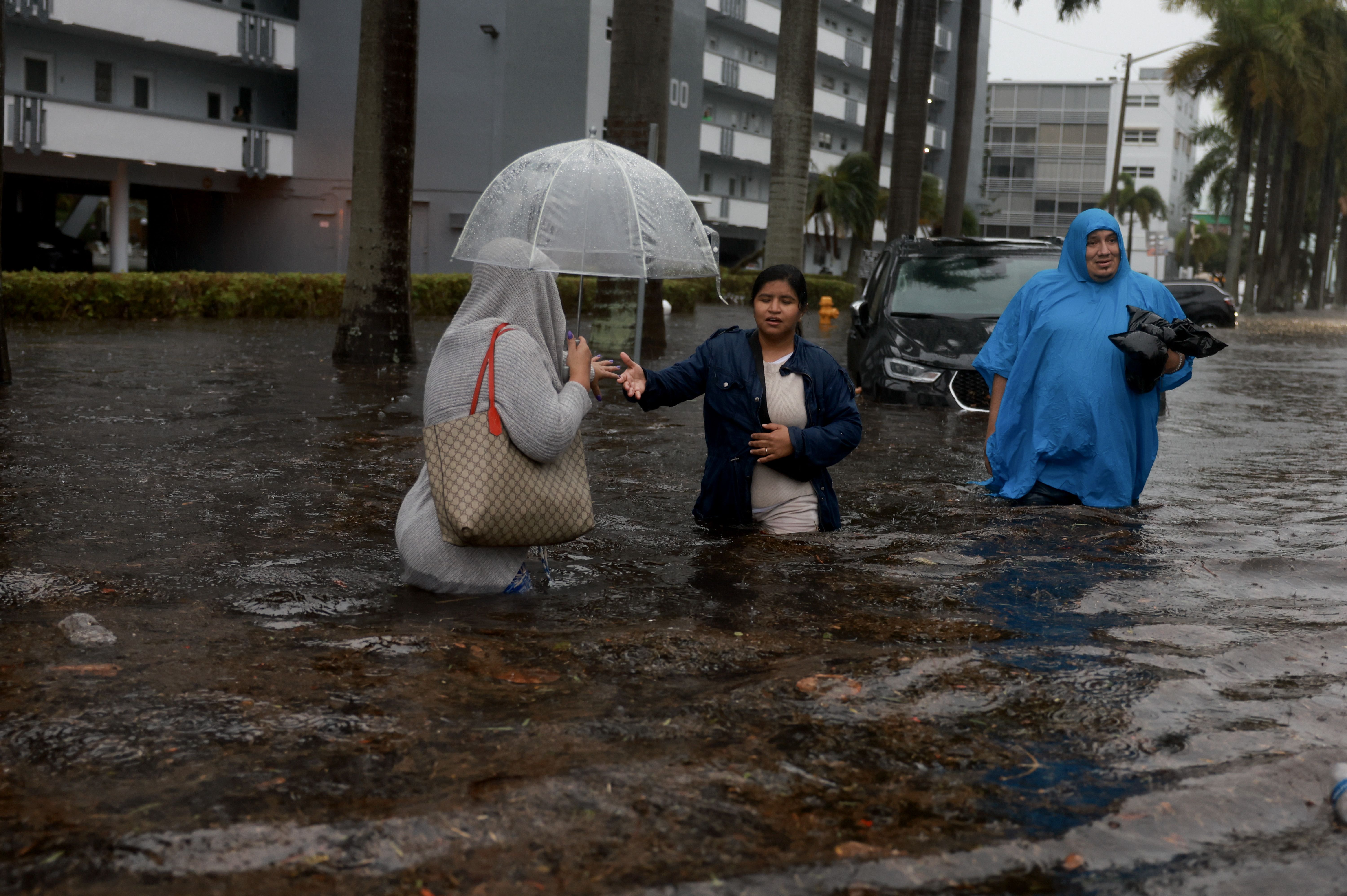
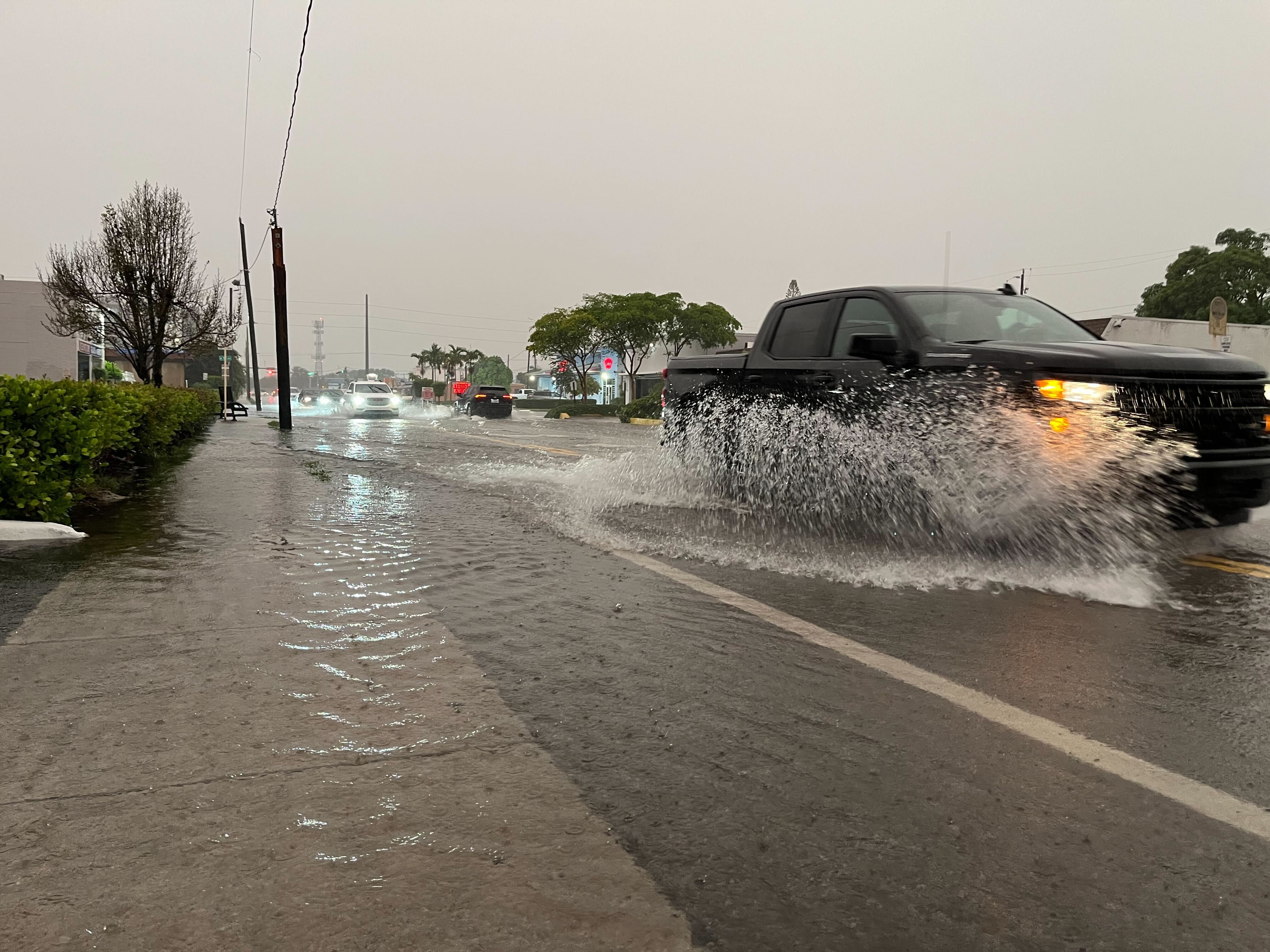
In photos: Flooding sweeps South Florida

Martin Vassolo contributed reporting.
Editor's note: This story has been corrected to reflect that a classroom building at Marjory Stoneman Douglas High School is being demolished, (not the entire school). It has been updated with new details throughout.
