Twin Cities could see record-high fall temperatures, followed by snow

Add Axios as your preferred source to
see more of our stories on Google.
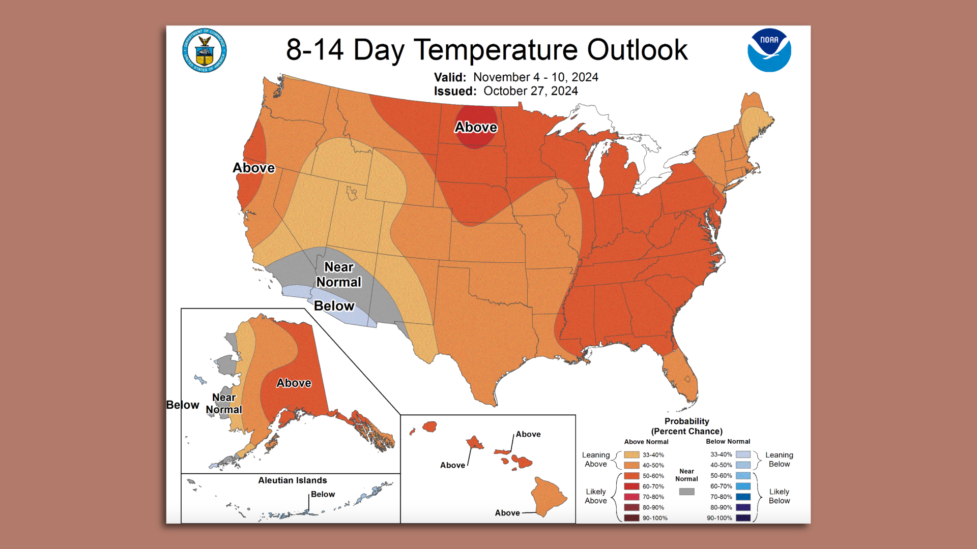
The outlook for Nov. 4–10. Image: Courtesy of NOAA
Sweater weather will have to wait a few more days.
State of play: It's the last week of October, and temps are expected to near 80 for a second consecutive day.
Driving the news: Tuesday's forecast high of 79 for the Twin Cities is one degree above the previous record, set in 1922.
- Monday's high of 75 at MSP airport tied the all-time high, per MPR News meteorologist Paul Huttner.
Threat level: Even if we don't set a new high, those temperatures are about 30 degrees above average for this time of year.
The big picture: Fall in the Twin Cities is getting hotter faster than most of the country. This year has been no exception.
Zoom in: September was the warmest (and driest) ever documented.
- While October isn't on track to set another hottest month record — we're currently in fourth place — the average high is running about 9 degrees above normal, NWS meteorologist Caleb Grunzke told Axios.
Zoom out: This year is all but certain to be the planet's warmest — narrowly beating 2023 as the hottest one tracked since at least the 19th century, per Axios' Andrew Freedman.
- Experts say it's the result of both natural climate fluctuations, such as El Niño, and long-term human-caused warming.
What we're watching: The National Oceanic and Atmospheric Administration's temperature outlook favors a warmer-than-average start to November.
Yes, but: Increased chances for precipitation mean temperatures may fluctuate, with a mix of cooler and warmer days in the weeks ahead, Grunzke says.
What's next: Daytime temperatures will dip into more normal ranges later this week, with the mercury dropping to the 50s. Rain is expected to move in tonight and last through Thursday.
The intrigue: The one cold day in the forecast is Halloween, with a forecasted high in the 40s. A new model suggests that the air on Thursday could be cold enough for rain to turn to snow over the Twin Cities.
The bottom line: Are we in for a 1991 blizzard repeat? NWS' current forecast predicts less than an inch of precipitation between Wednesday and Thursday.
- But a second consecutive year of snow on Halloween could be in the cards.