Who owns the beach? St. Pete Beach signs spark backlash

Add Axios as your preferred source to
see more of our stories on Google.
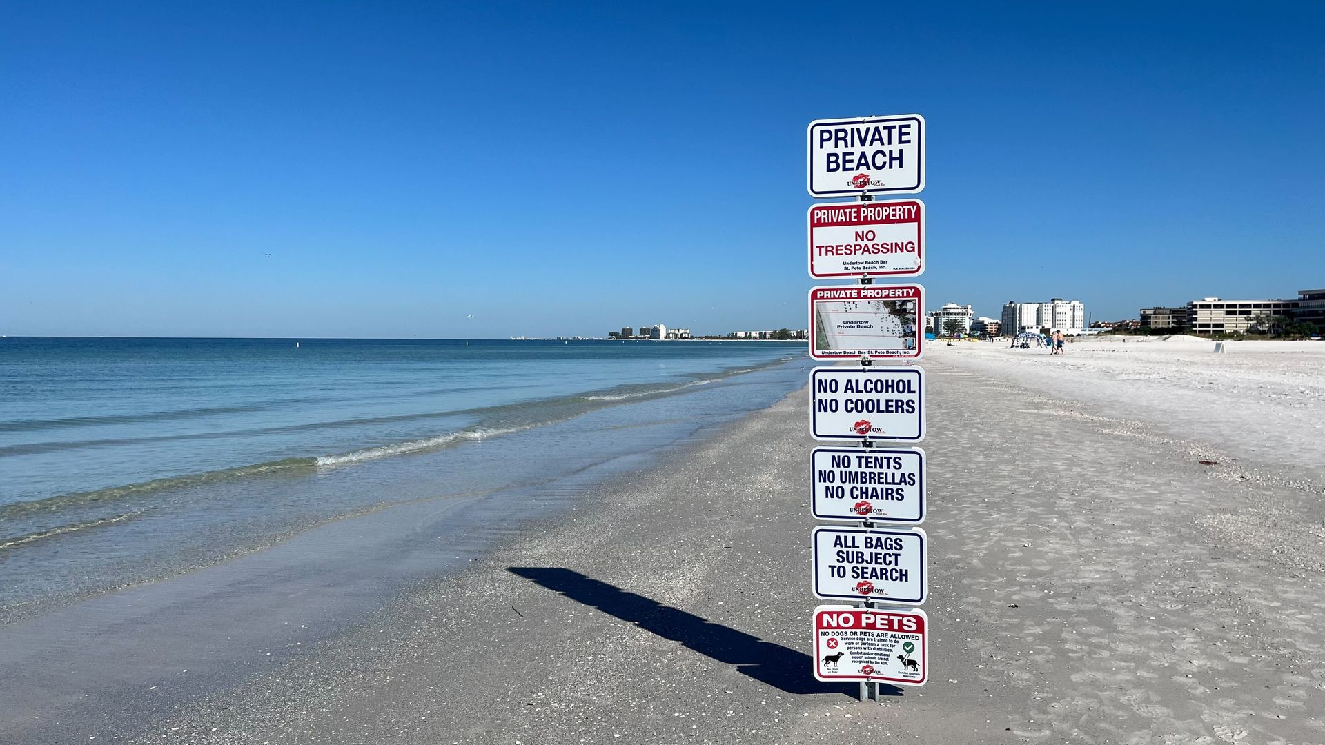
One of the Undertow's signs, pictured Tuesday morning about 4.5 hours after high tide. Photo: Kathryn Varn/Axios
The signs went up at the water's edge Friday evening with a foreboding message for beachgoers.
- "PRIVATE BEACH," read the top marker, followed by the name of a longtime St. Pete Beach establishment, Undertow Beach Bar, and its cheeky kissing lips logo.
Why it matters: The signs — and the differing interpretations of their legality — have reignited an age-old debate:
- Who owns the beach?
State of play: Walk along the water about a mile south of the 4700 Gulf Boulevard parking lot, and you'll spot the two signs about 100 feet apart so close to the water that the waves lap at their bases at high tide.
- A large swath of shore, extending more than the length of a football field from the bar's back patio toward the Gulf, belongs to the Undertow, the placards say.
- That gives the bar the right to ban coolers, tents, umbrellas and chairs and to search the bags of beachgoers, the signs say.
Yes, but: That's misleading, St. Pete Beach interim city attorney Ralf Brookes told Axios, speaking Tuesday morning during a visit to the beach to see for himself what City Hall had gotten reports about over the weekend.
- The city is "taking a closer look ... and seeing if we can't get these signs removed," he said.
How it works: Beach access is set by the mean high-water line, or the average height of the water over a period of time.
- The land seaward of that line is protected as public-access beach by the Florida Constitution, while the dry sand landward of the line is, in some cases, private.
- Public beach is "typically understood as the 'wet sand' area," Brookes said, although it would take a surveyor to determine the exact location of the water line.
Friction point: The Undertow owners commissioned a survey, Timothy Weber, an attorney for the bar, told Axios on Wednesday.
- And the signs are placed at the mean high-water line according to its findings, Weber said, adding that the survey was approved by the Florida Department of Environmental Protection.
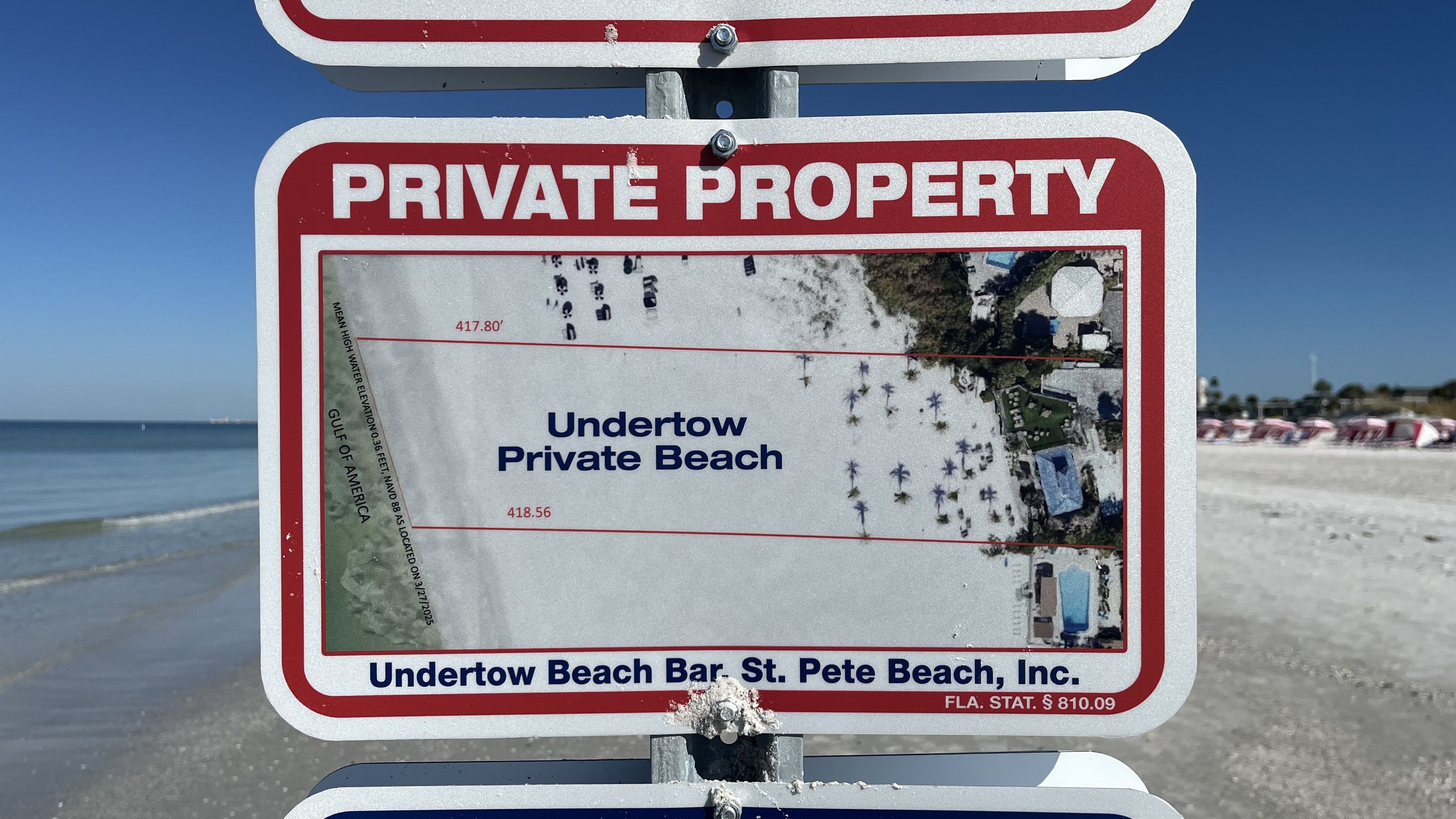
What they're saying: The line "is different from what the wet sand line may look like on any given day due to natural forces of erosion and accretion and the like," Weber said.
- "I understand that lay people like to use the 'wet sand' as an approximation of the seaward boundary, but it is only that — an approximation."
The other side: Brookes did not immediately return Axios' request for comment on Weber's account.
- The Department of Environmental Protection did not immediately respond to Axios' request for more information Wednesday.
Regardless of their legality, the signs caused a stir on the beach and in St. Pete Beach Facebook groups, with some commenters calling for a boycott.
- Shelley and Myron Sowirka, who were visiting from Michigan for their 30th wedding anniversary, said they saw workers erect the signs on Friday evening.
- "I'm appalled because this is a beach," Shelley Sowirka told Axios. "God created these things for us to use."