Where Richmond's 700 intersection safety projects are going

Add Axios as your preferred source to
see more of our stories on Google.
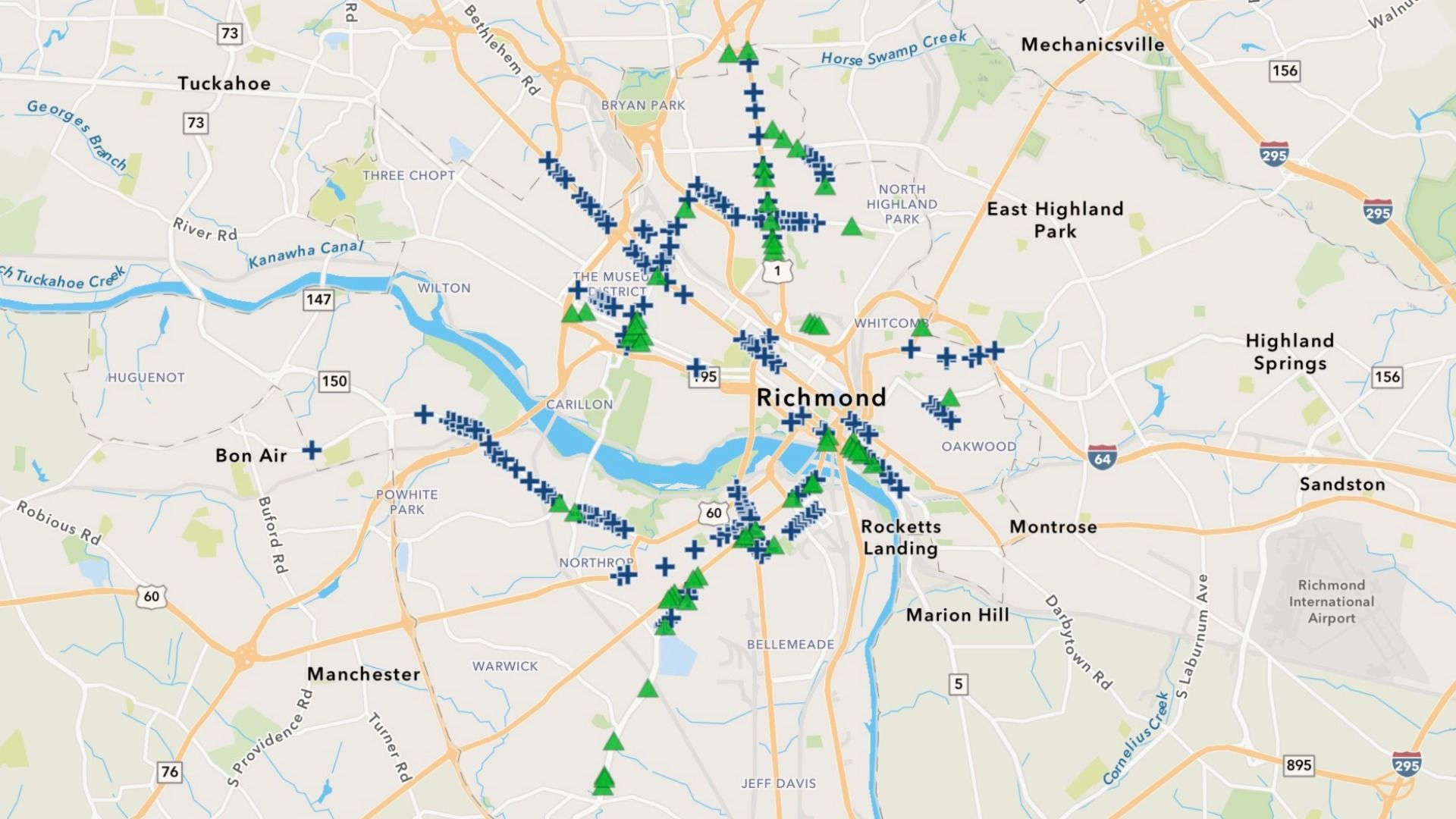
Zoom in here to find your street. Screenshot: Courtesy of the city of Richmond
Richmond is rolling out more than 700 safety improvements over the next two years as part of its push to eliminate traffic deaths and serious injuries by 2030.
Why it matters: The changes will touch hundreds of intersections across the city's High Injury Street Network, potentially changing how drivers, pedestrians and cyclists navigate Richmond's roads.
The latest: Richmond's Department of Transportation announced this week that it plans to make quick-build improvements at roughly 350 intersections starting this fall, followed by another 350 in fall 2027.
- Roughly 81% of fatal and serious-injury crashes from 2023 to 2025 occurred at intersections, per Richmond's in-the-works update to its Vision Zero plan.
Zoom in: The federally funded projects, shown on a new neighborhood-by-neighborhood dashboard, include adding high-visibility crosswalks, refreshed pavement markings, and other changes designed to force drivers to make slower, tighter left turns.
- The city hasn't released a cost total but says the treatments are relatively inexpensive and can reduce crash risks without waiting for larger street reconstruction projects.
By the numbers: Richmond hasn't yet publicly shared all of the intersections slated for improvements. An Axios review of the existing 244 locations found the biggest concentrations along:
- Forest Hill Avenue: roughly 30.
- West Broad Street, from the Museum District to Willow Lawn: 23.
- Brookland Park Boulevard and Parkway: 19.
- Hull Street: 18.
- Chamberlayne Avenue: 17.
- Arthur Ashe, from the Diamond to Carytown: 16.
Between the lines: The locations align with the streets where Richmond's most serious crashes are concentrated "and/or corridors identified through the state's Pedestrian Safety Action Plan," city spokesperson Jensen Gavulic tells Axios.
- Even outside the streets with dozens of planned upgrades, some individual locations have a history of deadly crashes, including West Main and Robinson streets in the Fan.
- But construction won't start all at once, Gavulic says, adding that work will be staggered based on factors like contractor availability and coordination with other nearby projects underway.
What's next: Another 106 locations will be added to the public map by this winter, Gavulic says, while the 2027 ones will be released for public feedback next summer.