Drought worsens across central North Carolina

Add Axios as your preferred source to
see more of our stories on Google.
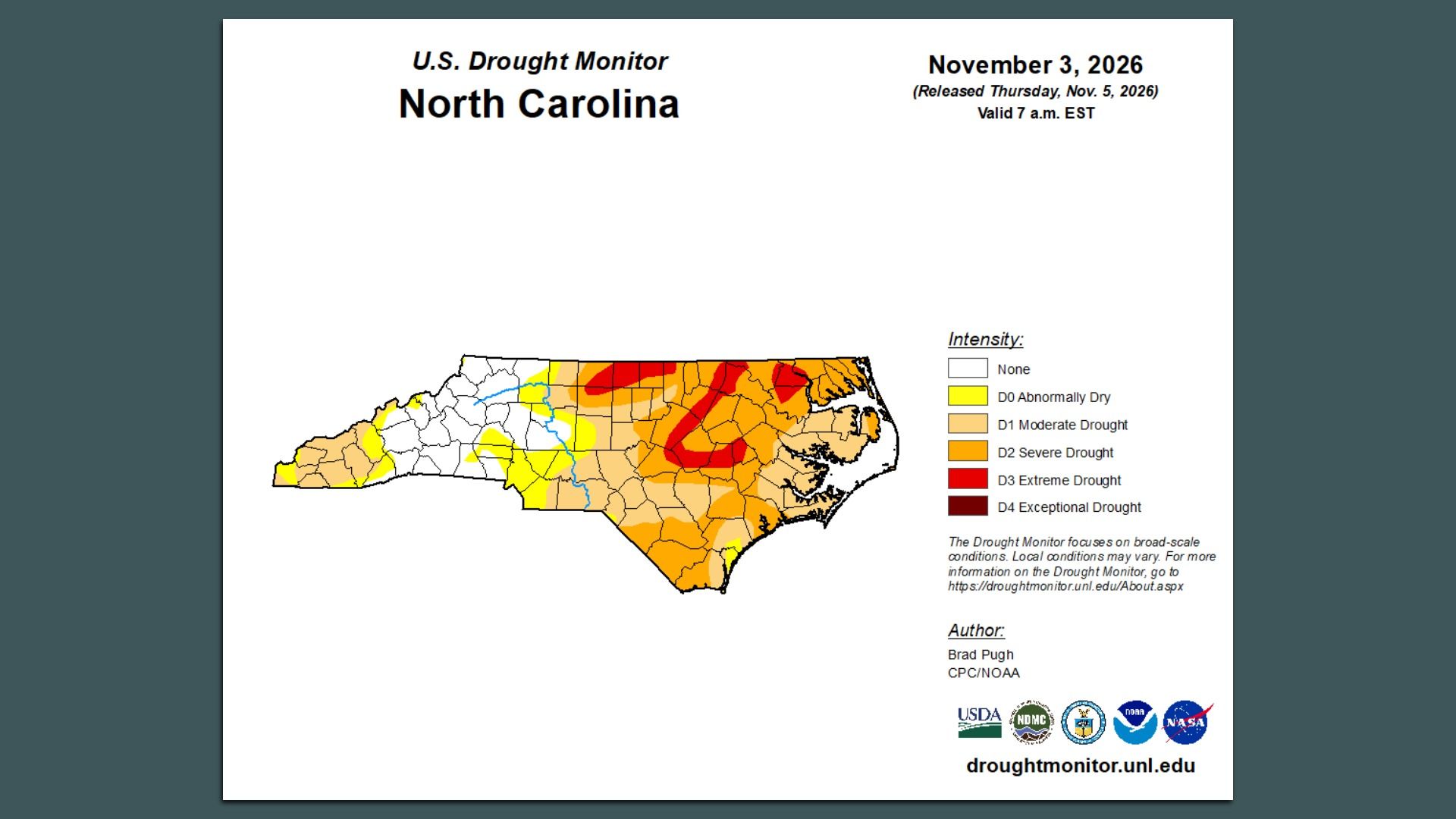
Map: U.S. Drought Monitor
Extreme drought has returned to parts of the Triangle after another extended period of time without significant rainfall.
Why it matters: Nearly 6 million North Carolinians now live in an area experiencing drought, up 14% from the previous week, according to the U.S. Drought Monitor.
Driving the news: The drought comes as North Carolina has experienced its fifth-driest January-to-September since at least 1895, with rainfall around 10 inches below normal.
- The Triangle has not had meaningful rainfall in three weeks, though rain is expected across eastern North Carolina this week.
What they're saying: "With year-to-date rainfall deficits back above 20 inches in spots and no recent recharge for lakes and soils, we're seeing conditions trending back toward early summer levels, and badly in need of rain," N.C. Drought Management Advisory Council wrote.
State of play: The drought has led to the region's biggest reservoirs falling to low levels, including Falls Lake, which serves Raleigh, Jordan Lake and Lake Michie, and the Little River Reservoir in Durham.
- Durham, specifically, could be close to declaring Stage 3 water restrictions, The News & Observer reported, which would severely cut down on water usage for irrigation and other outdoor usage.
- Raleigh is in a better place. Falls Lake is currently at 63% supply, and restrictions would only be triggered at 45%.