Rainstorms are getting more intense across the Triangle and North Carolina


Add Axios as your preferred source to
see more of our stories on Google.
Rainstorms have gotten more intense in the Triangle over the past five decades, a new climate analysis has found.
Why it matters: More intense precipitation events can cause flash-flooding, landslides, dangerous driving conditions and other potentially deadly hazards.
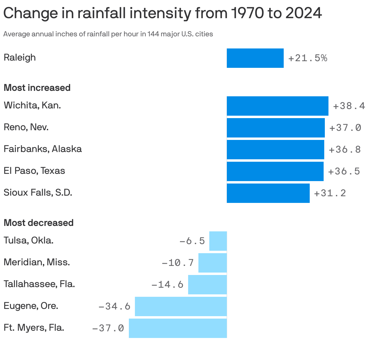
Driving the news: Hourly rainfall intensity in Raleigh increased between 1970 and 2024 by nearly 22%, per a new report from Climate Central, a research and communications group.
- That was higher than the average increase of 15% seen across other cities.
How it works: The researchers divided each location's total annual rainfall by its total hours of annual rainfall, using NOAA weather station data.
- That approach quantifies how much rain fell for each hour it was raining in a given year — in other words, rainfall intensity.
Between the lines: Human-driven climate change is resulting in warmer air, which holds more moisture and thus can drive more intense precipitation.
Zoom in: North Carolina had several notable intense rainfall events last year that highlight the trend.
- Hurricane Helene's devastation mostly centered on Western North Carolina — but the storm's intense downpours also broke rainfall records in the Triangle, CBS17 reported.
- And last year, Carolina Beach experienced a 1-in-1,000-year rain event, when a surprise storm dropped 20 inches of rain on the beach town in a 12-hour period, leading to widespread flooding.