Tropical threat puts New Orleans on high alert for flash flooding

Add Axios as your preferred source to
see more of our stories on Google.
The sandbags are filled in New Orleans, the pumps are prepped and now the region waits for the tropical system that has the potential to dump a month's worth of rain in a single day.
Why it matters: New Orleanians are on edge about flash flooding, which happens too frequently in this city below sea level.
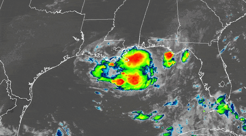
The big picture: The tropical system, called Invest 93L, is in the Gulf and expected to reach Louisiana's coast Thursday.
- It may develop into a tropical depression, the National Hurricane Center said Wednesday. It will be named Dexter if it strengthens into a tropical storm.
- Flooding is the biggest concern for New Orleans, according to the National Weather Service's Slidell office.
Threat level: A flood watch is in effect for southeast Louisiana through Saturday morning.
- Multiple rounds of heavy rainfall are expected through at least Saturday morning, NWS said. The greatest threat is Thursday and Friday.
- New Orleans is most likely to get 2 to 3 inches by Saturday night, with higher totals on the coast, according to the Wednesday forecast.
- In a worst-case scenario, NWS said, up to 10 inches could fall in Southeast Louisiana, which is more than the average rainfall in New Orleans for the entire month of July.
Between the lines: Rainfall rates in some of the storms could be more than 3 inches per hour, which is faster than the pumps can drain streets.
Zoom in: City buildings are closed Thursday and some events have been rescheduled.
- Neutral ground parking is allowed through Sunday night.
- Mayor LaToya Cantrell on Wednesday asked residents to stay off the roads if they start flooding.
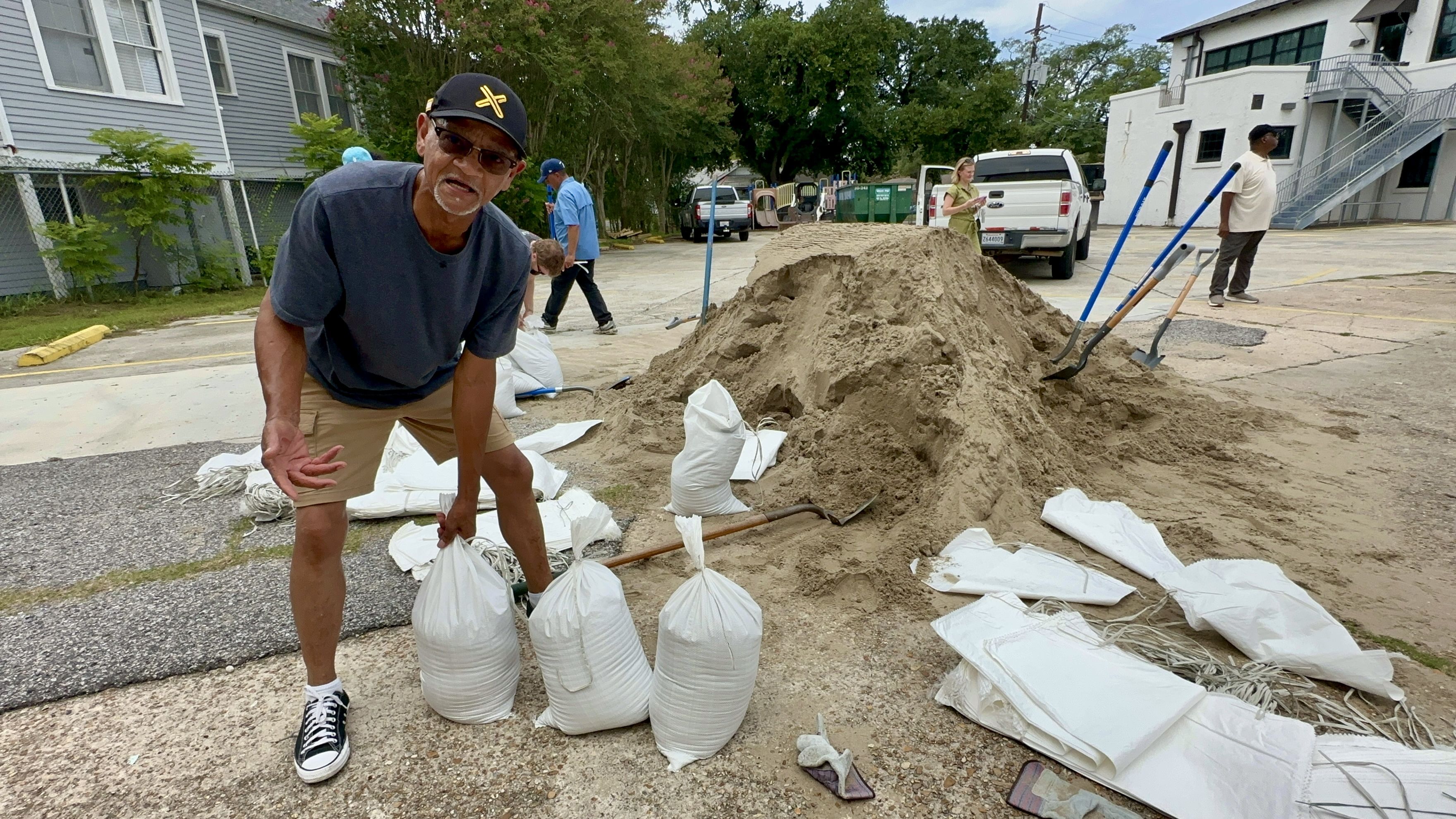
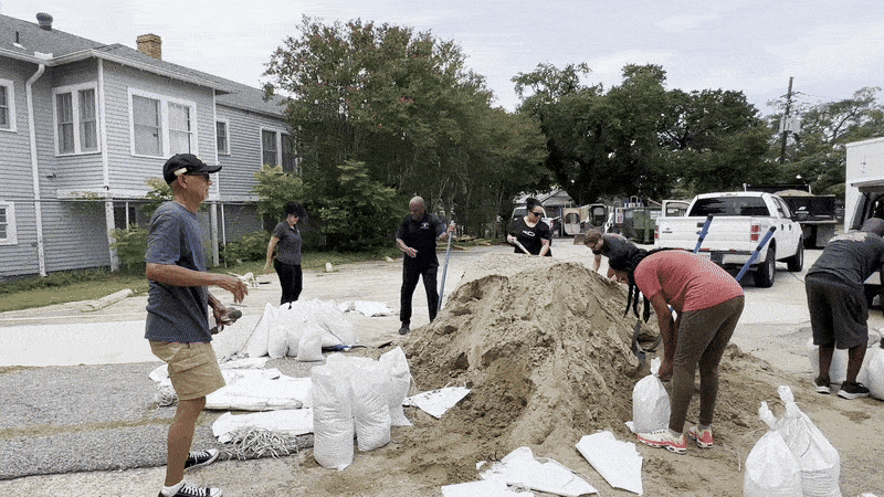
On the street: New Orleanians waited in line for about an hour Wednesday in Gentilly to fill sandbags to protect their homes, apartments and churches.
- "Hopefully, I won't need them," said Robert Johnson, a longtime Gentilly resident. "It's just erring on the side of caution."
- That was the vibe from others as they shoveled their bags in the sweltering heat. Their homes have flooded or gotten close to flooding in recent thunderstorms and they want to be proactive.
- Lynelle Batiste and other residents told Axios New Orleans they're concerned the pumps won't be able to keep up.
- The location had 1,000 DIY bags available, according to Councilman Eugene Green, and stayed open after the designated time due to demand.
Drainage prep
Drainage pumps in New Orleans and Jefferson Parish can handle 1 inch of rain the first hour and 0.5 inch per hour after that when the systems are working at full capacity.
- When rain falls too quickly, it overwhelms the pumps, causing street flooding.
- Authorities in both parishes say they are focusing on cleaning catch basins before the rain arrives.
The Sewerage & Water Board said 86 of 93 major pumps (map) were working as of Wednesday. All three power turbines are available Thursday too, leaders say.
- One of the pumps that drains the Carrollton Avenue/I-10 underpass isn't working, but the rest of the underpass pumps are, SWBNO said.
In Jefferson Parish, all 194 pumps were working as of Tuesday, said drainage director Ben Lepine.
- Employees have also tested the generators and are ready to staff pumping stations 24 hours a day if needed, he said in a statement.
Entergy said it is monitoring the storm and preparing for severe weather in south Louisiana.
- The company has materials, supplies and staffing available if needed, a spokesperson told Axios New Orleans.
What's next: Gov. Jeff Landry will give an update at 10:30am Thursday.
- See the latest forecast and spaghetti models. Plus, the live radar.
Editor's note: This story has been updated with new details.