Aug 14, 2024 - Climate
New Orleans ranks high in annual severe weather watches


Add Axios as your preferred source to
see more of our stories on Google.
New Orleans is in the Top 40 metros in terms of the most severe weather watches, according to federal data.
Why it matters: Our emergency phone alerts really do buzz more than usual.
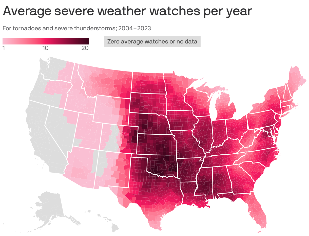
The big picture: The heat map indicates the thunderstorm and tornado watches issued by the National Oceanic and Atmospheric Administration.
- New Orleans averaged 11 annually between 2004 and 2023, according to NOAA. Baton Rouge averaged 13.
- Oklahoma City had the highest average of 19.
Between the lines: The numbers don't include heat advisories, flash flood warnings, air quality alerts, tropical storm warnings or any of the other weather alerts New Orleanians face on a regular basis.
The bottom line: Know how to get weather updates because there's always something lurking in New Orleans.