Columbus City Council approves new residential district map

Add Axios as your preferred source to
see more of our stories on Google.
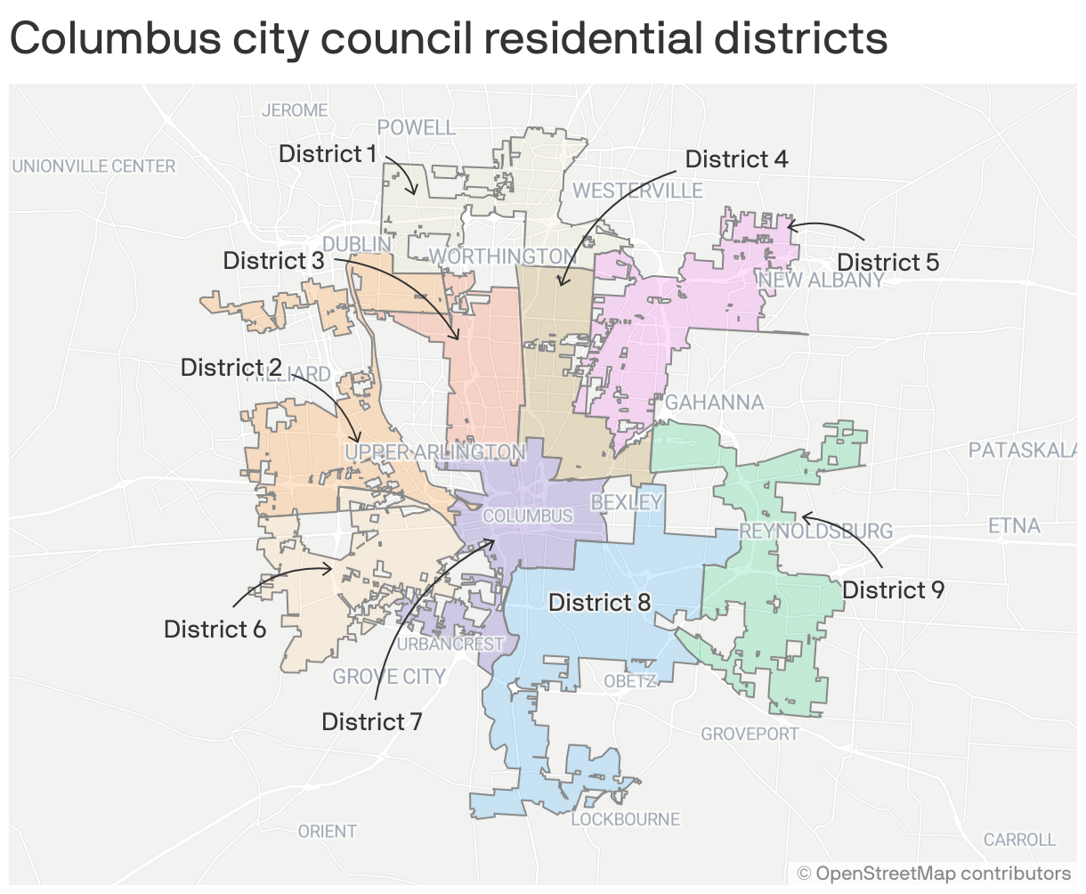
The new Columbus City Council district map is officially set and will be in place the next time citizens head to the polls.
Driving the news: Council members approved the new map out of three available options Monday.
- The map features nine districts of around 100,000 residents apiece.
Why it matters: The change will shape the representation at City Hall going forward with leaders now hailing from all areas of Columbus.
State of play: Council currently has seven members that serve in an "at-large" capacity. Each represents the whole city and can live anywhere.
- In 2018, voters supported a charter amendment creating residential districts and adding two more seats.
- A citizen commission held numerous hearings in 2021 and considered public comments before submitting three final draft maps to Council.
What they're saying: Though some residents have criticized the map in hearings and through an online tool, Councilman Emmanuel Remy defended the new lines before the Monday vote.
- "We understand that there may be unique differences between neighborhoods, and that is OK," Remy says of districts that lump various parts of Columbus together. "Because that is what makes our city so attractive."
- "(The draft maps) do not create lines of separation, they create lines of collaboration."
Yes, but: The entire city will still cast ballots for candidates in all nine races rather than each being decided exclusively by a district's constituency.
Be smart: Find your new district with this interactive map.
- The two of us at Axios Columbus will end up having the same Council member. District 2 represent!
What's next: The maps will be used in the 2023 election cycle.