
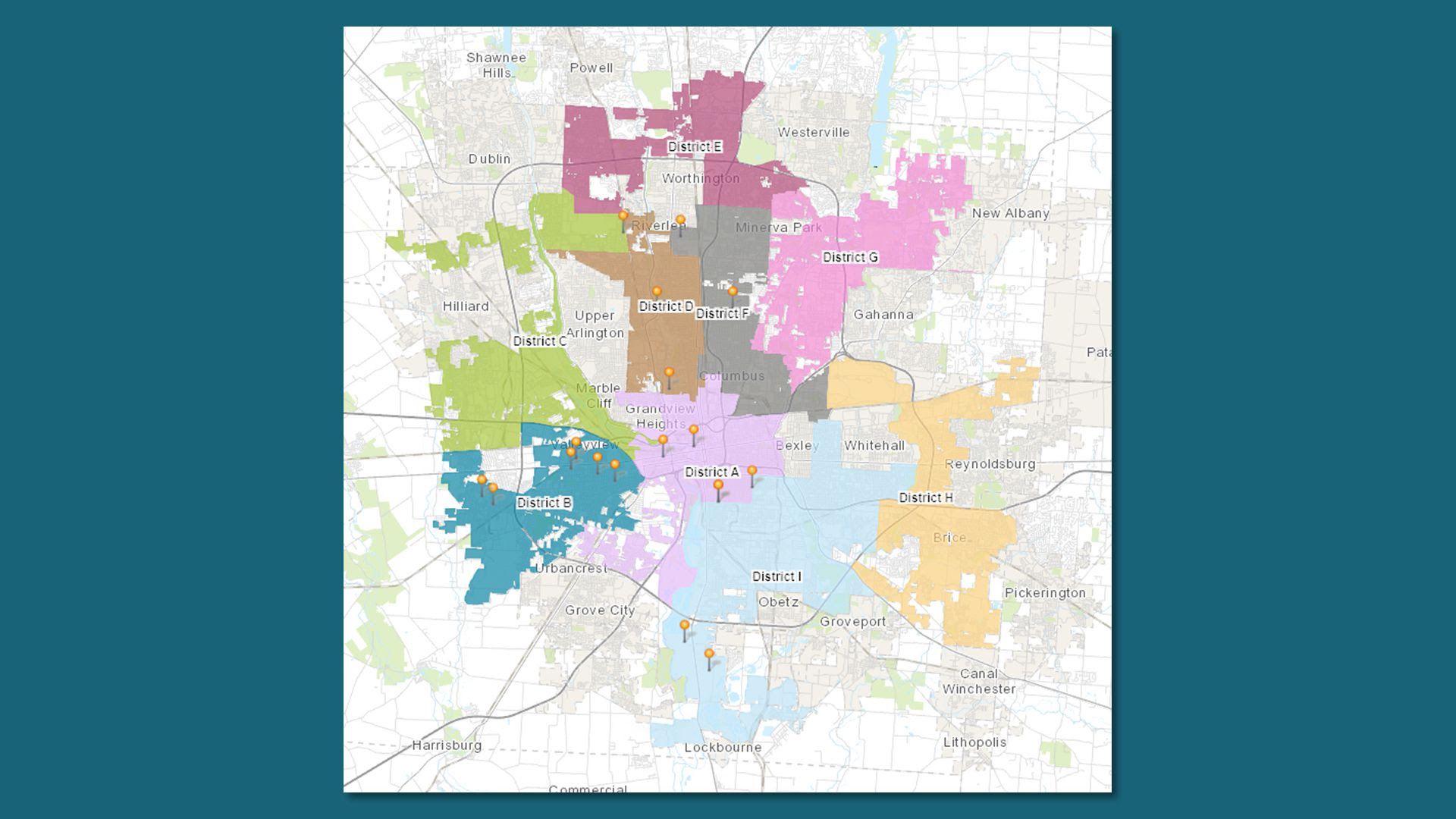
One of three proposed Columbus City Council district maps. Map courtesy of Council Residential Districting Commission
Does this potential Columbus City Council district map look fair to you?
- Local officials are seeking public comment through Nov. 6 on the latest draft maps for Council's new district boundaries.
Catch up quick: Council currently has seven members serving "at-large," meaning they can reside anywhere and each represent the whole city.
- Voters opted to change the system through a 2018 charter amendment to create residential districts and add two more seats.
Why it matters: Geographic districts will ensure Columbus residents have a representative on Council from roughly their neck of the woods, and ideally that member shares residents' interests and concerns at City Hall.
The latest: The Council Residential Districting Commission recently presented the next slate of draft maps, taking in 2020 Census data and feedback from earlier drawings.
- The Commission drew three potential maps with a mandate of keeping neighborhoods together in a given district.
By the numbers: The nine districts will each have roughly 100,000 constituents.
What's next: The Commission will release one more round of draft maps in mid-November, followed by a public town hall in December.
- Commission members will then submit three possible maps to Council, which will vote on a preferred map before the end of 2021.
- The new districts will go into effect for the Council elections in 2023.

Get more local stories in your inbox with Axios Columbus.
More Columbus stories
No stories could be found

Get a free daily digest of the most important news in your backyard with Axios Columbus.