
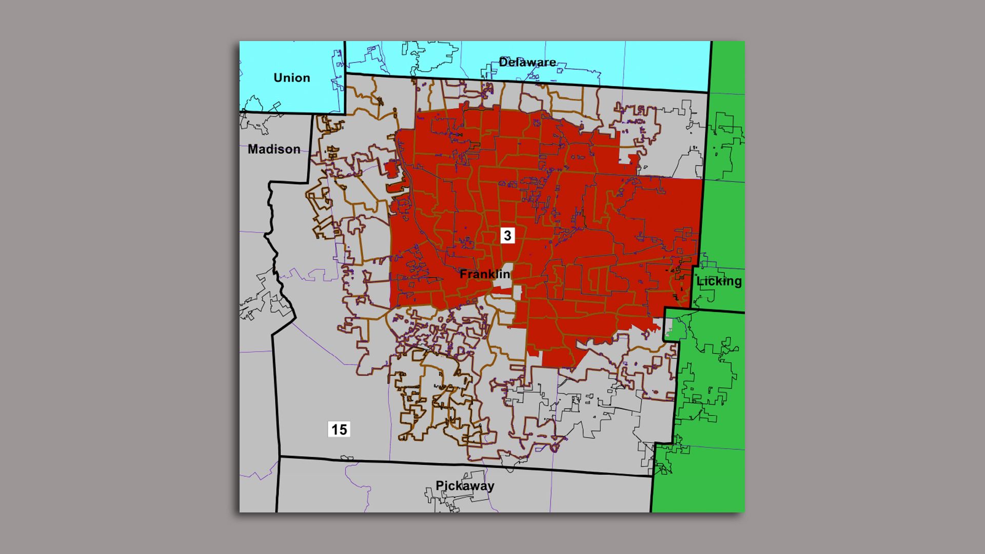
Two districts make up Franklin County in the new congressional map approved by Ohio lawmakers and Gov. Mike DeWine. Photo courtesy the Ohio state legislature
Franklin County will be split into two congressional districts — one urban and one mostly rural — under a new map approved by Ohio lawmakers last week.
Driving the news: Gov. Mike DeWine signed the map into law on Friday, though one election rights lawyer has already announced plans to challenge the new district shapes in court.
- The map separates Ohio's 11.7 million residents into 15 equally-populated districts.
Zoom in: Should the map withstand legal scrutiny, Columbus area residents would be split into two distinctly different districts. Here's a closer look at them:
3rd District: The GOP-drawn map includes just two Democratic-leaning districts across the state, and this is one of them.
- Located mostly within the I-270 outerbelt, it includes much of central and northern Columbus along with the communities of Worthington, Upper Arlington, Bexley, Whitehall, Gahanna, Reynoldsburg and others.
- The district would lean heavily blue, with the minority population making up close to half of all residents.
15th District: The rest of Franklin County would be located in this Republican-leaning district.
- This includes southern Columbus and German Village, along with the communities of Dublin, Hilliard, Westerville, New Albany, Grove City, Groveport, Canal Winchester and Obetz.
- Pairing these towns with all or parts of six rural counties in southwest Ohio gives the district a Republican tilt, though it is still close enough to be considered a "competitive" district.
- White constituents would make up more than 75% of its population.

Get more local stories in your inbox with Axios Columbus.
More Columbus stories
No stories could be found

Get a free daily digest of the most important news in your backyard with Axios Columbus.