Milton nears Florida as "dangerous major hurricane"


Add Axios as your preferred source to
see more of our stories on Google.
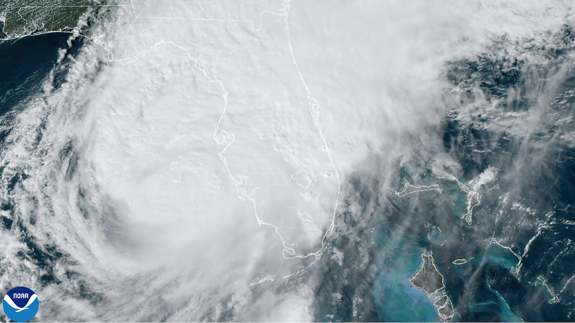
A visible satellite image of Hurricane Milton seen approaching Florida Wednesday afternoon. Image: NOAA
Hurricane Milton is expected to be a "dangerous major hurricane" when it reaches Florida's west-central coast Wednesday night as the storm remains on track for a potentially calamitous landfall near or just south of Tampa Bay.
Threat level: The storm track is looking likely to slip just south of Tampa Bay to a point between there and Sarasota. Where the peak surge hits will cause widespread, potentially "catastrophic" destruction, the National Weather Service warned.
- The NWS issued an extreme wind warning in Tampa, St. Petersburg and Clearwater through 9:30pm ET as major hurricane winds pushed onshore. Sustained winds of 115 mph or greater were expected, per the agency.
The National Hurricane Center has lowered Tampa Bay's storm surge projections slightly, to a still-record-setting 8- to 12-foot surge above ground level.
- As of Wednesday afternoon, the National Hurricane Center forecast would bring the full wrath of the storm ashore near or just north of Sarasota, Siesta Key and Punta Gorda, with a "catastrophic" 9- to 13-foot surge. This forecast may still be adjusted slightly.
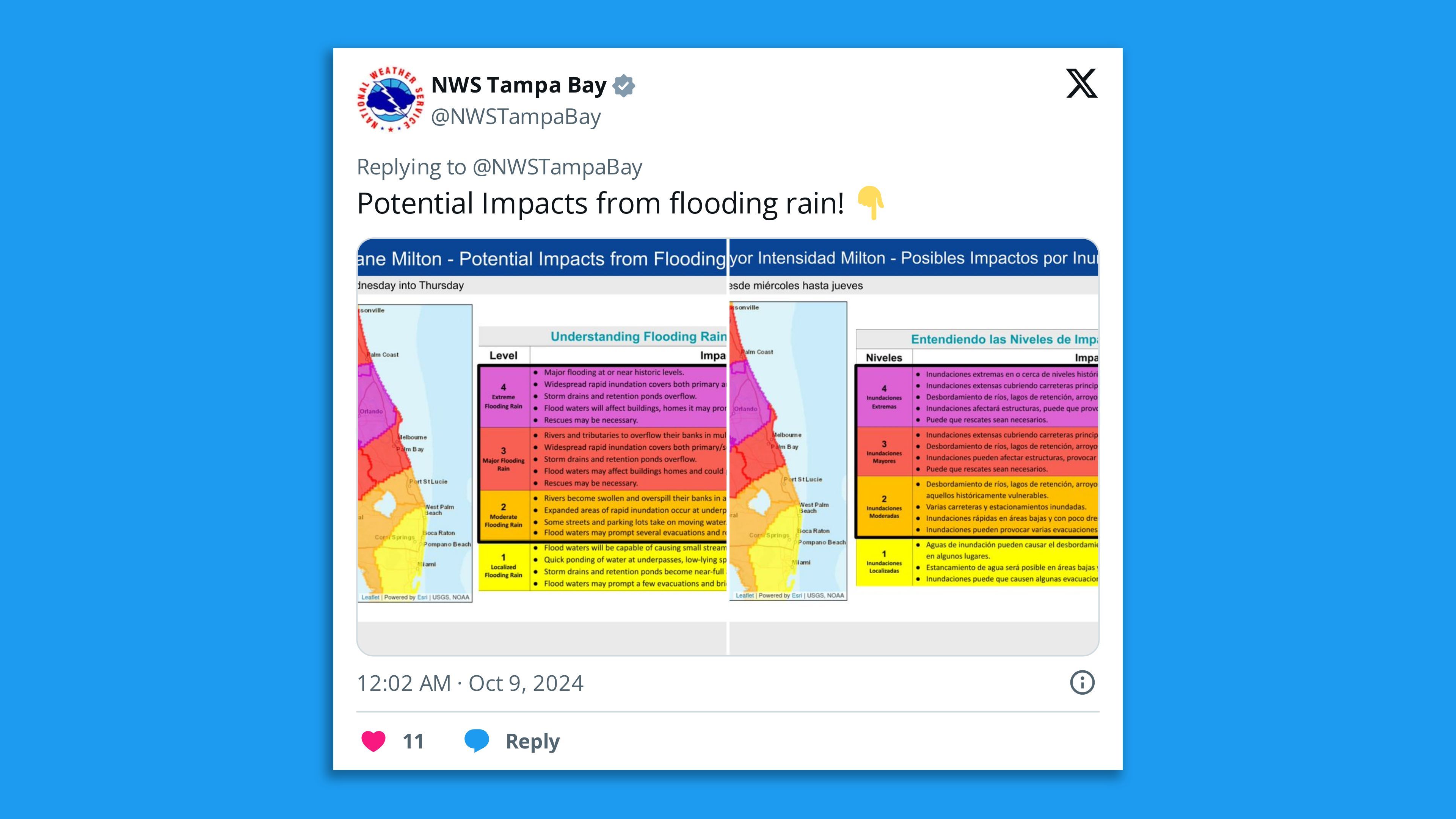
- The storm will also bring flooding rains and punishing winds along and to the north of its track. These rains could total 6 to 12 inches, with as much as 18 inches in some spots.
- The Weather Prediction Center has issued a rare "High Risk" of excessive rainfall from Tampa through Orlando.
The intrigue: In addition, Hurricane Milton is expected to bring hurricane-force wind gusts well inland, across the peninsula to the east coast as it exits over the Atlantic on Thursday, according to NHC.
- Winds will be particularly strong on the northwestern, or back, side of the storm, NHC warned.
- Tropical storm-force winds have already started overspreading the west coast of Florida, with a wind gust in St. Petersburg to 55 mph.
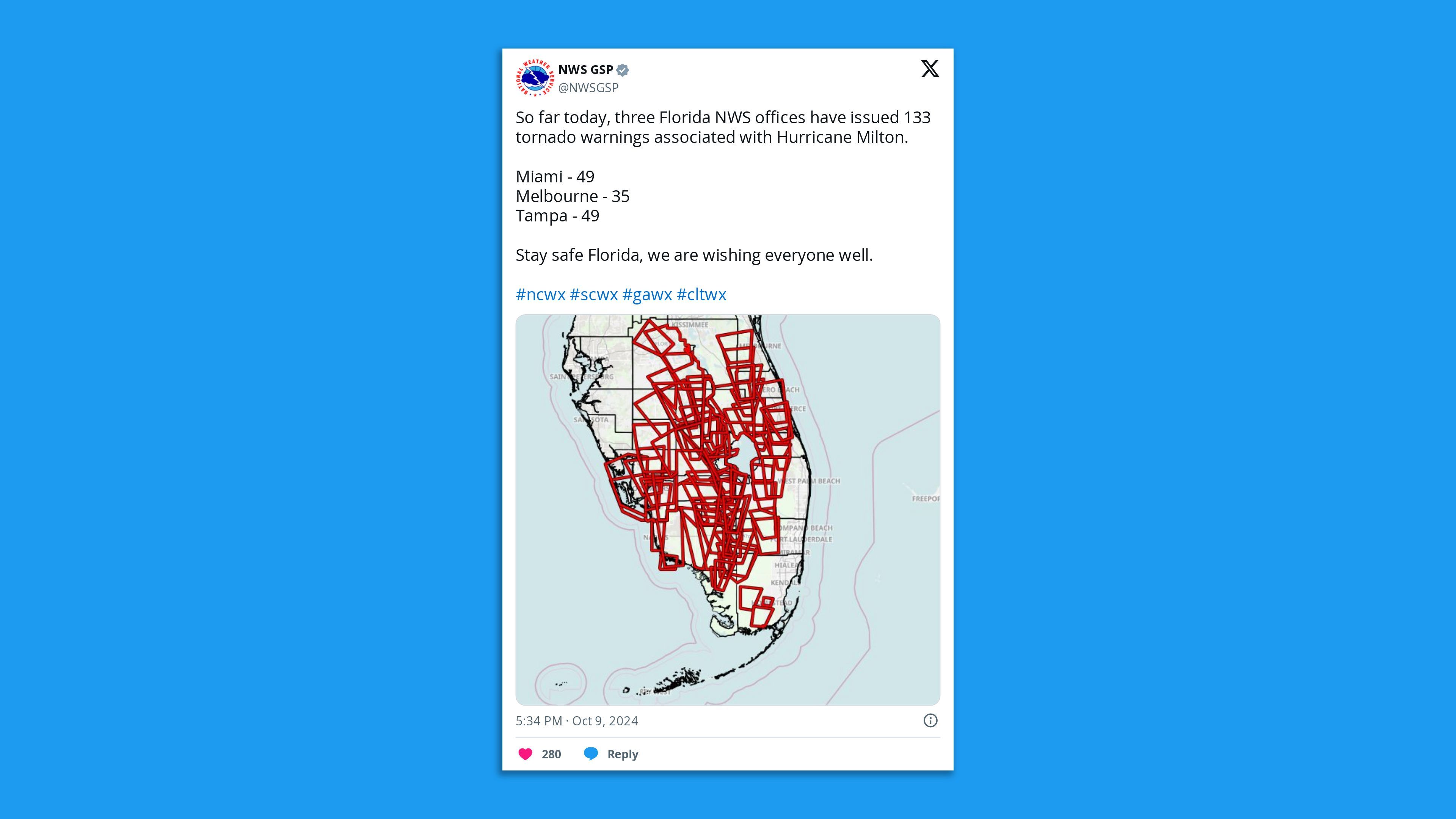
- Multiple damaging tornadoes have already occurred in southern Florida, with the tornado outbreak likely to spread north today into central Florida. Damage was reported in Ft. Myers and several other communities from coast-to-coast.
State of play: While the storm lost some of its record-setting intensity from Monday night and again Tuesday night, it still had 120 mph maximum sustained winds as of late Wednesday morning and into the evening, making it a Category 3 storm.
- Milton was moving northeast at 15 mph from a position of about 50 miles west-southwest of Sarasota as of 6pm ET.
- "Weather conditions will steadily deteriorate across portions of the Florida Gulf Coast throughout the day," NHC said, with landfall sometime on Wednesday night or early Thursday.
The big picture: Florida Gov. Ron DeSantis has declared an emergency for 51 counties.
- "The time to prepare, including evacuate if told to do so, is quickly coming to an end along the Florida west coast," NHC warned Wednesday at 11am ET.
Stunning stat: Milton twice entered the top 5 list of strongest Atlantic hurricanes as measured by their minimum central air pressure readings.
- It took second place, behind Hurricane Wilma, for the strongest storm so late in the season.
Zoom in: Hurricane Milton is expected to be a large and intense Category 3 or borderline Category 4 storm at landfall.
- The NHC noted Wednesday its wind field is expanding in size as it closes in on the coast. This would increase the storm surge magnitude and area.
- It will also increase the storm's reach. Hurricane and tropical storm warnings are in effect for portions of the east coast of Florida, all the way to Georgia.

Context: Human-caused climate change is among several factors that conspired to propel Hurricane Milton's rarely seen "explosive" intensification.
- Sea level rise tied to climate change makes this storm potentially more destructive today than it would have been even a few decades ago.
- Global warming is leading to more instances of rapid intensification. The trend was seen as recently as two weeks ago, when Hurricane Helene rapidly intensified before hitting Florida's less-populated Big Bend region.
- Milton was over record-warm waters for this time of year when it intensified so quickly.
Between the lines: Climate change made those ocean temperatures up to 800 times more likely today than in a preindustrial climate with lower greenhouse gases in the air, according to Climate Central, a research nonprofit.
What they're saying: "There is high confidence that Milton will remain a very dangerous hurricane when it reaches Florida, and maintain hurricane status as it moves across the state," NHC stated Wednesday morning.
- "Milton has the potential to be one of the most destructive hurricanes on record for west-central Florida," NHC stated.
The bottom line: The storm is locked in on a landfall between Tampa Bay and Sarasota, but a track difference of just a few miles will make a vast difference in impacts, particularly storm surge heights.
More from Axios:
- What 'horrific' Hurricane Milton could look like for Tampa Bay
- Climate change likely has made Hurricane Milton more dangerous
- "You are going to die": Tampa mayor warns against ignoring Milton evacuation orders
- Hurricane Milton: Many threats likely from "extremely dangerous" storm
Editor's note: This article has been updated with new forecast details and information on the response to the storm. It has also been corrected to reflect that Hurricane Milton was still a Category 5 storm late Tuesday (not Thursday).
