Climate change helped fuel Hurricane Milton's explosive growth

Add Axios as your preferred source to
see more of our stories on Google.
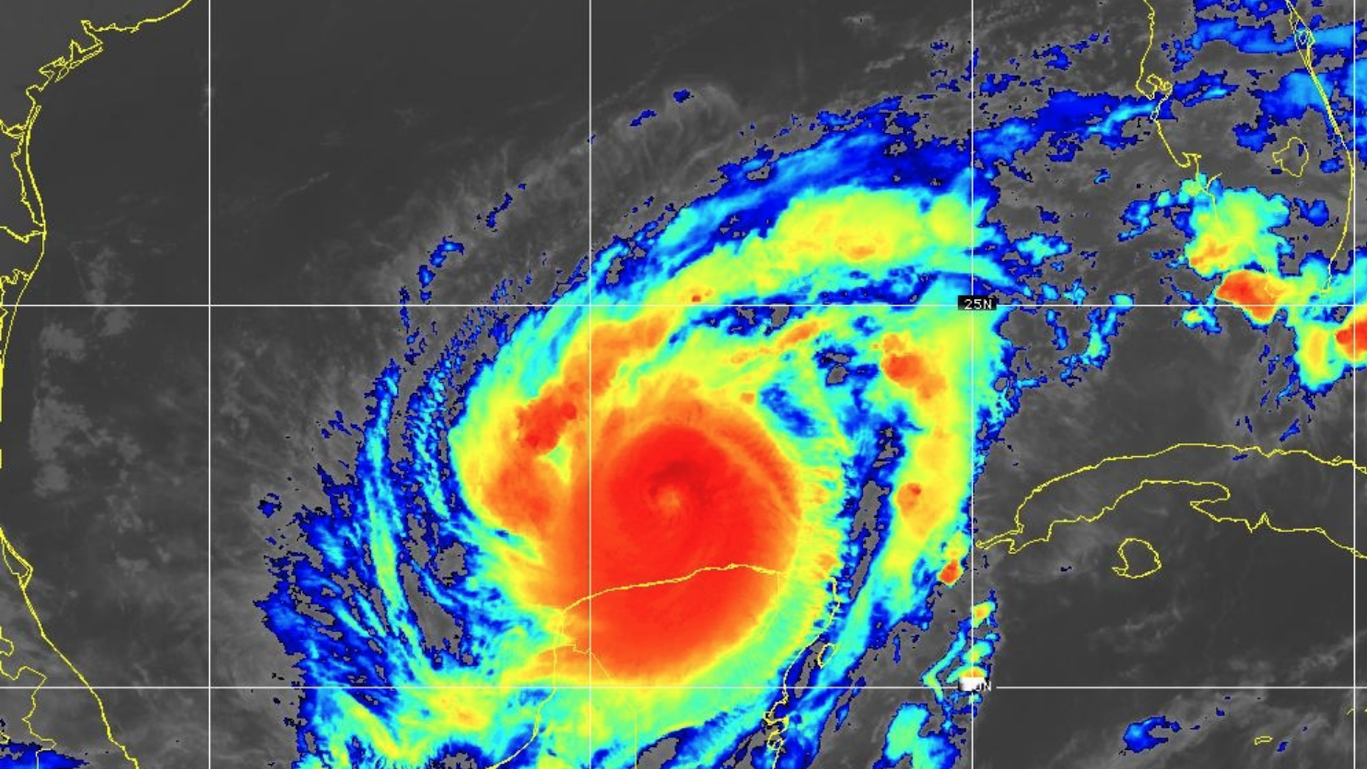
Satellite image of Hurricane Milton as a Category 4 storm last week. Image: NOAA
Hurricane Milton, which reached the top 5 list of most intense storms on record in the Atlantic Ocean, poses a dire threat to Tampa Bay and other highly populated areas on Florida's west coast.
The big picture: Human-caused climate change is among several factors that conspired to propel Hurricane Milton's rarely seen "explosive" intensification.
- Sea level rise tied to climate change makes this storm potentially more destructive today than it would have been even a few decades ago.
Threat level: The storm, now a high-end Category 4, is on course for a calamitous encounter with the 17th-biggest metro area in the U.S. That area is unusually vulnerable to storm surge due to its coastline's shape and large population living near sea level.
- The forecast calls for an unheard-of 10 to 15 feet of surge in Tampa Bay depending on the storm's exact track.
- This would flood a vast swath of real estate, including critical infrastructure for the city, region and the U.S. military.
Context: Climate change helped to enable this storm to become stronger, faster.
- Global warming is leading to more instances of rapid intensification. The trend was seen as recently as two weeks ago, when Hurricane Helene rapidly intensified before hitting Florida's less-populated Big Bend region.
- The storm was over record-warm waters for this time of year when it intensified so quickly. A marine heat wave is underway in the southern Gulf of Mexico, where Milton peaked not once but two separate times Monday and Tuesday as a historic, top 5 most intense storm in the Atlantic.
- Climate change made those ocean temperatures up to 800 times more likely today than in a preindustrial climate with lower greenhouse gases in the air, according to calculations from Climate Central, a research nonprofit.
The intrigue: A study published in August found that marine heat waves in the Gulf of Mexico make rapid intensification an average of 50% more likely to occur.
- Favorable atmospheric conditions are also needed in order to complete the recipe for high-end storms.
Background conditions in the atmosphere also conspired to floor the gas pedal on the storm's winds, going from 90 mph to 180 mph maximum sustained winds in less than 24 hours.
Between the lines: A rare alignment of weather features — some of which are up to chance and not due to climate change — also lined up to throttle the fearsome storm into the upper echelon of its potential intensity.
- A warm, moisture-laden atmosphere and low levels of wind shear also assisted with rapid intensification.
- Some studies show hurricane peak intensities climbing as climate change continues, possibly helping Hurricane Milton and future storms like it top off near its potential intensity.
There's some evidence that climate change is behind a decrease in shear near coastlines globally.
- That's helping hurricanes intensify through landfall, Karthik Balaguru of Pacific Northwest National Laboratory told Axios.
Editor's note: This story was updated with additional context.
