Tropical Depression Francine drenches Louisiana after making landfall as a hurricane


Add Axios as your preferred source to
see more of our stories on Google.
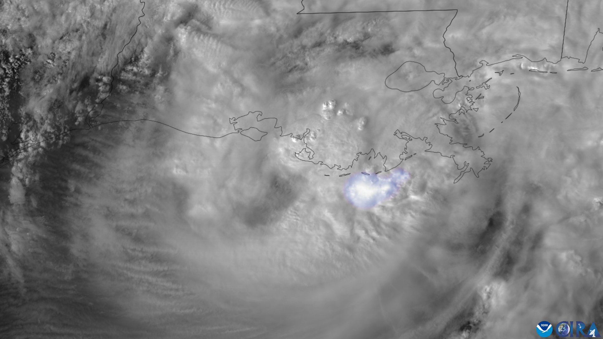
Satellite view of Hurricane Francine at landfall, including flashes of lightning. Photo: NOAA/CIRA
Hurricane Francine made landfall in Louisiana as a Category 2 storm Wednesday afternoon, and has caused significant flooding and widespread power outages that are spreading to neighboring states Thursday morning.
The latest: The center of Francine, now a tropical depression with maximum sustained winds of 35 mph, passed some 35 miles west-northwest of New Orleans, per the National Hurricane Center.
- This brought the most intense part of the storm, known as the eyewall, across the city, where a wind gust to 78 mph was recorded at Louis Armstrong International Airport.
Threat level: The heavy rain that ranged from 6 to 9 inches — setting daily records across metro New Orleans, prompted the National Weather Service to issue a flash flood emergency overnight for most of metro New Orleans.
- In New Orleans, 7.33 inches of rain fell, which was one of the city's top 10 heaviest rainfall events on record for any month, and the wettest September day.
- Metairie in Jefferson Parish was particularly hard hit, with numerous reports of cars submerged in water, and floodwaters lapping against homes and businesses.
- The potential for flooding on Thursday from Tropical Storm Francine shifts north into nearby states including Alabama, Mississippi, Georgia and parts of Tennessee.
- Power outages as of Thursday morning totaled more than 390,000 customers in Louisiana, and about 60,000 customers in Mississippi, per poweroutage.us.
Zoom in: Hurricane Francine has hit a part of the Gulf Coast uniquely vulnerable to storm surge flooding, due to sinking land, sea level rise and the shape of the coastline.
- Storm surge flooding was hitting coastal Mississippi on Thursday morning, with a maximum surge of 4 to 6 feet expected in some areas.
By the numbers: Francine was the 7th hurricane during the past 7 years to strike Louisiana, according to meteorologist Michael Lowry.
- Since 2000, seven Category 2 hurricanes or stronger have made landfall in Louisiana, according to Philip Klotzbach of Colorado State University.
Context: The storm has been feeding off the unusually warm Gulf of Mexico waters, which has the highest level of ocean heat content on record for the region at this time of year.
- Climate change is making tropical cyclones deliver more rainfall and intensify more rapidly while also causing storm surge flooding that's more damaging through rising sea levels.
- Francine fit into a recent pattern of intensifying storms in the northern Gulf of Mexico by strengthening up through landfall in southern Louisiana.
- This trend has been tied in part to human-caused climate change, and increasing ocean temperatures near the coast.
What's next: The storm is likely to weaken to a post-tropical low Thursday, though this will mainly reflect weakened winds and the storm's organization.
- Heavy rains and flooding will be the main threat throughout the day for multiple states, including Alabama, Mississippi, Tennessee, Georgia.
Follow Axios New Orleans' coverage
Editor's note: This story was updated with the latest forecast information and storm impacts.
